
Carinhanha
Município de Carinhanha | |
|---|---|
 Carinhanha Square | |
 Seal | |
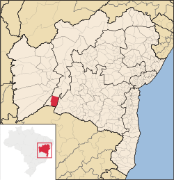 Location of Carinhanha in Bahia | |
 Carinhanha Location of Carinhanha in the Brazil | |
| Coordinates: 14°18′18″S 43°45′54″W / 14.30500°S 43.76500°W | |
| Country | |
| Region | Northeast |
| State | |
| Founded | August 17, 1932 |
| Government | |
| • Mayor | Paulo Elisio Cotrim (2013-2016) |
| Area | |
| • Total | 2,529.45 km2 (976.63 sq mi) |
| Elevation | 440 m (1,440 ft) |
| Population (2020 [1]) | |
| • Total | 29,070 |
| • Density | 11/km2 (30/sq mi) |
| Demonym | Carinhanhense |
| Time zone | UTC−3 (BRT) |
| Website | carinhanha |
Carinhanha is a municipality in the state of Bahia in the North-East region of Brazil. Carinhanha covers 2,529.45 km2 (976.63 sq mi), and has a population of 29,070 with a population density of 12 inhabitants per square kilometer. It is located on the banks of the Rio São Francisco and the Carinhanha River, which also forms the border of the state of Minas Gerais.[2]
YouTube Encyclopedic
-
1/5Views:16 6793 0012 99315 276450
-
Carinhanha entre Rios de Histórias
-
CARINHANHA - BAHIA - REPORTAGEM SOBRE AS CURIOSIDADES E UM POUCO DA HISTÓRIA DO LUGAR
-
Rio Carinhanha - março/2020 - Pontal, Carinhanha
-
Rio São Francisco em Carinhanha-BA
-
DOIS ATEUS EM CARINHANHA-BA
Transcription
See also
References
- ^ IBGE 2020
- ^ "Carinhanha" (in Portuguese). Brasília, Brazil: Instituto Brasileiro de Geografia e Estatística. 2015. Retrieved 2015-06-14.

 | This Bahia, Brazil location article is a stub. You can help Wikipedia by expanding it. |