
Caraway, Arkansas | |
|---|---|
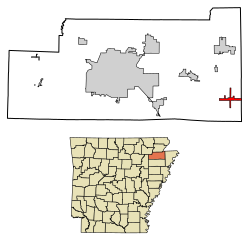 Location of Caraway in Craighead County, Arkansas. | |
| Coordinates: 35°45′33″N 90°19′23″W / 35.75917°N 90.32306°W | |
| Country | United States |
| State | Arkansas |
| County | Craighead |
| Incorporated | 1923 |
| Area | |
| • Total | 2.31 sq mi (5.98 km2) |
| • Land | 2.30 sq mi (5.97 km2) |
| • Water | 0.01 sq mi (0.01 km2) |
| Elevation | 226 ft (69 m) |
| Population (2020) | |
| • Total | 1,133 |
| • Density | 491.75/sq mi (189.83/km2) |
| Time zone | UTC-6 (Central (CST)) |
| • Summer (DST) | UTC-5 (CDT) |
| ZIP code | 72419 |
| Area code | 870 |
| FIPS code | 05-11410 |
| GNIS feature ID | 0057508 |
| Website | www |
Caraway is a city[2] in Craighead County, Arkansas, United States. The population was 1,279 at the 2010 census. It is included in the Jonesboro, Arkansas Metropolitan Statistical Area.
YouTube Encyclopedic
-
1/2Views:6671 111
-
Arkansas Women’s Hall of Fame: Hattie Caraway
-
Central High All Class Reunion
Transcription
History
The town originally began as a lumber camp known as White Switch in 1912. It was incorporated in 1923, taking its name from then-U.S. Senator Thaddeus Caraway.[3]
Geography
Caraway is located in the Arkansas Delta region at 35°45′33″N 90°19′23″W / 35.75917°N 90.32306°W (35.759143, -90.323051).[4] According to the United States Census Bureau, the town has a total area of 6.0 km2 (2.3 mi2), all land.
Ecologically, Caraway is located within the St. Francis Lowlands ecoregion within the larger Mississippi Alluvial Plain. The St. Francis Lowlands are a flat region mostly covered with row crop agriculture today, though also containing sand blows and sunken lands remaining from the 1811–12 New Madrid earthquakes. Waterways have mostly been channelized, causing loss of aquatic and riparian wildlife habitat.[5] The St. Francis Sunken Lands Wildlife Management Area, which preserves some of the bottomland hardwood forest typical of this ecoregion prior to development for row agriculture lies just west of Caraway along the St. Francis River.
List Of Highways
Demographics
| Census | Pop. | Note | %± |
|---|---|---|---|
| 1930 | 425 | — | |
| 1940 | 477 | 12.2% | |
| 1950 | 970 | 103.4% | |
| 1960 | 821 | −15.4% | |
| 1970 | 952 | 16.0% | |
| 1980 | 1,165 | 22.4% | |
| 1990 | 1,178 | 1.1% | |
| 2000 | 1,349 | 14.5% | |
| 2010 | 1,279 | −5.2% | |
| 2020 | 1,133 | −11.4% | |
| U.S. Decennial Census[6] | |||
2020 census
| Race | Number | Percentage |
|---|---|---|
| White (non-Hispanic) | 1,068 | 94.26% |
| Black or African American (non-Hispanic) | 1 | 0.09% |
| Native American | 3 | 0.26% |
| Other/Mixed | 36 | 3.18% |
| Hispanic or Latino | 25 | 2.21% |
As of the 2020 United States census, there were 1,133 people, 422 households, and 231 families residing in the city.
2000 census
As of the census[8] of 2000, there were 1,349 people, 547 households, and 386 families residing in the town. The population density was 224.5/km2 (581.4/mi2). There were 606 housing units at an average density of 100.9/km2 (261.2/mi2). The racial makeup of the town was 97.63% White, 0.07% Native American, 0.07% Asian, 1.33% from other races, and 0.89% from two or more races. 2.89% of the population were Hispanic or Latino of any race.
There were 547 households, out of which 34.9% had children under the age of 18 living with them, 54.1% were married couples living together, 13.2% had a female householder with no husband present, and 29.4% were non-families. 27.6% of all households were made up of individuals, and 14.6% had someone living alone who was 65 years of age or older. The average household size was 2.41 and the average family size was 2.93.
In the town the population was spread out, with 25.4% under the age of 18, 9.0% from 18 to 24, 25.8% from 25 to 44, 24.9% from 45 to 64, and 14.9% who were 65 years of age or older. The median age was 37 years. For every 100 females, there were 87.9 males. For every 100 females age 18 and over, there were 80.9 males.
The median income for a household in the town was $22,279, and the median income for a family was $26,600. Males had a median income of $25,809 versus $17,000 for females. The per capita income for the town was $11,647. About 21.9% of families and 26.3% of the population were below the poverty line, including 37.1% of those under age 18 and 35.6% of those age 65 or over.
Education
It is a part of the Riverside School District. It was served by the Caraway School District until it consolidated into Riverside on July 1, 1985.[9]
Notable people
- Nick Bacon, an army first sergeant during the Vietnam War and recipient of the Medal of Honor
- Deleta Williams, Missouri state representative
References
- ^ "2020 U.S. Gazetteer Files". United States Census Bureau. Retrieved October 29, 2021.
- ^ Local.Arkansas.gov - Caraway, retrieved September 3, 2012
- ^ "Caraway (Craighead County)". Encyclopedia of Arkansas History and Culture.
- ^ "US Gazetteer files: 2010, 2000, and 1990". United States Census Bureau. February 12, 2011. Retrieved April 23, 2011.
- ^
 This article incorporates public domain material from Woods, A.J., Foti, T.L., Chapman, S.S., Omernik, J.M.; et al. Ecoregions of Arkansas (PDF). United States Geological Survey.
{{citation}}: CS1 maint: multiple names: authors list (link) (color poster with map, descriptive text, summary tables, and photographs). - ^ "Census of Population and Housing". Census.gov. Retrieved June 4, 2015.
- ^ "Explore Census Data". data.census.gov. Retrieved December 30, 2021.
- ^ "U.S. Census website". United States Census Bureau. Retrieved January 31, 2008.
- ^ "ConsolidationAnnex_from_1983.xls Archived 2015-09-12 at the Wayback Machine." Arkansas Department of Education. Retrieved on October 13, 2017.
Municipalities and communities of Craighead County, Arkansas, United States | ||
|---|---|---|
| Cities | 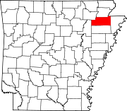 | |
| Towns | ||
| CDP | ||
| Other unincorporated communities | ||
| Ghost town | ||