
Caramoran | |
|---|---|
| Municipality of Caramoran | |
 Flag | |
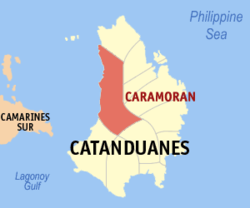 Map of Catanduanes with Caramoran highlighted | |
OpenStreetMap  | |
 Caramoran Location within the Philippines | |
| Coordinates: 13°59′N 124°08′E / 13.98°N 124.13°E | |
| Country | Philippines |
| Region | Bicol Region |
| Province | Catanduanes |
| District | Lone district |
| Founded | August 29, 1948 |
| Barangays | 27 (see Barangays) |
| Government | |
| • Type | Sangguniang Bayan |
| • Mayor | Glenda V. Aguilar |
| • Vice Mayor | Chyrrel D. Baro |
| • Representative | Hector S. Sanchez |
| • Municipal Council | Members |
| • Electorate | 21,982 voters (2022) |
| Area | |
| • Total | 263.74 km2 (101.83 sq mi) |
| Elevation | 41 m (135 ft) |
| Highest elevation | 286 m (938 ft) |
| Lowest elevation | 0 m (0 ft) |
| Population (2020 census)[3] | |
| • Total | 32,114 |
| • Density | 120/km2 (320/sq mi) |
| • Households | 6,573 |
| Economy | |
| • Income class | 3rd municipal income class |
| • Poverty incidence | 34.85 |
| • Revenue | ₱ 151.1 million (2020) |
| • Assets | ₱ 342.3 million (2020) |
| • Expenditure | ₱ 166.4 million (2020) |
| • Liabilities | ₱ 119.1 million (2020) |
| Service provider | |
| • Electricity | First Catanduanes Electric Cooperative (FICELCO) |
| Time zone | UTC+8 (PST) |
| ZIP code | 4808 |
| PSGC | |
| IDD : area code | +63 (0)52 |
| Native languages | Central Bikol Tagalog |
| Website | www |
Caramoran, officially the Municipality of Caramoran, is a 3rd class municipality in the province of Catanduanes, Philippines. According to the 2020 census, it has a population of 32,114 people.[3]
The main sources of livelihood of the town are growing rice, coconuts, and lasa and fishing. The white beaches and clean sea water of Toytoy and Sabang, the water falls of Ab-haw, Awinis and Garagag are some of the attractions, and together with the Hilacan River, are the main source of water for irrigation.
YouTube Encyclopedic
-
1/2Views:777313
-
PALUMBANES ISLANDS, Caramoran, Catanduanes, Philippines
-
Unique na Trabaho sa Caramoran, Catanduanes Vlog #34
Transcription
History

The early Spanish missionaries who came to the Philippines landed in Napacahan, a sitio in Tubli and established a parish, which lasted for many years. In the parish church, St. John the Baptist had been venerated until this day as the Patron Saint (feast day June 24).
Early Caramoran history disclosed the fact that the town originated in Napacahan, but due to relentless and repeated Muslim piracy in the 17th to the 18th century, the town was transferred to its present site Caramoran poblacion where the Muslim pirates could not anchor because of barrier reefs.
Over a hundred years after Spanish Sovereignty was established in 1570, Caramoran was founded as a town in 1676 side by side with the Catholic Church.
In the early colonial era, Catanduanes was only composed of two towns. The first, Viga, was founded in 1619 under the incumbency of Governor-General Manuel de Leon. In 1676, he established another town, which is now the municipality of Caramoran.
There are at least two possible origins of the name Caramoran. Old people of the town of Caramoan in Camarines Sur theorized that since their town is only separated almost 2 kilometers by Maqueda Channel from Caramoran in Catanduanes, the place also abound in “cara”, the turtle's precious shell made into combs, bowls and decorative articles. Hence, a place where turtle “cara” shells are found in abundance, as in Caramoan. Another version is that this place is where “namo”, wild plants that grow on vines with edible roots, are plentiful; Caramoran has this plant growing in abundance. These two towns are both far from their provincial capital and as such the inhabitants are closely knit in many aspects.
The municipal government ceased to exist when Caramoran was fused to the Municipality of Pandan in 1906, only to be resurrected following the incessant demand of the people under the leadership of then Don Camilo Rubio.
The late ex-Congressman Francisco Perfecto fathered the bill in congress recreating Caramoran as an independent municipality. On August 29, 1948, then President Elpidio Quirino signed Republic Act No. 159 re-creating the municipality of Caramoran.[5] Cong. Perfecto filed a bill “Outlawing Storm” and this fact made Catanduanes known to the world because the beautiful island lies in the typhoon belt, perhaps without destructive storms in this province, especially this municipality of Caramoran must have prospered and developed fast.
Geography
Caramoran is located in the northern part of the island province of Catanduanes, 86 kilometres (53 mi) from the capital town of Virac. From Tabaco, Albay, it can be reached by chartering a small passenger/cargo motorboat direct to Caramoran, or commercial ferry services like the M/V Eugenia, Starferry, or the fast sea vessel M/V Calixta to San Andres (Calolbon). From Virac or San Andres, a passenger jeepney or mini bus can be taken to Caramoran.
The municipality has the largest land area of the municipalities in the province. It has a total land area of 26,374 hectares (65,170 acres) which is 16.7% of the total land area of the province. [6]
Caramoran is bounded on the north by the municipality of Pandan, on the east by the municipalities of Viga, Panganiban and Bagamanoc, on the south by the municipalities of San Andres and Virac, on the west by Maqueda Channel.
Barangays
Caramoran is politically subdivided into 27 barangays. [6] Each barangay consists of puroks and some have sitios.
- Baybay (Poblacion)
- Bocon
- Bothoan (Poblacion)
- Buenavista
- Bulalacao
- Camburo
- Dariao
- Datag East
- Datag West
- Guiamlong
- Hitoma
- Icanbato (Poblacion)
- Inalmasinan
- Iyao
- Mabini
- Maui
- Maysuran
- Milaviga
- Panique
- Sabangan
- Sabloyon
- Salvacion
- Supang
- Toytoy (Poblacion)
- Tubli
- Tucao
- Obi
Climate
| Climate data for Caramoran | |||||||||||||
|---|---|---|---|---|---|---|---|---|---|---|---|---|---|
| Month | Jan | Feb | Mar | Apr | May | Jun | Jul | Aug | Sep | Oct | Nov | Dec | Year |
| Mean daily maximum °C (°F) | 28.9 (84.0) |
29.3 (84.7) |
30.1 (86.2) |
31.3 (88.3) |
32.1 (89.8) |
32.4 (90.3) |
32.1 (89.8) |
32.0 (89.6) |
32.0 (89.6) |
31.1 (88.0) |
30.3 (86.5) |
29.3 (84.7) |
30.9 (87.6) |
| Daily mean °C (°F) | 25.3 (77.5) |
25.5 (77.9) |
26.0 (78.8) |
27.1 (80.8) |
27.9 (82.2) |
28.2 (82.8) |
28.0 (82.4) |
27.9 (82.2) |
27.7 (81.9) |
27.0 (80.6) |
26.6 (79.9) |
25.9 (78.6) |
26.9 (80.5) |
| Mean daily minimum °C (°F) | 21.8 (71.2) |
21.7 (71.1) |
22.0 (71.6) |
22.9 (73.2) |
23.7 (74.7) |
24.0 (75.2) |
23.9 (75.0) |
23.9 (75.0) |
23.5 (74.3) |
23.0 (73.4) |
23.0 (73.4) |
22.6 (72.7) |
23.0 (73.4) |
| Average rainfall mm (inches) | 356 (14.0) |
261 (10.3) |
246 (9.7) |
146 (5.7) |
195 (7.7) |
215 (8.5) |
274 (10.8) |
205 (8.1) |
299 (11.8) |
571 (22.5) |
771 (30.4) |
651 (25.6) |
4,190 (165.1) |
| Source: Climate-Data.org[7] | |||||||||||||
Caramoran has a tropical rainforest climate (Af) with heavy to very heavy rainfall year-round and with extremely heavy rainfall in January.
Demographics
| Year | Pop. | ±% p.a. |
|---|---|---|
| 1903 | 1,914 | — |
| 1948 | 9,619 | +3.65% |
| 1960 | 13,384 | +2.79% |
| 1970 | 17,540 | +2.74% |
| 1975 | 18,055 | +0.58% |
| 1980 | 19,386 | +1.43% |
| 1990 | 20,999 | +0.80% |
| 1995 | 21,963 | +0.84% |
| 2000 | 23,790 | +1.73% |
| 2007 | 25,618 | +1.03% |
| 2010 | 28,063 | +3.37% |
| 2015 | 30,056 | +1.32% |
| 2020 | 32,114 | +1.31% |
| Source: Philippine Statistics Authority[8][9][10][11] | ||
In the 2020 census, the population of Caramoran was 32,114 people,[3] with a density of 120 inhabitants per square kilometre or 310 inhabitants per square mile.
Economy
References
- ^ Municipality of Caramoran | (DILG)
- ^ "2015 Census of Population, Report No. 3 – Population, Land Area, and Population Density" (PDF). Philippine Statistics Authority. Quezon City, Philippines. August 2016. ISSN 0117-1453. Archived (PDF) from the original on May 25, 2021. Retrieved July 16, 2021.
- ^ a b c Census of Population (2020). "Region V (Bicol Region)". Total Population by Province, City, Municipality and Barangay. Philippine Statistics Authority. Retrieved 8 July 2021.
{{cite encyclopedia}}: CS1 maint: numeric names: authors list (link) - ^ "PSA Releases the 2018 Municipal and City Level Poverty Estimates". Philippine Statistics Authority. 15 December 2021. Retrieved 22 January 2022.
- ^ "An Act to Recreate the Former Municipality of Caramoran, Province of Catanduanes". LawPH.com. n.d. Archived from the original on March 24, 2012. Retrieved 2011-04-08.
- ^ a b "Province: Catanduanes". PSGC Interactive. Quezon City, Philippines: Philippine Statistics Authority. Retrieved 12 November 2016.
- ^ "Climate: Caramoran". Climate-Data.org. Retrieved 27 October 2020.
- ^ Census of Population (2015). "Region V (Bicol Region)". Total Population by Province, City, Municipality and Barangay. Philippine Statistics Authority. Retrieved 20 June 2016.
{{cite encyclopedia}}: CS1 maint: numeric names: authors list (link) - ^ Census of Population and Housing (2010). "Region V (Bicol Region)" (PDF). Total Population by Province, City, Municipality and Barangay. National Statistics Office. Retrieved 29 June 2016.
{{cite encyclopedia}}: CS1 maint: numeric names: authors list (link) - ^ Censuses of Population (1903–2007). "Region V (Bicol Region)". Table 1. Population Enumerated in Various Censuses by Province/Highly Urbanized City: 1903 to 2007. National Statistics Office.
{{cite encyclopedia}}: CS1 maint: numeric names: authors list (link) - ^ "Province of Catanduanes". Municipality Population Data. Local Water Utilities Administration Research Division. Retrieved 17 December 2016.
- ^ "Poverty incidence (PI):". Philippine Statistics Authority. Retrieved December 28, 2020.
- ^ "Estimation of Local Poverty in the Philippines" (PDF). Philippine Statistics Authority. 29 November 2005.
- ^ "2003 City and Municipal Level Poverty Estimates" (PDF). Philippine Statistics Authority. 23 March 2009.
- ^ "City and Municipal Level Poverty Estimates; 2006 and 2009" (PDF). Philippine Statistics Authority. 3 August 2012.
- ^ "2012 Municipal and City Level Poverty Estimates" (PDF). Philippine Statistics Authority. 31 May 2016.
- ^ "Municipal and City Level Small Area Poverty Estimates; 2009, 2012 and 2015". Philippine Statistics Authority. 10 July 2019.
- ^ "PSA Releases the 2018 Municipal and City Level Poverty Estimates". Philippine Statistics Authority. 15 December 2021. Retrieved 22 January 2022.
External links
Places adjacent to Caramoran | ||||||||||||||||
|---|---|---|---|---|---|---|---|---|---|---|---|---|---|---|---|---|
| ||||||||||||||||
Virac (capital and largest municipality) | |
| Municipalities | |