
Cap Malheureux | |
|---|---|
Village | |
 Notre Dame Auxiliatrice at Cap Malheureux | |
 Cap Malheureux | |
| Coordinates: 19°59′10″S 57°36′43″E / 19.98611°S 57.61194°E | |
| Country | |
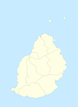
| Districts | Rivière du Rempart District |
| Government | |
| Population (2011)[1] | |
| • Total | 5,070 |
| • Density | 509.5/km2 (1,320/sq mi) |
| Time zone | UTC+4 (MUT) |
| Area code | 230 |
| ISO 3166 code | MU |
Cap Malheureux is a village in Mauritius located in Rivière du Rempart District. The village is administered by the Cap Malheureux Village Council under the aegis of the Rivière du Rempart District Council.[2] According to the 2011 census by Statistics Mauritius, its population was 5,070.[1]
YouTube Encyclopedic
-
1/3Views:1 9592 1772 641
-
VLOG M08 - île Maurice / Cap malheureux & Le morne / Drone DJI Phantom 4
-
BEAUTIFUL Cap Malheureux Beach | Coin de Mire | Fishermen • Mauritius
-
Cape Point Apartments - Cap Malheureux - Mauritius
Transcription
History
The name Cap Malheureux, meaning "Unlucky Cape", was given by the French who held the island from 1715 to 1810. The island was often the bone of contention of many great explorers of the time, including the British.
In 1810 the British decided to take the island in order to stop the raids on British fleets by the corsairs. Following an unsuccessful attempt to invade via Grand Port in the south in August 1810 (claimed as the only defeat in the Napoleonic Wars of the Royal Navy by the French), British navy and army forces from Bombay, Madras and the Cape of Good Hope took the French by surprise by landing in the North of the island, where the French defences were weakest. As a result, the French were defeated inland and over the years the area became known as Cap Malheureux as a reminder of the 1810 invasion.[citation needed] [3]
See also
References
- ^ a b "Table G1 - Resident population by geographical location, whereabouts on census night and sex" (PDF). Statistics Mauritius. 2011: 3 and 4. Archived from the original (PDF) on 3 March 2016. Retrieved 19 December 2012.
{{cite journal}}: Cite journal requires|journal=(help) - ^ Ministry of Local Government and Outer Islands. "Local Government Act 2011" (PDF). Government of Mauritius. Archived from the original (PDF) on 14 November 2012. Retrieved 19 December 2012.
{{cite journal}}: Cite journal requires|journal=(help) - ^ "History of Mauritius: 1810". Mauritius Holidays. Retrieved 2020-12-16.
External links
![]() Media related to Cap Malheureux at Wikimedia Commons
Media related to Cap Malheureux at Wikimedia Commons