
Cape Hawaii
Мыс Гавайи | |
|---|---|
 Cape Hawaii | |
| Coordinates: 71°1′30″N 177°54′56″W / 71.02500°N 177.91556°W | |
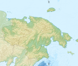
| Location | Wrangel Island |
| Offshore water bodies | Chukchi Sea |
| Area | |
| • Total | Chukotka, Russian Far East |
| Elevation | 96 m (315 ft) |
Cape Hawaii (Russian: Мыс Гавайи) is a headland of Wrangel Island. Administratively it belongs to the Chukotka Autonomous Okrug, Russian Federation.
This cape is located on the southeastern coast of Wrangel Island, facing the Chukchi Sea, about 40 km (25 mi) east of Rodgers Harbor.[1]
History
Cape Hawaii was named in August 1867 by Thomas Long, the captain of American whaling bark Nile,[2] after the Hawaiian Islands, where his ship was based.[3] On 23 August 1881 the headland was the first point of Wrangel Island sighted by Lieutenant Robert M. Berry on USS Rodgers during the search for the Jeannette.[4][5]
In the 1960s, a radar station of the Soviet Air Defence Forces was built on Cape Hawaii. The military personnel lived in it autonomously with supplies delivered by air. They rarely visited neighboring Ushakovskoye village, and only following an invitation of local authorities or in connection with significant events. In 1992 the military radar installation at Cape Hawaii was closed.[6]
 |
See also
References
- ^ Sailing Directions for Siberia. United States. Hydrographic Office; p. 53
- ^ Wrangel Island, The Geographical Journal. Vol. 62, No. 6 (Dec., 1923), pp. 440-444
- ^ John Muir, S. Hall Young<, The Alaska Route: The Cruise of the Corwin, Travels in Alaska,
- ^ George W. De Long, Raymond Lee Newcomb, Our Lost Explorers: The Narrative of the Jeannette Arctic Expedition. p. 60
- ^ Leontiev V.V. , Novikova K.A. Toponymic Dictionary of the North-East of the USSR / scientific. ed. G. A. Menovschikov ; FEB AN USSR . North-East complex. Research institutes. Lab archeology, history and ethnography. - Magadan: Magad. Prince Publishing House , 1989 . ISBN 5-7581-0044-7
- ^ Warriors (In Russian)
External links
- Military on Wrangel Island (in Russian)
- Medvedev establishes environmental buffer zone around Wrangel Island
This Chukotka Autonomous Okrug location article is a stub. You can help Wikipedia by expanding it. |