
Cape Buor-Khaya
Мыс Буор-Хая | |
|---|---|
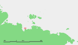 Location of Cape Buor-Khaya | |
 Cape Buor-Khaya | |
| Coordinates: 71°56′38″N 132°47′38″E / 71.94389°N 132.79389°E | |
| Location | Sakha (Yakutia), |
| Offshore water bodies | Laptev Sea |
| Area | |
| • Total | Russian Far East |
Cape Buor Khaya, (Russian: Мыс Буор-Хая; Mys Buor-Khaya) is a headland in the Laptev Sea.[1]
Geography
It is located between the Buor-Khaya Gulf on the west and the Yana Bay on the east. It is a conspicuous headland and has an 11 m high light on a framework tower.[2]
The sea in the area surrounding the cape is frozen for about nine months every year and often clogged with ice floes. On its eastern side there is a long semi-submerged landspit known as Kosa Buor-Khaya.
Administratively the Buor-Khaya Cape belongs to the Sakha Republic (Yakutia) of the Russian Federation.
Climate
The area has a subarctic climate (Dfc) bordering on a tundra climate (ET).
| Climate data for Cape Buor-Khaya | |||||||||||||
|---|---|---|---|---|---|---|---|---|---|---|---|---|---|
| Month | Jan | Feb | Mar | Apr | May | Jun | Jul | Aug | Sep | Oct | Nov | Dec | Year |
| Record high °C (°F) | 4.9 (40.8) |
8.2 (46.8) |
8.7 (47.7) |
15.0 (59.0) |
28.0 (82.4) |
33.0 (91.4) |
34.0 (93.2) |
31.0 (87.8) |
26.0 (78.8) |
18.0 (64.4) |
10.0 (50.0) |
16.0 (60.8) |
34.0 (93.2) |
| Mean daily maximum °C (°F) | −16.5 (2.3) |
−15.7 (3.7) |
−10.0 (14.0) |
−3.6 (25.5) |
4.3 (39.7) |
11.5 (52.7) |
14.6 (58.3) |
13.3 (55.9) |
9.1 (48.4) |
−1.1 (30.0) |
−10.5 (13.1) |
−15.7 (3.7) |
−2.1 (28.2) |
| Daily mean °C (°F) | −19.5 (−3.1) |
−18.9 (−2.0) |
−13.4 (7.9) |
−6.9 (19.6) |
1.0 (33.8) |
7.8 (46.0) |
10.8 (51.4) |
10.1 (50.2) |
6.4 (43.5) |
−3.6 (25.5) |
−13.2 (8.2) |
−18.6 (−1.5) |
−5.3 (22.5) |
| Mean daily minimum °C (°F) | −22.6 (−8.7) |
−22.2 (−8.0) |
−17.2 (1.0) |
−10.6 (12.9) |
−2.6 (27.3) |
4.3 (39.7) |
7.3 (45.1) |
7.0 (44.6) |
3.9 (39.0) |
−6.2 (20.8) |
−16.3 (2.7) |
−21.5 (−6.7) |
−8.5 (16.7) |
| Record low °C (°F) | −51.0 (−59.8) |
−48.0 (−54.4) |
−43.9 (−47.0) |
−38.9 (−38.0) |
−28.0 (−18.4) |
−13.9 (7.0) |
−7.2 (19.0) |
−3.0 (26.6) |
−10.0 (14.0) |
−32.0 (−25.6) |
−48.0 (−54.4) |
−51.0 (−59.8) |
−51.0 (−59.8) |
| Source: [3] | |||||||||||||
References
- ^ GoogleEarth
- ^ Russian Coastal explorer[permanent dead link]
- ^ "Weather Averages for Cape Buor-Khaya (1955-2011)". climatebase.ru. Retrieved 18 December 2014.
External links
This Sakha Republic location article is a stub. You can help Wikipedia by expanding it. |