
Cañaboncito | |
|---|---|
Barrio | |
 Welcome sign at Parcelas Cañaboncito in Barrio Cañaboncito | |
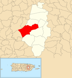 Location of Cañaboncito within the municipality of Caguas shown in red | |
 Cañaboncito Location of Puerto Rico | |
| Coordinates: 18°12′52″N 66°04′54″W / 18.214467°N 66.081672°W[1] | |
| Commonwealth | |
| Municipality | |
| Area | |
| • Total | 7.61 sq mi (19.7 km2) |
| • Land | 7.61 sq mi (19.7 km2) |
| • Water | 0 sq mi (0 km2) |
| Elevation | 636 ft (194 m) |
| Population (2010) | |
| • Total | 27,464 |
| • Density | 3,608.9/sq mi (1,393.4/km2) |
| Source: 2010 Census | |
| Time zone | UTC−4 (AST) |
Cañaboncito is a barrio in the municipality of Caguas, Puerto Rico. Its population in 2010 was 27,464. The barrio has over 90 sectors.[3][4][5]
YouTube Encyclopedic
-
1/2Views:302506
-
Visitando un terreno en Caguas PR 🇵🇷
-
Comunidad Las Carolinas Caguas PR
Transcription
History
Cañaboncito has 90 sectors.[6]
Cañaboncito was in Spain's gazetteers[7] until Puerto Rico was ceded by Spain in the aftermath of the Spanish–American War under the terms of the Treaty of Paris of 1898 and became an unincorporated territory of the United States. In 1899, the United States Department of War conducted a census of Puerto Rico finding that the population of Cañaboncito barrio was 1,400.[8]
| Census | Pop. | Note | %± |
|---|---|---|---|
| 1900 | 1,400 | — | |
| 1910 | 1,492 | 6.6% | |
| 1920 | 2,208 | 48.0% | |
| 1930 | 3,357 | 52.0% | |
| 1940 | 3,526 | 5.0% | |
| 1950 | 3,285 | −6.8% | |
| 1960 | 5,727 | 74.3% | |
| 1970 | 0 | −100.0% | |
| 1980 | 24,170 | — | |
| 1990 | 26,453 | 9.4% | |
| 2000 | 28,669 | 8.4% | |
| 2010 | 27,464 | −4.2% | |
| U.S. Decennial Census 1899 (shown as 1900)[9] 1910-1930[10] 1930-1950[11] 1980-2000[12] 2010[13] | |||
See also
References
- ^ a b "US Gazetteer 2019". US Census. US Government.
- ^ U.S. Geological Survey Geographic Names Information System: Cañaboncito barrio
- ^ Picó, Rafael; Buitrago de Santiago, Zayda; Berrios, Hector H. Nueva geografía de Puerto Rico: física, económica, y social, por Rafael Picó. Con la colaboración de Zayda Buitrago de Santiago y Héctor H. Berrios. San Juan Editorial Universitaria, Universidad de Puerto Rico,1969.
- ^ Gwillim Law (20 May 2015). Administrative Subdivisions of Countries: A Comprehensive World Reference, 1900 through 1998. McFarland. p. 300. ISBN 978-1-4766-0447-3. Retrieved 25 December 2018.
- ^ Puerto Rico: 2010 Population and Housing Unit Counts.pdf (PDF). U.S. Dept. of Commerce, Economics and Statistics Administration, U.S. Census Bureau. 2010.
- ^ "Lista Sectores por Barrio Separados" (PDF). caguas.gov.pr (in Spanish). Municipio Autónomo de Caguas Oficina de Planificación Unidad de Información Geográfica y Estadísticas Vitales. Retrieved 15 October 2022.
- ^ "Anuario del comercio, de la industria, de la magistratura y de la administración. 1881". Biblioteca Nacional de España (in Spanish). p. 1614. Retrieved 4 April 2023.
- ^ Joseph Prentiss Sanger; Henry Gannett; Walter Francis Willcox (1900). Informe sobre el censo de Puerto Rico, 1899, United States. War Dept. Porto Rico Census Office (in Spanish). Imprenta del gobierno. p. 162.
- ^ "Report of the Census of Porto Rico 1899". War Department Office Director Census of Porto Rico. Archived from the original on July 16, 2017. Retrieved September 21, 2017.
- ^ "Table 3-Population of Municipalities: 1930 1920 and 1910" (PDF). United States Census Bureau. Archived (PDF) from the original on August 17, 2017. Retrieved September 21, 2017.
- ^ "Table 4-Area and Population of Municipalities Urban and Rural: 1930 to 1950" (PDF). United States Census Bureau. Archived (PDF) from the original on August 30, 2015. Retrieved September 21, 2014.
- ^ "Table 2 Population and Housing Units: 1960 to 2000" (PDF). United States Census Bureau. Archived (PDF) from the original on July 24, 2017. Retrieved September 21, 2017.
- ^ Puerto Rico: 2010 Population and Housing Unit Counts.pdf (PDF). U.S. Dept. of Commerce Economics and Statistics Administration U.S. Census Bureau. 2010. Archived (PDF) from the original on 2017-02-20. Retrieved 2019-08-02.
This Caguas, Puerto Rico location article is a stub. You can help Wikipedia by expanding it. |