
Cần Giờ district
Huyện Cần Giờ | |
|---|---|
 Seal | |
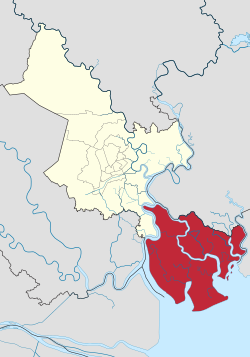 Cần Giờ in the metropolitan area of HCMC | |
 Cần Giờ district | |
| Coordinates: 10°30′43″N 106°52′50″E / 10.51194°N 106.88056°E | |
| Country | |
| Centrally governed city | Ho Chi Minh City |
| Seat | Cần Thạnh Town |
| Divisions | 1 township (thị trấn), 6 communes (xã) |
| Area | |
| • Total | 704 km2 (272 sq mi) |
| Population (2018) | |
| • Total | 74,960 |
| • Density | 110/km2 (280/sq mi) |
| Time zone | UTC+07 (ICT) |
| Website | cangio.hochiminhcity.gov.vn |
Cần Giờ is a coastal suburban district of Ho Chi Minh City, in the Southeast region of Vietnam.
The district is located 50 km from downtown Ho Chi Minh City. As of 2010, the district had an area of 704 km² and population of 70,697.[1] Cần Giờ is home to Cần Giờ Mangrove Forest, a biosphere reserve listed by UNESCO.
YouTube Encyclopedic
-
1/3Views:4142 0052 103
-
Du lịch Cần Giờ có gì? - Can Gio district tourist area- Bôn Ba TV
-
Khám Phá Cần Giờ HCM - Những Cây Cầu Cao Tốc Ngủ Lâu Nhất Miền Nam - Cao Tốc Bắc Nam
-
Trying Vietnam's HIGHEST RATED Food Tour 🇻🇳 (on motorbikes)
Transcription
Geographical location
Cần Giờ borders Nhà Bè district to the north, Long An and Tiền Giang provinces to the west, Đồng Nai province to the northeast, Bà Rịa–Vũng Tàu province to the southeast, and the East Sea to the south. The district is bordered on the West by the Soai Rap river, which currently connects through the Binh Khanh Ferry Terminal, with plans to construct the Cần Giờ Bridge.[2]
Administration
Cần Giờ district includes the town of Cần Thạnh and six communes:
|
|
References
- ^ "HCMC's Population and population density in 2010 by district". HCMC Office of Statistics. Archived from the original on July 5, 2017. Retrieved Feb 4, 2014.
- ^ "Work on Can Gio Bridge to start in 2022". The Saigon Times. June 23, 2020. Archived from the original on May 24, 2022. Retrieved November 9, 2021.

| Ho Chi Minh City |
|  |
|---|---|---|
| Bà Rịa–Vũng Tàu province | ||
| Bình Dương province |
| |
| Bình Phước province |
| |
| Đồng Nai province | ||
| Tây Ninh province |
| |
※ denotes provincial seat | ||
| International | |
|---|---|
| National | |
This article about a location in Ho Chi Minh City, Vietnam is a stub. You can help Wikipedia by expanding it. |