
Buug | |
|---|---|
| Municipality of Buug | |
 A street dance performance during Bog Festival | |
 Flag  Seal | |
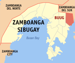 Map of Zamboanga Sibugay with Buug highlighted | |
OpenStreetMap  | |
 Buug Location within the Philippines | |
| Coordinates: 7°43′43″N 123°03′39″E / 7.7286°N 123.0608°E | |
| Country | Philippines |
| Region | Zamboanga Peninsula |
| Province | Zamboanga Sibugay |
| District | 1st district |
| Founded | February 2, 1960 |
| Barangays | 27 (see Barangays) |
| Government | |
| • Type | Sangguniang Bayan |
| • Mayor | Dionesia B. Lagas |
| • Vice Mayor | Jonam R. Lagas |
| • Representative | Wilter Y. Palma |
| • Municipal Council | Members |
| • Electorate | 26,069 voters (2022) |
| Area | |
| • Total | 134.06 km2 (51.76 sq mi) |
| Elevation | 174 m (571 ft) |
| Highest elevation | 551 m (1,808 ft) |
| Lowest elevation | 0 m (0 ft) |
| Population (2020 census)[3] | |
| • Total | 38,425 |
| • Density | 290/km2 (740/sq mi) |
| • Households | 9,019 |
| Economy | |
| • Income class | 3rd municipal income class |
| • Poverty incidence | 25.32 |
| • Revenue | ₱ 170.7 million (2020) |
| • Assets | ₱ 642.2 million (2020) |
| • Expenditure | ₱ 150.6 million (2020) |
| • Liabilities | ₱ 188.7 million (2020) |
| Service provider | |
| • Electricity | Zamboanga del Sur 2 Electric Cooperative (ZAMSURECO 2) |
| Time zone | UTC+8 (PST) |
| ZIP code | 7009 |
| PSGC | |
| IDD : area code | +63 (0)62 |
| Native languages | Subanon Cebuano Chavacano Tagalog |
| Website | www |
Buug, officially the Municipality of Buug (Cebuano: Lungsod sa Buug; Chavacano: Municipalidad de Buug; Tagalog: Bayan ng Buug), is a 3rd class municipality in the province of Zamboanga Sibugay, Philippines. According to the 2020 census, it has a population of 38,425 people.[3]
YouTube Encyclopedic
-
1/5Views:2 22315 89814 21010 176585
-
Buug Taariikh leh..
-
Fikrad & Buug #36 | Dirkii Sacmaallada | Axmed I. Cawaale | Somali
-
Fikrad & Buug #4 | Talk Like TED | Carmine Gallo | Somali
-
Fikrad & Buug #27 | Things I Wish I'd Known Before We Got Married | Dr Gary Ghapman| Somali
-
Barangay Labrador to Buug Town Proper via Buug-Bayog Road.
Transcription
Etymology
The name Buug was derived from the word bog, a Subanen word for secondary forest which is the same as the Cebuano-Visayan term buog. Accordingly, a group of Subanens stumbled upon this bog that was endowed with a stream and sufficient supply of water while they were moving from one place to another in search of a safe place to start a living away from marauders who were in search for slaves and things to loot. From then on people began to refer to the bog as Buug.
History
Buug grew into a thriving community through the initiative of the timuays, the Subanen chieftains, who held leadership of the community. A school was opened which drew in the first trickle of Subanon, Cebuano, and other Visayan settlers. When the Samar Mining Company (SAMICO) opened the Sibuguey project in 1957 at Bobuan (now part of the municipality of Bayog), the next group of settlers flooded in. More people came when the Pagadian-Zamboanga National Highway reached Buug in 1958. The highway is part of the Pan-Philippine Highway (also known as the Maharlika Highway and AH26).
Buug was originally a barangay of the municipality of Margosatubig and became a baranggay of Malangas when the former was divided in 1951. It became a municipality through Executive Order No. 380 issued by President Carlos P. Garcia on February 2, 1960. Instrumental in the formation of the Municipality of Buug was the persistence of Mr. Quirino M. Gonzales, a fisherman who also was a councilor of Malangas and a native of Merida, Leyte. He is also a distant relative of then Senator Neptali Gonzales. Gonzales became the first appointed mayor and was called the "Father of Buug". After being proclaimed as a municipality, flocks of settlers established residence and trade in the place.[5]
Geography
Buug is located in the central Zamboanga Peninsula, on the island of Mindanao. It has a pentagon-like shape bounded on the south by Dumanquilas Bay, Bayog on the north, Kumalarang on the east, Diplahan on the west, and Malangas on south-west. The distance from Manila to Buug is approximately 790 kilometres (490 mi). It is five hours away from Zamboanga City by bus, one hour and 45 minutes bus drive from the Ipil, and 57 kilometres (35 mi) away from Pagadian, or 45 minutes of travel by bus.
Climate
| Climate data for Buug, Zamboanga Sibugay | |||||||||||||
|---|---|---|---|---|---|---|---|---|---|---|---|---|---|
| Month | Jan | Feb | Mar | Apr | May | Jun | Jul | Aug | Sep | Oct | Nov | Dec | Year |
| Mean daily maximum °C (°F) | 30 (86) |
30 (86) |
31 (88) |
31 (88) |
29 (84) |
28 (82) |
28 (82) |
28 (82) |
28 (82) |
28 (82) |
29 (84) |
29 (84) |
29 (84) |
| Mean daily minimum °C (°F) | 20 (68) |
20 (68) |
21 (70) |
22 (72) |
23 (73) |
23 (73) |
23 (73) |
23 (73) |
23 (73) |
23 (73) |
22 (72) |
21 (70) |
22 (72) |
| Average precipitation mm (inches) | 22 (0.9) |
18 (0.7) |
23 (0.9) |
24 (0.9) |
67 (2.6) |
120 (4.7) |
132 (5.2) |
156 (6.1) |
119 (4.7) |
124 (4.9) |
54 (2.1) |
24 (0.9) |
883 (34.6) |
| Average rainy days | 9.4 | 9.1 | 11.5 | 11.9 | 20.1 | 22.5 | 22.4 | 23.2 | 21.5 | 22.2 | 15.7 | 11.5 | 201 |
| Source: Meteoblue[6] (Use with caution: this is modeled/calculated data, not measured locally.) | |||||||||||||
It has an average temperature of 26 °C (79 °F) and has an average elevation of 200 metres (660 ft) above sea level. It is away from the typhoon belt and enjoying a Type IV climate, i.e. rainfall is more or less evenly distributed throughout the year.
Barangays
Buug is politically subdivided into 27 barangays. Each barangay consists of puroks while some have sitios.
- Agutayan
- Bagong Borbon
- Basalem
- Bawang
- Bliss
- Bulaan
- Compostela
- Danlugan
- Datu Panas
- Del Monte
- Guintuloan
- Guitom
- Guminta
- Labrador
- Lantawan
- Mabuhay
- Maganay
- Manlin
- Muyo
- Pamintayan
- Pling
- Poblacion
- Pulog
- San Jose
- Talairan
- Talamimi
- Villacastor (Galit)
Demographics
|
| ||||||||||||||||||||||||||||||||||||
| Source: Philippine Statistics Authority[7][8][9][10] | |||||||||||||||||||||||||||||||||||||
Economy
Credit institutions and commercial businesses have multiplied. Appliance centers and merchandisers with main branches in big cities have invested in the area. Cottage industries have also sprouted. Buug's economy is based on two sectors categorized by the local government:
- Agriculture which consists of farming, livestock & poultry, and fisheries.
- Service Activities such as trade/commerce & industry, finance, personal and community service.
Government
Local government
The local executive council is administered by a mayor. The legislative council is headed by a vice mayor with ten municipal councilors as members, eight of which are elected, plus the representative of Sangguniang Kabataan and the president of the Association of Barangay Captains (ABC).
Congress representation
Buug belongs to the first district of Zamboanga Sibugay. The current representative is Wilter W. Palma II
Education
There are two higher education institutions in Buug. Mindanao State University- Buug offers courses in education, agriculture, fisheries, liberal arts, information technology, hospitality industry, environmental science, etc. It also has a high school which serves as the laboratory school of the College of Education. St. John College of Buug Foundation, Inc. the only private college which offers courses criminology and business administration. A private high school managed by the Sisters of St. Paul of Chartres is also located here, the St. Paul School (formerly Holy Trinity Academy) which offers primary and high school education. The first high school which opened in Buug is a Gabaldon school called Western Mindanao Institute, a private school. Public high schools are also present such as the Buug National High School (which opened in 1996) located in Barangay Manlin and Del Monte National High School. INTERNACIONAL COLEGIO de TECNOLOGIA-ICT Main Campus Datu Panas established 2008 and school operation in 2009 registered with TESDA and DepEd in 2016, the only private school in Buug offered various technical courses and the only technical school offered cable television installation NC 2 in region 9.
References
- ^ Municipality of Buug | (DILG)
- ^ "2015 Census of Population, Report No. 3 – Population, Land Area, and Population Density" (PDF). Philippine Statistics Authority. Quezon City, Philippines. August 2016. ISSN 0117-1453. Archived (PDF) from the original on May 25, 2021. Retrieved July 16, 2021.
- ^ a b Census of Population (2020). "Region IX (Zamboanga Peninsula)". Total Population by Province, City, Municipality and Barangay. Philippine Statistics Authority. Retrieved 8 July 2021.
- ^ "PSA Releases the 2018 Municipal and City Level Poverty Estimates". Philippine Statistics Authority. 15 December 2021. Retrieved 22 January 2022.
- ^ Manlin, Alicia. "Municipality of Buug". Municipal Planning and Development Coordinator. Retrieved January 8, 2014.
- ^ "Buug: Average Temperatures and Rainfall". Meteoblue. Retrieved 1 May 2020.
- ^ Census of Population (2015). "Region IX (Zamboanga Peninsula)". Total Population by Province, City, Municipality and Barangay. Philippine Statistics Authority. Retrieved 20 June 2016.
- ^ Census of Population and Housing (2010). "Region IX (Zamboanga Peninsula)" (PDF). Total Population by Province, City, Municipality and Barangay. National Statistics Office. Retrieved 29 June 2016.
- ^ Censuses of Population (1903–2007). "Region IX (Zamboanga Peninsula)". Table 1. Population Enumerated in Various Censuses by Province/Highly Urbanized City: 1903 to 2007. National Statistics Office.
{{cite encyclopedia}}: CS1 maint: numeric names: authors list (link) - ^ "Province of Zamboanga Sibugay". Municipality Population Data. Local Water Utilities Administration Research Division. Retrieved 17 December 2016.
- ^ "Poverty incidence (PI):". Philippine Statistics Authority. Retrieved December 28, 2020.
- ^ "Estimation of Local Poverty in the Philippines" (PDF). Philippine Statistics Authority. 29 November 2005.
- ^ "2003 City and Municipal Level Poverty Estimates" (PDF). Philippine Statistics Authority. 23 March 2009.
- ^ "City and Municipal Level Poverty Estimates; 2006 and 2009" (PDF). Philippine Statistics Authority. 3 August 2012.
- ^ "2012 Municipal and City Level Poverty Estimates" (PDF). Philippine Statistics Authority. 31 May 2016.
- ^ "Municipal and City Level Small Area Poverty Estimates; 2009, 2012 and 2015". Philippine Statistics Authority. 10 July 2019.
- ^ "PSA Releases the 2018 Municipal and City Level Poverty Estimates". Philippine Statistics Authority. 15 December 2021. Retrieved 22 January 2022.
External links
- Buug Profile at PhilAtlas.com
- /www.buug.gov.ph/ Official Website of the Municipality of Buug]
- Philippine Standard Geographic Code
- Philippine Census Information
Places adjacent to Buug | |
|---|---|
Ipil (capital and largest municipality) | |
| Municipalities | |