
Butiama District | |
|---|---|
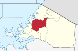 Butiama District of Mara Region | |
| Coordinates: 01°46′S 033°58′E / 1.767°S 33.967°E | |
| Country | |
| Region | Mara Region |
| Area | |
| • Total | 1,962 km2 (758 sq mi) |
| Population (2022) | |
| • Total | 281,656 |
| • Density | 140/km2 (370/sq mi) |
| Website | Regional website |
Butiama District is one of the seven districts of Mara Region of Tanzania. It is bordered to the north by Roya District across the Kirumi Bridge on the Mara river. Its administrative centre is the town of Butiama. Julius Nyerere was born in Butiama; the Mwalimu Nyerere Museum is located in his town of birth.
According to the 2022 Tanzania National Census, the population of the Butiama District was 281,656.[1][2]
Transport
Road
Paved Trunk road T4 from Mwanza to the Kenyan border passes through Butiama District from south to north. Trunk road T17 from Musoma to Arusha Region passes through the district from north to south.[3]
Administrative subdivisions
As of 2012, Butiama District was administratively divided into 20 wards.[2]
Wards
- Bisumwa
- Buhemba
- Bukabwa
- Buruma
- Busegwe
- Bumangi
- Buswahili
- Butiama
- Butuguri
- Bwiregi
- Etaro
- Kukirango
- Kyanyari
- Masaba
- Mirwa
- Muriaza
- Nyakatende
- Nyamimange
- Nyankanga
- Nyegina
- Sirorisimba
References
- ^ "Tanzania: Administrative Division (Regions and Districts) - Population Statistics, Charts and Map". www.citypopulation.de. Retrieved 2024-02-11.
- ^ a b "Census 2012". National Bureau of Statistics. Archived from the original on 5 March 2016. Retrieved 9 December 2015.
- ^ "Trunk and Regional Roads in Tanzania". Tanroads. Archived from the original on 8 December 2015. Retrieved 1 December 2015.