
Burnside, Pennsylvania | |
|---|---|
 The Irvin-Patchin House on Main Street | |
 Location of Burnside in Clearfield County, Pennsylvania. | |
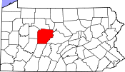 Map showing Clearfield County in Pennsylvania | |
 Burnside Pennsylvania | |
| Coordinates: 40°48′48″N 78°47′16″W / 40.81333°N 78.78778°W | |
| Country | United States |
| State | Pennsylvania |
| County | Clearfield |
| Incorporated | 1874 |
| Government | |
| • Type | Borough Council |
| Area | |
| • Total | 1.73 sq mi (4.49 km2) |
| • Land | 1.68 sq mi (4.35 km2) |
| • Water | 0.06 sq mi (0.14 km2) |
| Elevation | 1,340 ft (410 m) |
| Population | |
| • Total | 188 |
| • Density | 111.90/sq mi (43.20/km2) |
| Time zone | UTC-5 (Eastern (EST)) |
| • Summer (DST) | UTC-4 (EDT) |
| ZIP code | 15721 |
| Area code | 814 |
| FIPS code | 42-10280 |
Burnside is a borough that is located in Clearfield County, Pennsylvania, United States. The population was 188 at thetime of the 2020 census.[3]
YouTube Encyclopedic
-
1/2Views:85 285329 412
-
Cherokee Oklahoma Reservation - Freedmen - Black Indians
-
Top 10 Chicken Coops
Transcription
Geography
Burnside is located in southwestern Clearfield County at 40°48′48″N 78°47′16″W / 40.81333°N 78.78778°W (40.813203, -78.787645),[4] along the West Branch Susquehanna River. It is bordered on the north, east, and south by Burnside Township and on the west by Indiana County.
U.S. Route 219 passes through the borough, leading north 37 miles (60 km) to DuBois and south 26 miles (42 km) to Ebensburg.
According to the United States Census Bureau, Burnside has a total area of 1.73 square miles (4.49 km2), of which 1.68 square miles (4.35 km2) is land and 0.054 square miles (0.14 km2), or 3.16%, is water.[5]
Demographics
| Census | Pop. | Note | %± |
|---|---|---|---|
| 1880 | 279 | — | |
| 1890 | 292 | 4.7% | |
| 1900 | 647 | 121.6% | |
| 1910 | 493 | −23.8% | |
| 1920 | 480 | −2.6% | |
| 1930 | 350 | −27.1% | |
| 1940 | 414 | 18.3% | |
| 1950 | 400 | −3.4% | |
| 1960 | 307 | −23.2% | |
| 1970 | 316 | 2.9% | |
| 1980 | 347 | 9.8% | |
| 1990 | 350 | 0.9% | |
| 2000 | 283 | −19.1% | |
| 2010 | 234 | −17.3% | |
| 2020 | 188 | −19.7% | |
| 2021 (est.) | 189 | [3] | 0.5% |
| Sources:[6][7][8][9][2] | |||
As of the census[7] of 2000, there were 283 people, 102 households, and seventy-nine families residing in the borough.
The population density was 168.8 inhabitants per square mile (65.2/km2). There were 115 housing units at an average density of 68.6 per square mile (26.5/km2).
The racial makeup of the borough was 100.00% White.
There were 102 households, out of which 35.3% had children who were under the age of eighteen living with them, 61.8% were married couples living together, 11.8% had a female householder with no husband present, and 21.6% were non-families. 17.6% of all households were made up of individuals, and 7.8% had someone living alone who was sixty-five years of age or older.
The average household size was 2.77 and the average family size was 3.10.
Within the borough, the population was spread out, with 25.1% of residents who were under the age of eighteen, 8.8% from who were aged eighteen to twenty-four, 27.9% who were aged twenty-five to forty-four, 25.8% who were aged forty-five to sixty-four, and 12.4% who were sixty-five years of age or older. The median age was thirty-seven years.
For every one hundred females, there were 106.6 males. For every one hundred females who were aged eighteen or older, there were 100.0 males.
The median income for a household in the borough was $21,818, and the median income for a family was $22,031. Males had a median income of $25,833 compared with that of $12,250 for females.
The per capita income for the borough was $9,993.
Approximately 22.2% of families and 27.2% of the population were living below the poverty line, including 48.5% of those who were under the age of eighteen and 4.4% of those who were sixty-five or older.
References
- ^ "ArcGIS REST Services Directory". United States Census Bureau. Retrieved October 12, 2022.
- ^ a b "Census Population API". United States Census Bureau. Retrieved Oct 12, 2022.
- ^ a b Bureau, US Census. "City and Town Population Totals: 2020—2021". Census.gov. US Census Bureau. Retrieved August 7, 2022.
- ^ "US Gazetteer files: 2010, 2000, and 1990". United States Census Bureau. 2011-02-12. Retrieved 2011-04-23.
- ^ "Geographic Identifiers: 2010 Census Summary File 1 (G001): Burnside borough, Pennsylvania". U.S. Census Bureau, American Factfinder. Archived from the original on April 30, 2015. Retrieved April 30, 2015.
- ^ "Census of Population and Housing". U.S. Census Bureau. Retrieved 11 December 2013.
- ^ a b "U.S. Census website". United States Census Bureau. Retrieved 2008-01-31.
- ^ "Incorporated Places and Minor Civil Divisions Datasets: Subcounty Resident Population Estimates: April 1, 2010 to July 1, 2012". Population Estimates. U.S. Census Bureau. Archived from the original on 11 June 2013. Retrieved 11 December 2013.
- ^ "Census of Population and Housing". Census.gov. Retrieved June 4, 2016.
Municipalities and communities of Clearfield County, Pennsylvania, United States | ||
|---|---|---|
| City | ||
| Boroughs | ||
| Townships | ||
| CDPs | ||
| Unincorporated communities |
| |
| Footnotes | ‡This populated place also has portions in an adjacent county or counties | |