
Burleigh, New Jersey | |
|---|---|
 House in Burleigh | |
 Map of the former Whitesboro-Burleigh CDP in Cape May County. Inset: Location of Cape May County in New Jersey. | |
 Burleigh Location in Cape May County  Burleigh Location in New Jersey  Burleigh Location in the United States | |
| Coordinates: 39°02′51″N 74°50′48″W / 39.047486°N 74.846665°W | |
| Country | |
| State | |
| County | Cape May |
| Township | Middle |
| Area | |
| • Total | 1.55 sq mi (4.03 km2) |
| • Land | 1.52 sq mi (3.94 km2) |
| • Water | 0.03 sq mi (0.08 km2) 2.07% |
| Elevation | 10 ft (3 m) |
| Population | |
| • Total | 766 |
| • Density | 502.95/sq mi (194.20/km2) |
| Time zone | UTC−05:00 (Eastern (EST)) |
| • Summer (DST) | UTC−04:00 (Eastern (EDT)) |
| ZIP Code | |
| Area code | 609 |
| FIPS code | 34-08890[5][6][7] |
| GNIS feature ID | 02583977[5][8] |
Burleigh is an unincorporated community and census-designated place (CDP)[9] located within Middle Township in Cape May County, in the U.S. state of New Jersey; Until the 2000 census the area had been part of the Whitesboro-Burleigh CDP, which was split in 2010 into separate CDPs for Burleigh and Whitesboro.[10] As of the 2010 United States Census, the CDP's population was 725.[11]
YouTube Encyclopedic
-
1/3Views:1 0971 676 534514
-
CAPE MAY COUNTY HOOD SCENERY - JERSEY SHORE
-
Madness at the Boat Ramp!! | Boneheaded Boaters of the Week | Broncos Guru
-
Hamilton Square, New Jersey Tornado 7-29-21
Transcription
Geography
According to the United States Census Bureau, the CDP had a total area of 1.550 square miles (4.015 km2), including 1.518 square miles (3.932 km2) of land and 0.032 square miles (0.083 km2) of water (2.07%).[5][12]
Demographics
| Census | Pop. | Note | %± |
|---|---|---|---|
| 2010 | 725 | — | |
| 2020 | 766 | 5.7% | |
| Population sources: 2010[11] 2020[3] | |||
2010 census
The 2010 United States census counted 725 people, 270 households, and 180 families in the CDP. The population density was 477.5 per square mile (184.4/km2). There were 321 housing units at an average density of 211.4 per square mile (81.6/km2). The racial makeup was 72.69% (527) White, 15.59% (113) Black or African American, 0.00% (0) Native American, 3.17% (23) Asian, 0.28% (2) Pacific Islander, 5.66% (41) from other races, and 2.62% (19) from two or more races. Hispanic or Latino of any race were 13.66% (99) of the population.[11]
Of the 270 households, 28.5% had children under the age of 18; 50.0% were married couples living together; 10.4% had a female householder with no husband present and 33.3% were non-families. Of all households, 26.7% were made up of individuals and 9.3% had someone living alone who was 65 years of age or older. The average household size was 2.69 and the average family size was 3.30.[11]
24.8% of the population were under the age of 18, 10.3% from 18 to 24, 21.1% from 25 to 44, 28.7% from 45 to 64, and 15.0% who were 65 years of age or older. The median age was 39.9 years. For every 100 females, the population had 90.3 males. For every 100 females ages 18 and older there were 94.6 males.[11]
Education
It is within the Middle Township School District,[13] which operates Middle Township High School.
Countywide schools include Cape May County Technical High School[14][15] and Cape May County Special Services School District.
In 1993 Richard Degener of The Press of Atlantic City described what is now the location of the private K-12 school Cape Christian Academy as being in Burleigh.[16] The school is currently in the Cape May Courthouse CDP and not the Burleigh CDP.[17]
References
- ^ "ArcGIS REST Services Directory". United States Census Bureau. Retrieved October 11, 2022.
- ^ U.S. Geological Survey Geographic Names Information System: Burleigh Census Designated Place, Geographic Names Information System. Accessed October 18, 2012.
- ^ a b Census Data Explorer: Burleigh CDP, New Jersey, United States Census Bureau. Accessed June 15, 2023.
- ^ Look Up a ZIP Code for Burleigh, NJ, United States Postal Service. Accessed October 18, 2012.
- ^ a b c Gazetteer of New Jersey Places, United States Census Bureau. Accessed July 21, 2016.
- ^ U.S. Census website, United States Census Bureau. Accessed September 4, 2014.
- ^ Geographic Codes Lookup for New Jersey, Missouri Census Data Center. Accessed June 9, 2023.
- ^ US Board on Geographic Names, United States Geological Survey. Accessed September 4, 2014.
- ^ State of New Jersey Census Designated Places - BVP20 - Data as of January 1, 2020, United States Census Bureau. Accessed December 1, 2022.
- ^ New Jersey: 2010 - Population and Housing Unit Counts - 2010 Census of Population and Housing (CPH-2-32), United States Census Bureau, August 2012, pg. III-3. Accessed October 18, 2012. "Cape May County—New CDPs: Belleplain, Burleigh (formed from part of deleted Whitesboro-Burleigh CDP and additional area), and Whitesboro (formed from part of deleted Whitesboro-Burleigh CDP); Deleted CDPs: Whitesboro-Burleigh (split to form all of Whitesboro and part of Burleigh CDPs)."
- ^ a b c d e DP-1 - Profile of General Population and Housing Characteristics: 2010 Demographic Profile Data for Burleigh CDP, New Jersey Archived 2020-02-12 at archive.today, United States Census Bureau. Accessed October 18, 2012.
- ^ US Gazetteer files: 2010, 2000, and 1990, United States Census Bureau. Accessed September 4, 2014.
- ^ "2020 CENSUS - SCHOOL DISTRICT REFERENCE MAP: Cape May County, NJ" (PDF). U.S. Census Bureau. Retrieved April 8, 2024.
- ^ Frequently Asked Questions Archived October 27, 2019, at the Wayback Machine, Cape May County Technical High School. Accessed October 27, 2019. "All residents of Cape May County are eligible to attend Cape May County Technical High School.... The Cape May County Technical High School is a public school so there is no cost to residents of Cape May County."
- ^ Technical High School Admissions Archived October 27, 2019, at the Wayback Machine, Cape May County Technical High School. Accessed October 27, 2019. "All students who are residents of Cape May County may apply to the Technical High School."
- ^ Degener, Richard (September 23, 1993). "Propertied Class / Cape Christian Academy Buys Land For Central Campus". The Press of Atlantic City. pp. C1–C2. - Available from Newsbank, ID# news/0EAEAA6D18083359. Clipping of first and of second pages at Newspapers.com.
- ^ "Home". Cape Christian Academy. Retrieved July 15, 2021.
10 Oyster Road Cape May Court House, NJ 08210
- See map of CDP from the 2010 U.S. Census - page 1 and page 2. In contrast it is across from but not in the Burleigh CDP: Seen here.
External links
- The Cape May County Gazette, community newspaper
- The Beachcomber
Municipalities and communities of Cape May County, New Jersey, United States | ||
|---|---|---|
| Cities | 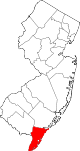 | |
| Boroughs | ||
| Townships | ||
| CDPs | ||
| Other communities | ||