
Bueng Bun
บึงบูรพ์ | |
|---|---|
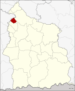 District location in Sisaket province | |
| Coordinates: 15°19′49″N 104°2′42″E / 15.33028°N 104.04500°E | |
| Country | Thailand |
| Province | Sisaket |
| Seat | Bueng Bun |
| Area | |
| • Total | 49.582 km2 (19.144 sq mi) |
| Population (2005) | |
| • Total | 10,655 |
| • Density | 214.9/km2 (557/sq mi) |
| Time zone | UTC+7 (ICT) |
| Postal code | 33220 |
| Geocode | 3311 |
Bueng Bun (Thai: บึงบูรพ์, pronounced [bɯ̄ŋ būːn]) is a district (amphoe) of Sisaket province, northeastern Thailand.
History
The minor district (king amphoe) was created on 18 July 1977, when the four tambons, Po, Dot, Siao, and Nong Ma were split off from Uthumphon Phisai district.[1] In 1979 all sub-districts except Po were returned to Uthumphon Phisai.[2] The minor district was upgraded to a full district on 4 July 1994.[3]
Geography
Neighboring districts are (from the north clockwise): Rasi Salai, Uthumphon Phisai, and Pho Si Suwan of Sisaket Province, and Rattanaburi of Surin province.
Administration
The district is divided into two sub-districts (tambons), which are further subdivided into 25 villages (mubans). Bueng Bun is a township (thesaban tambon) which covers parts of both tambon. There is one further tambon administrative organization (TAO).
| No. | Name | Thai name | Villages | Pop. | |
|---|---|---|---|---|---|
| 1. | Po | เป๊าะ | 16 | 6,207 | |
| 2. | Bueng Bun | บึงบูรพ์ | 9 | 4,448 |
References
- ^ ประกาศกระทรวงมหาดไทย เรื่อง แบ่งท้องที่อำเภออุทุมพรพิสัย จังหวัดศรีสะเกษ ตั้งเป็นกิ่งอำเภอบึงบูรพ์ (PDF). Royal Gazette (in Thai). 94 (67 ง): 2886. July 19, 1977. Archived from the original (PDF) on March 24, 2012.
- ^ ประกาศกระทรวงมหาดไทย เรื่อง เปลี่ยนแปลงเขตกิ่งอำเภอบึงบูรพ์ อำเภออุทุมพรพิสัย จังหวัดศรีสะเกษ (PDF). Royal Gazette (in Thai). 96 (192 ง): 4343. November 20, 1979. Archived from the original (PDF) on May 24, 2012.
- ^ พระราชกฤษฎีกาตั้งอำเภอเปือยน้อย ... และอำเภอศรีวิไล พ.ศ. ๒๕๓๗ (PDF). Royal Gazette (in Thai). 111 (21 ก): 32–35. June 3, 1994. Archived from the original (PDF) on September 30, 2007.
External links
Sisaket (capital) | ||
| Districts (amphoe) |  | |
| Related topics | ||
| Neighboring areas |
| |
This Sisaket Province location article is a stub. You can help Wikipedia by expanding it. |