
Bucks, Alabama | |
|---|---|
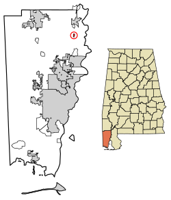 Location in Mobile County, Alabama | |
 Bucks | |
| Coordinates: 31°1′7.72″N 88°1′27.07″W / 31.0188111°N 88.0241861°W | |
| Country | United States |
| State | Alabama |
| County | Mobile |
| Area | |
| • Total | 0.42 sq mi (1.10 km2) |
| • Land | 0.39 sq mi (1.00 km2) |
| • Water | 0.04 sq mi (0.09 km2) |
| Elevation | 49 ft (15 m) |
| Population | |
| • Total | 22 |
| • Density | 56.85/sq mi (21.93/km2) |
| Time zone | UTC-6 (Central (CST)) |
| • Summer (DST) | UTC-5 (CDT) |
| ZIP code | 36512 |
| Area code | 251 |
| FIPS code | 01-10456 |
Bucks is an unincorporated community and census-designated place (CDP) in Mobile County, Alabama, United States.[3] As of the 2020 census, its population was 22,[2] down from 32 at the 2010 census.[4] It is located in the northeastern section of the county near the Mobile River, along U.S. Route 43. The James M. Barry Electric Generating Plant, a coal- and natural gas-fired power station operated by Alabama Power, is located in Bucks.
YouTube Encyclopedic
-
1/2Views:3 334 0822 052
-
15 Unbelievable Bear Attacks And Interactions Caught On Camera
-
I payed $100 for everything? Crazy Estate Sale Haul - Part Time Reseller
Transcription
Demographics
| Census | Pop. | Note | %± |
|---|---|---|---|
| 2020 | 22 | — | |
| U.S. Decennial Census[5] | |||
In 2010, Bucks had a population of 32. The racial and ethnic composition of the population was 59.4% white, 31.3% black or African American, 3.1% Native American, 6.3% from two or more races and 3.1% Hispanic or Latino of any race.[6]
Geography
Bucks is located at 31°1′7.72″N 88°1′27.07″W / 31.0188111°N 88.0241861°W. The elevation is 49 feet (15 m).[3] U.S. Route 43, the only highway through the community, leads south 23 miles (37 km) to Mobile and north 5 miles (8 km) to Mount Vernon.
According to the U.S. Census Bureau, the Bucks CDP has an area of 0.42 square miles (1.1 km2), of which 0.04 square miles (0.10 km2), or 8.51%, are water.[1] The Mobile River forms the eastern edge of the community.
Education
Residents are zoned to Mobile County Public School System campuses.[7] Residents are zoned to Citronelle High School.[8]
References
- ^ a b "2021 U.S. Gazetteer Files". United States Census Bureau. Retrieved April 21, 2022.
- ^ a b "Bucks CDP, Alabama: 2020 DEC Redistricting Data (PL 94-171)". U.S. Census Bureau. Retrieved April 21, 2022.
- ^ a b "Bucks, Alabama". Alabama Home Town Locator. Retrieved March 9, 2008.
- ^ "U.S. Census website". United States Census Bureau. Retrieved May 14, 2011.
- ^ "Census of Population and Housing". Census.gov. Retrieved June 4, 2016.
- ^ 2010 population by race and Hispanic or Latino by place report for Alabama from the US Census]
- ^ "2010 CENSUS - CENSUS BLOCK MAP: Bucks CDP, AL." U.S. Census Bureau. Retrieved on November 27, 2018.
- ^ "Citronelle High School Attendance Zone Archived 2021-07-25 at the Wayback Machine." Mobile County Public School System. Retrieved on November 27, 2018.
Municipalities and communities of Mobile County, Alabama, United States | ||
|---|---|---|
| Cities |  | |
| Towns | ||
| CDPs | ||
| Unincorporated communities | ||
| Ghost town | ||
| Indian reservation | ||
| Footnotes | ‡This populated place also has portions in an adjacent county or counties | |
This Mobile County, Alabama state location article is a stub. You can help Wikipedia by expanding it. |