
Buck Township | |
|---|---|
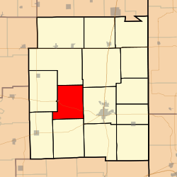 Location in Edgar County | |
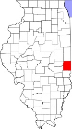 Edgar County's location in Illinois | |
| Coordinates: 39°38′29″N 87°49′36″W / 39.64139°N 87.82667°W | |
| Country | United States |
| State | Illinois |
| County | Edgar |
| Established | November 4, 1856 |
| Area | |
| • Total | 34.27 sq mi (88.8 km2) |
| • Land | 34.27 sq mi (88.8 km2) |
| • Water | 0 sq mi (0 km2) 0% |
| Elevation | 676 ft (206 m) |
| Time zone | UTC-6 (CST) |
| • Summer (DST) | UTC-5 (CDT) |
| ZIP codes | 61917, 61933, 61944, 61949 |
| FIPS code | 17-045-09213 |
Buck Township is one of fifteen townships in Edgar County, Illinois, USA. As of the 2020 census, its population was 214 and it contained 124 housing units.[2] Buck Township was originally named Pilot Grove Township, but the name was changed on May 9, 1857.
YouTube Encyclopedic
-
1/1Views:4 029
-
Our Hometown: Doylestown 1954
Transcription
Geography
According to the 2021 census gazetteer files, Buck Township has a total area of 34.27 square miles (88.76 km2), all land.[3]
Cities, towns, villages
Extinct towns
- Mays
Major highways
Demographics
As of the 2020 census[2] there were 214 people, 127 households, and 86 families residing in the township. The population density was 6.24 inhabitants per square mile (2.41/km2). There were 124 housing units at an average density of 3.62 per square mile (1.40/km2). The racial makeup of the township was 98.13% White, 0.00% African American, 0.00% Native American, 0.00% Asian, 0.00% Pacific Islander, 0.00% from other races, and 1.87% from two or more races. Hispanic or Latino of any race were 0.47% of the population.
There were 127 households, out of which 21.30% had children under the age of 18 living with them, 37.01% were married couples living together, 30.71% had a female householder with no spouse present, and 32.28% were non-families. 21.30% of all households were made up of individuals, and 7.10% had someone living alone who was 65 years of age or older. The average household size was 2.45 and the average family size was 2.90.
The township's age distribution consisted of 16.7% under the age of 18, 18.6% from 18 to 24, 16.1% from 25 to 44, 31.8% from 45 to 64, and 16.7% who were 65 years of age or older. The median age was 42.2 years. For every 100 females, there were 85.1 males. For every 100 females age 18 and over, there were 77.4 males.
The median income for a household in the township was $55,938, and the median income for a family was $73,667. Males had a median income of $42,917 versus $31,250 for females. The per capita income for the township was $29,175. About 1.2% of families and 6.8% of the population were below the poverty line, including none of those under age 18 and 5.8% of those age 65 or over.
| Census | Pop. | Note | %± |
|---|---|---|---|
| 1930 | 683 | — | |
| 1940 | 623 | −8.8% | |
| 1950 | 594 | −4.7% | |
| 1960 | 512 | −13.8% | |
| 1970 | 394 | −23.0% | |
| 1980 | 293 | −25.6% | |
| 1990 | 366 | 24.9% | |
| 2000 | 309 | −15.6% | |
| 2010 | 307 | −0.6% | |
| 2020 | 214 | −30.3% | |
| U.S. Decennial Census[4] | |||
School districts
- Kansas Community Unit School District 3
- Paris Community Unit School District 4
- Shiloh Community Unit School District 1
Political districts
- Illinois's 15th congressional district
- State House District 109
- State Senate District 55
References
- "Buck Township, Edgar County, Illinois". Geographic Names Information System. United States Geological Survey, United States Department of the Interior. Retrieved January 10, 2010.
- United States Census Bureau 2007 TIGER/Line Shapefiles
- United States National Atlas
- ^ U.S. Geological Survey Geographic Names Information System: Buck Township, Edgar County, Illinois
- ^ a b "Explore Census Data". data.census.gov. Retrieved January 22, 2023.
- ^ Bureau, US Census. "Gazetteer Files". Census.gov. Retrieved January 22, 2023.
- ^ "Census of Population and Housing". Census.gov. Retrieved June 4, 2016.
External links
Places adjacent to Buck Township, Edgar County, Illinois | |
|---|---|
Municipalities and communities of Edgar County, Illinois, United States | ||
|---|---|---|
| Cities |  | |
| Villages | ||
| Townships | ||
| Unincorporated communities | ||
| Footnotes | ‡This populated place also has portions in an adjacent county or counties | |