
Borgund herad | |
|---|---|
 Sogn og Fjordane within Norway | |
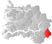 Borgund within Sogn og Fjordane | |
| Coordinates: 61°02′55″N 7°48′49″E / 61.0487°N 7.8135°E | |
| Country | Norway |
| County | Sogn og Fjordane |
| District | Sunnfjord |
| Established | 1 Jan 1864 |
| • Preceded by | Lærdal Municipality |
| Disestablished | 1 Jan 1964 |
| • Succeeded by | Lærdal Municipality |
| Administrative centre | Steinklepp |
| Area (upon dissolution) | |
| • Total | 635 km2 (245 sq mi) |
| Demonym | Borgynd[1] |
| Time zone | UTC+01:00 (CET) |
| • Summer (DST) | UTC+02:00 (CEST) |
| ISO 3166 code | NO-1423 |
Borgund is a former municipality in Sogn og Fjordane county, Norway. It was located in the southeastern part of the traditional district of Sogn. The 635-square-kilometre (245 sq mi) municipality existed from 1864 until its dissolution in 1964. It encompassed an area in the eastern part of the present-day Lærdal Municipality. The administrative center of Borgund was the village of Steinklepp, just northeast of the village of Borgund. Steinklepp was the site of a store, a bank, and a school. The historical Filefjell Kongevegen road passes through the Borgund area.[3]
YouTube Encyclopedic
-
1/3Views:1 42426 0062 644
-
Borgund Stave Church
-
Norway - Borgund stavkirke (stave church)
-
Costa Luminosa - Borgund Stave Church
Transcription
Location

The former municipality of Borgund was situated near the southeastern end of the Sognefjorden, along the Lærdalselvi river. The lower parts of the municipality were farms such as Sjurhaugen and Nedrehegg. They were at an elevation of about 270 m (890 ft) above sea level. Høgeloft, on the border with the neighboring municipality of Hemsedal, is a mountain in the Filefjell range and it was the highest point in Borgund at 1,920 m (6,300 ft) above sea level. The lakes Eldrevatnet, Juklevatnet, and Øljusjøen were also located near the border with Hemsedal.
History
Borgund was established as a municipality in 1864 when it was separated from the municipality of Lærdal. Initially it had a population of 963. During the 1960s, there were many municipal mergers across Norway due to the work of the Schei Committee. On 1 January 1964, the municipality of Borgund (population: 492) was merged with the Muggeteigen area (population: 11) of the neighboring Årdal Municipality and all of Lærdal Municipality (population: 1,755) were all merged to form a new, larger municipality of Lærdal.[4]
Name
The municipality (originally the parish) is named after the old Borgund farm (Old Norse: Borgyndr or Borgund) since the historic Borgund Stave Church was built there. The first element is borg which means "castle" or "fortified place". The last element is the suffix -und which means "rich" or "having a lot of something".[5]
Government
During its existence, this municipality was governed by a municipal council of directly elected representatives. The mayor was indirectly elected by a vote of the municipal council.[6]
Municipal council
The municipal council (Heradsstyre) of Borgund was made up of 13 representatives that were elected to four year terms. The party breakdown of the final municipal council was as follows:
| Party Name (in Nynorsk) | Number of representatives | |
|---|---|---|
| Labour Party (Arbeidarpartiet) | 8 | |
| Conservative Party (Høgre) | 1 | |
| Joint List(s) of Non-Socialist Parties (Borgarlege Felleslister) | 4 | |
| Total number of members: | 13 | |
| Note: On 1 January 1964, Borgund became part of Lærdal Municipality. | ||
| Party Name (in Nynorsk) | Number of representatives | |
|---|---|---|
| Labour Party (Arbeidarpartiet) | 7 | |
| Joint List(s) of Non-Socialist Parties (Borgarlege Felleslister) | 6 | |
| Total number of members: | 13 | |
| Party Name (in Nynorsk) | Number of representatives | |
|---|---|---|
| Labour Party (Arbeidarpartiet) | 6 | |
| Joint List(s) of Non-Socialist Parties (Borgarlege Felleslister) | 5 | |
| Local List(s) (Lokale lister) | 1 | |
| Total number of members: | 12 | |
| Party Name (in Nynorsk) | Number of representatives | |
|---|---|---|
| Labour Party (Arbeidarpartiet) | 7 | |
| Joint List(s) of Non-Socialist Parties (Borgarlege Felleslister) | 5 | |
| Total number of members: | 12 | |
| Party Name (in Nynorsk) | Number of representatives | |
|---|---|---|
| Labour Party (Arbeidarpartiet) | 4 | |
| Joint List(s) of Non-Socialist Parties (Borgarlege Felleslister) | 6 | |
| Local List(s) (Lokale lister) | 2 | |
| Total number of members: | 12 | |
| Party Name (in Nynorsk) | Number of representatives | |
|---|---|---|
| Labour Party (Arbeidarpartiet) | 4 | |
| Joint List(s) of Non-Socialist Parties (Borgarlege Felleslister) | 5 | |
| Local List(s) (Lokale lister) | 3 | |
| Total number of members: | 12 | |
| Note: Due to the German occupation of Norway during World War II, no elections were held for new municipal councils until after the war ended in 1945. | ||
Mayors
- 1864-1867: Haakon Henrikson Eraker
- 1868-1873: John Knutson Hegg
- 1874-1875: Haakon H. Kvamme, Sr.
- 1876-1883: John Knutson Hegg
- 1884-1887: Roar H. Husum
- 1888-1891: Ola Kirkevold
- 1892-1901: John Knutson Hegg
- 1902-1910: Anders L. Nesset
- 1911-1914: Ola E. Eggum
- 1915-1916: Jakob S. Hovland
- 1917-1917: Lars A. Nesse
- 1918-1919: Håkon H. Kvamme, Jr.
- 1920-1922: Ola O. Kvenshagen
- 1923-1928: Lars A. Nesse
- 1929-1931: Ola O. Kvenshagen
- 1936-1945: Nils A. Lyslo
- 1945-1945: Roar O. Husum
- 1946-1947: Hallvard Borlaug
- 1952-1955: Roar O. Husum
- 1948-1951: Torstein Hillestad (Ap)
- 1956-1957: Olav Sletthagen(Ap)
- 1958-1963: Anders Lunden (Ap)
See also
References
- ^ "Navn på steder og personer: Innbyggjarnamn" (in Norwegian). Språkrådet.
- ^ "Forskrift om målvedtak i kommunar og fylkeskommunar" (in Norwegian). Lovdata.no.
- ^ "Borgund – Sogn og Fjordane". Store norske leksikon (in Norwegian). Archived from the original on 29 September 2012. Retrieved 7 December 2009.
- ^ Jukvam, Dag (1999). Historisk oversikt over endringer i kommune- og fylkesinndelingen (PDF) (in Norwegian). Statistisk sentralbyrå. ISBN 9788253746845.
- ^ Rygh, Oluf (1919). Norske gaardnavne: Nordre Bergenhus amt (in Norwegian) (12 ed.). Kristiania, Norge: W. C. Fabritius & sønners bogtrikkeri. p. 74.
- ^ Hansen, Tore; Vabo, Signy Irene, eds. (20 September 2022). "kommunestyre". Store norske leksikon (in Norwegian). Kunnskapsforlaget. Retrieved 1 January 2023.
- ^ "Kommunevalgene og Ordførervalgene 1959" (PDF) (in Norwegian). Oslo: Statistisk sentralbyrå. 1960. Retrieved 16 February 2020.
- ^ "Kommunevalgene og Ordførervalgene 1955" (PDF) (in Norwegian). Oslo: Statistisk sentralbyrå. 1957. Retrieved 16 February 2020.
- ^ "Kommunevalgene og Ordførervalgene 1951" (PDF) (in Norwegian). Oslo: Statistisk sentralbyrå. 1952. Retrieved 16 February 2020.
- ^ "Kommunevalgene og Ordførervalgene 1947" (PDF) (in Norwegian). Oslo: Statistisk sentralbyrå. 1948. Retrieved 16 February 2020.
- ^ "Kommunevalgene og Ordførervalgene 1945" (PDF) (in Norwegian). Oslo: Statistisk sentralbyrå. 1947. Retrieved 16 February 2020.
- ^ "Kommunevalgene og Ordførervalgene 1937" (PDF) (in Norwegian). Oslo: Statistisk sentralbyrå. 1938. Retrieved 13 May 2020.
- ^ "Ordførarar i Lærdal kommune". NRK Fylkesliksikon (in Norwegian). 9 January 2004. Retrieved 29 May 2023.
External links
 Lærdal travel guide from Wikivoyage
| |||
 | Towns and cities |  | |
| Municipalities | |||