
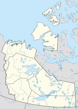
 Borden Island, Northwest Territories and Nunavut | |
 Borden Island  Borden Island  Borden Island | |
| Geography | |
|---|---|
| Location | Northern Canada |
| Coordinates | 78°30′03″N 111°13′12″W / 78.50083°N 111.22000°W |
| Archipelago | Queen Elizabeth Islands Arctic Archipelago |
| Area | 2,795 km2 (1,079 sq mi) |
| Length | 94 km (58.4 mi) |
| Width | 82 km (51 mi) |
| Administration | |
Canada | |
| Territory | Nunavut; Northwest Territories |
| Demographics | |
| Population | Uninhabited |
Borden Island is an uninhabited, low-lying island in the Queen Elizabeth Islands of northern Canada.[1] Split between Nunavut and the Northwest Territories, it is the northernmost point of the latter.
YouTube Encyclopedic
-
1/2Views:2 390358
-
Minister in a Minute: Sir Robert Borden
-
Building a Blog homepage in TailwindCSS - Part 5 | Transitions and Purgecss
Transcription
Some features and history
With an area of 2,795 km2 (1,079 sq mi) in size, 93.9 kilometres (58.3 mi) long and 82 kilometres (51 mi) wide, Borden is the 171st largest island in the world, and Canada's 30th largest island. It lies north of Mackenzie King Island and is similarly split between the Northwest Territories (larger portion) and Nunavut, with the border running along the 110th meridian west.[2]
The first known sighting of the island was by Vilhjalmur Stefansson in 1916, it was originally described as a single landmass.[3] However, in 1947, during an aerial survey by the Royal Canadian Air Force the island was found to be two islands divided by Wilkins Strait.[4]
Naming
The island is named for Robert Borden, Prime Minister of Canada 1911–1920.[5]
References
- ^ "Borden Island". www.thecanadianencyclopedia.ca. The Canadian Encyclopedia. Retrieved September 19, 2021.
- ^ "Mackenzie King Island | The Canadian Encyclopedia". www.thecanadianencyclopedia.ca. Retrieved September 19, 2021.
- ^ Stefansson, Vilhjalmur (1922). The Friendly Arctic: The Story of Five Years in Polar Regions. New York: Macmillan.
- ^ Thomson, Don W., Skyview Canada: A Story of Aerial Photography in Canada, R.B.W. Ltd: Ottawa, Canada, 1975, p. 130
- ^ "Canadian Leaders - Sir Robert Borden". Canada and the First World War. Retrieved September 19, 2021.
Further reading
- Geological Survey of Canada, John Adams, and Heather Penney. The 1956 June 3 Arctic Margin Earthquake Off Borden Island, Northwest Territories. Open file (Geological Survey of Canada), 2693. 1993.
