
Boon Lay | |
|---|---|
| Other transcription(s) | |
| • Chinese | 文礼 |
| • Pinyin | Wén lǐ |
| • Malay | Boon Lay |
| • Tamil | பூன் லே |
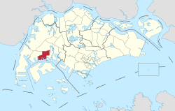 Location of Boon Lay in Singapore | |
| Country | |
| Region | West Region
|
| CDC | |
| Government | |
| • Mayors | South West CDC |
| • Members of Parliament | West Coast GRC |
| Area | |
| • Total | 8.23 km2 (3.18 sq mi) |
| Population (2022) | |
| • Total | 3- |
| Ethnic groups | |
Boon Lay is a planning area located in the West Region of Singapore. The planning area is bounded by the planning areas of Pioneer to the west, Jurong West to the north, Jurong East to the east and the strait of Selat Jurong to the south.
The Boon Lay Planning Area is different from Boon Lay. The latter is a residential neighbourhood located in the adjacent Jurong West Planning Area. Along with adjacent Pioneer, the Boon Lay Planning Area is a constituent part of the much larger Jurong Industrial Estate.
YouTube Encyclopedic
-
1/3Views:423391833
-
New 3RM listing at 216B BoonLay
-
Disinfection Operations at Boon Lay Place Market and Food Village
-
2023 August Singapore Jurong Regional Line: Construction between Boon Lay and Gek Poh
Transcription
Geography
Location
The Boon Lay Planning Area is located along the southwestern coast of the Singapore mainland and to the north of Jurong Island.
Included as part of the territory of Boon Lay Planning Area is Pulau Samulun, a minor island off Singapore's southwestern coast and connected to the mainland via Jalan Samulun.
Subzones
As defined by the Urban Redevelopment Authority, Boon Lay Planning Area is officially divided into 4 subzones:
| Name of estates | Location | Notable structures | Accessibility |
|---|---|---|---|
| Liu Fang | Areas bounded by Ayer Rajah Expressway (AYE), Pioneer Road, Jalan Buroh and Jurong Port Road | Jurong Hill | Buses |
| Samulun | Areas bounded by Jalan Buroh, Tanjong Kling Road, Shipyard Road, Selat Samulun, Selat Pulau Damar and Jurong Pier Road | Pulau Samulun | Buses |
| Shipyard | Areas bounded by Pioneer Road, Tanjong Kling Road, Shipyard Road, Selat Samulun and Benoi Basin. | Buses | |
| Tukang | Areas bounded by Ayer Rajah Expressway (AYE), Pioneer Road North, International Road and Corporation Road | Buses |