
Bonto Tangnga | |
|---|---|
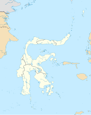 Bonto Tangnga Location in South Sulawesi and Indonesia 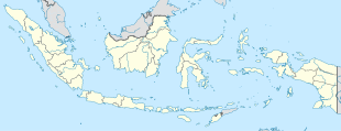 Bonto Tangnga Bonto Tangnga (Indonesia) | |
| Coordinates: 5°27′54.2052″S 119°55′50.2644″E / 5.465057000°S 119.930629000°E | |
| Country | |
| Province | South Sulawesi |
| Regency | Bantaeng Regency |
| District | Uluere District |
| Elevation | 3,050 ft (930 m) |
| Population (2010) | |
| • Total | 1,055[1] |
| Time zone | UTC+8 (Indonesia Central Standard Time) |
Bonto Tangnga is a village in Uluere district, Bantaeng Regency in South Sulawesi province. Its population is 1055.[1]: 1783
Climate
Bonto Tangnga has a tropical monsoon climate (Am) with little rainfall from August to October and heavy to very heavy rainfall in the remaining months.
| Climate data for Bonto Tangnga | |||||||||||||
|---|---|---|---|---|---|---|---|---|---|---|---|---|---|
| Month | Jan | Feb | Mar | Apr | May | Jun | Jul | Aug | Sep | Oct | Nov | Dec | Year |
| Mean daily maximum °C (°F) | 25.2 (77.4) |
25.2 (77.4) |
25.6 (78.1) |
26.0 (78.8) |
25.8 (78.4) |
25.3 (77.5) |
25.3 (77.5) |
26.0 (78.8) |
26.8 (80.2) |
27.3 (81.1) |
26.4 (79.5) |
25.4 (77.7) |
25.9 (78.5) |
| Daily mean °C (°F) | 21.4 (70.5) |
21.5 (70.7) |
21.6 (70.9) |
21.8 (71.2) |
21.6 (70.9) |
21.0 (69.8) |
20.5 (68.9) |
20.7 (69.3) |
21.4 (70.5) |
22.0 (71.6) |
22.0 (71.6) |
21.5 (70.7) |
21.4 (70.6) |
| Mean daily minimum °C (°F) | 17.6 (63.7) |
17.8 (64.0) |
17.7 (63.9) |
17.6 (63.7) |
17.5 (63.5) |
16.8 (62.2) |
15.8 (60.4) |
15.5 (59.9) |
16.0 (60.8) |
16.8 (62.2) |
17.7 (63.9) |
17.7 (63.9) |
17.0 (62.7) |
| Average precipitation mm (inches) | 577 (22.7) |
441 (17.4) |
374 (14.7) |
285 (11.2) |
232 (9.1) |
133 (5.2) |
102 (4.0) |
40 (1.6) |
46 (1.8) |
75 (3.0) |
280 (11.0) |
418 (16.5) |
3,003 (118.2) |
| Source: Climate-Data.org[2] | |||||||||||||
References
- ^ a b "Archived copy" (PDF). Archived from the original (PDF) on 2013-04-06. Retrieved 2020-07-16.
{{cite web}}: CS1 maint: archived copy as title (link) - ^ "Climate: Bonto Tangnga". Climate-Data.org. Retrieved July 16, 2020.
This South Sulawesi location article is a stub. You can help Wikipedia by expanding it. |