
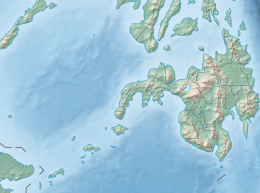
 Bongao Island Location within the Philippines | |
| Geography | |
|---|---|
| Coordinates | 5°1′14″N 119°45′12″E / 5.02056°N 119.75333°E |
| Adjacent to | Celebes Sea Sulu Sea |
| Area | 10.44 km2 (4.03 sq mi) |
| Administration | |
| Region | Bangsamoro |
| Province | Tawi-Tawi |
| Municipality | Bongao |
| Demographics | |
| Population | 75,076 (2020) |
| Pop. density | 7,191/km2 (18625/sq mi) |
| Ethnic groups | Sama |
| Additional information | |
 | |
Bongao Island is one of the islands of the Sulu Archipelago, a chain of islands between Mindanao and Borneo. Bongao Island is the town center of the municipality of Bongao, the capital of the province of Tawi-Tawi, the southernmost province of the Philippines.
Being the urban area of Bongao, it is the trading center of the whole province. Commercial centers, banks, schools, hospitals and government buildings are located in the island. The main seaport of the Tawi-Tawi is also situated in the island. But the island also has natural attractions, which includes many beach resorts and the imposing mountain at the center of the island, Bud Bongao, which overlooks the landscape.

Barangays
10 out of Bongao's 35 barangays is situated in the island.
- Bongao Poblacion
- Lamion
- Nalil
- Pag-asa
- Pahut
- Pasiagan
- Simandagit
- Tubig-Boh
- Tubig-Mampallam
- Tubig Tanah
Geography
The total land area of Bongao Island is approximately 10.44 km2 (4.03 sq mi). Directly north of the island is the island of Sanga-Sanga and its northeast is Pababag island. Both islands are still part of the municipality of Bongao. The island is around 58 km (36 mi) from Sabah, Malaysia, much nearer than Jolo or Zamboanga.

Demographics
According to the latest 2020 census, Bongao Island's total number of residents is 75,076.[1]
This table shows the population of the island's barangays.
| Barangay | Population (2020) |
|---|---|
| Bongao Poblacion | 15,462 |
| Lamion | 8,296 |
| Nalil | 5,487 |
| Pag-asa | 7,891 |
| Pahut | 1,874 |
| Pasiagan | 3,786 |
| Simandagit | 8,741 |
| Tubig-Boh | 8,664 |
| Tubig-Mampallam | 6,211 |
| Tubig Tanah | 8,664 |
| Total | 75,076 |
Residents of the island practice Islam and are part of the ethnic group, Sama. But since the Bongao is the capital of commerce, it also has Christians and other groups such as Tausug, Yakan and Bisaya.
Transport
There are regular flights from Zamboanga and Cotabato through Sanga-Sanga Airport located in the adjacent island of Sanga-Sanga.[2] [3] There are also scheduled boat trips from Zamboanga and Jolo to Bongao.[4]
References
- ^ "Municipality of Bongao (Capital): Philippine Standard Geographic Code". Philippine Statistics Authority. Retrieved 2020-06-30.
- ^ "Cebu Pacific added more flights for Zamboanga - Tawi-Tawi route".
- ^ "PHILIPPINE AIRLINES ADDS COTABATO – TAWI TAWI SERVICE FROM JUNE 2022".
- ^ "Aleson Shipping Schedule of Trips".