
Boghé
بوغي | |
|---|---|
Commune and town | |
 | |
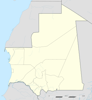 Boghé Location in Mauritania | |
| Coordinates: 16°35′N 14°16′W / 16.583°N 14.267°W | |
| Country | |
| Region | Brakna |
| Elevation | 13 m (43 ft) |
| Population (2013 census) | |
| • Total | 42,759 |
| Time zone | UTC+0 (GMT) |
Boghé (also Bogué) is a town and commune in the Brakna Region of southern Mauritania, located on the border with Senegal.[1]
In 2013, it had a census population of 40,341.
The city has a high school but no university. Efforts are under way to build a hospital to serve the city and its region.[citation needed]
Climate
In Boghé, the climate is warm and temperate. There is little rainfall. The Köppen-Geiger climate classification is BSh. The average annual temperature in Boghe is 29.0 °C (84.2 °F). About 244 mm (9.61 in) of precipitation falls annually.
| Climate data for Boghe | |||||||||||||
|---|---|---|---|---|---|---|---|---|---|---|---|---|---|
| Month | Jan | Feb | Mar | Apr | May | Jun | Jul | Aug | Sep | Oct | Nov | Dec | Year |
| Mean daily maximum °C (°F) | 31.4 (88.5) |
33.6 (92.5) |
36.3 (97.3) |
39.0 (102.2) |
40.7 (105.3) |
40.8 (105.4) |
38.2 (100.8) |
36.5 (97.7) |
37.3 (99.1) |
38.3 (100.9) |
36.0 (96.8) |
31.3 (88.3) |
36.6 (97.9) |
| Mean daily minimum °C (°F) | 14.5 (58.1) |
16.2 (61.2) |
19.6 (67.3) |
21.6 (70.9) |
24.1 (75.4) |
25.4 (77.7) |
25.7 (78.3) |
25.9 (78.6) |
25.7 (78.3) |
23.3 (73.9) |
19.6 (67.3) |
16.0 (60.8) |
21.5 (70.6) |
| Average precipitation mm (inches) | 1 (0.0) |
1 (0.0) |
0 (0) |
0 (0) |
0 (0) |
11 (0.4) |
56 (2.2) |
91 (3.6) |
68 (2.7) |
16 (0.6) |
0 (0) |
0 (0) |
244 (9.6) |
| Source: Climate-Data.org, Climate data | |||||||||||||
References
- ^ "Collectivités urbaines à vocation agricole, pastorale ou agropastorale". République Islamique de Mauritanie:Communes de Mauritanie. Archived from the original on May 4, 2004. Retrieved January 14, 2009.
16°35′N 14°16′W / 16.583°N 14.267°W
This Mauritania location article is a stub. You can help Wikipedia by expanding it. |