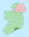
Boatstrand (Irish: Trá na mBád)[1] is a coastal village on the Copper Coast, Ireland, which lies between Annestown and Bunmahon.[2]
It consists of around 14 cottages and has a tiny fishing cove which is very popular in the summer time,[3] from which a small fishing fleet and leisure craft launch.[4] The dock dates back to the 1800s and is a hub of activity, especially in the summer months.[5] It is also home to Dunbrattin Head, one of the best fishing spots in County Waterford. This is due to the rocks at the end of the head, which attract fish like mackerel due to the warmer temperatures there.[6] It is also a popular point for sea swimming, with many swimmers using Boatstrand as the finish point for their swim. A popular swim is from Kilmurrin cove to Boatstrand.[3] [4]
The promontory fort at Dunabrattin is the largest found along the Waterford coastline, covering an area of around 6 hectares. The fort protected a Celtic clan called the Brattins who lived at this cliff top location around 2,000 years ago.[7]
YouTube Encyclopedic
-
1/2Views:399425
-
Boatstrand Harbour Irland Co. Waterford
-
BOAT STRAND WATERFORD IRELAND
Transcription
Gallery
-
Boats in harbour
-
Coast to the west of Dunabrattin Head
References
- ^ "Placenames Database of Ireland". Dublin City University. Retrieved 14 January 2015.
- ^ safeharbour ie Hypnotherapy Clinic. "safeharbour ie Hypnotherapy Clinic :Boatstrand County Waterford". Safeharbour.ie. Retrieved 22 July 2012.
- ^ a b "Kilmurrin Cove to Boatstrand". LoneSwimmer. 29 June 2011. Retrieved 22 July 2012.
- ^ a b "Tramore, Boatstrand and Stradbally — East and South of Ireland: pilotage, charts, photos and marine business listings". Visitmyharbour.com. Retrieved 22 July 2012.
- ^ "Boatstrand". LoneSwimmer. Retrieved 22 July 2012.
- ^ Angling. "Angling | Tramore Tourism — Official Guide to Tramore". Tramore.ie. Archived from the original on 23 July 2012. Retrieved 22 July 2012.
- ^ "Dunabrattin". Prehistoric Waterford. Retrieved 14 January 2015.


