
Bloomingdale, Georgia | |
|---|---|
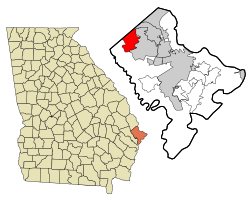 Location in Chatham County and the state of Georgia | |
| Coordinates: 32°7′27″N 81°18′26″W / 32.12417°N 81.30722°W | |
| Country | United States |
| State | Georgia |
| County | Chatham |
| Established | 1840 |
| Area | |
| • Total | 14.05 sq mi (36.39 km2) |
| • Land | 13.78 sq mi (35.69 km2) |
| • Water | 0.27 sq mi (0.70 km2) |
| Elevation | 20 ft (6 m) |
| Population (2020) | |
| • Total | 2,790 |
| • Density | 202.45/sq mi (78.17/km2) |
| Time zone | UTC−05:00 (Eastern (EST)) |
| • Summer (DST) | UTC−04:00 (EDT) |
| ZIP code | 31302 |
| Area code | 912 |
| FIPS code | 13-08844[3] |
| GNIS feature ID | 0331192[2] |
| Website | www |
Bloomingdale is a city in Chatham County, Georgia, United States. As of the 2020 census, the city had a population of 2,790. It is part of the Savannah metropolitan statistical area.
YouTube Encyclopedic
-
1/1Views:2 671
-
Atlantic PRO Divers Jacksonville Scuba Lesson
Transcription
Geography
Bloomingdale is located along the northwestern border of Chatham County at 32°7′27″N 81°18′26″W / 32.12417°N 81.30722°W (32.124122, -81.307211).[4] It is bordered to the northeast by Port Wentworth, to the east by Pooler, to the south by a western portion of Savannah, and to the northwest by Effingham County. U.S. Route 80 runs east–west through the center of Bloomingdale, and Interstate 16 runs parallel to it through the southern part of the city, with access from Exit 152. Both highways lead east 13 miles (21 km) to downtown Savannah.
According to the United States Census Bureau, Bloomingdale has a total area of 14.0 square miles (36.3 km2), of which 12.8 square miles (33.1 km2) is land and 1.2 square miles (3.2 km2), or 8.90%, is water.[5]
Demographics
| Census | Pop. | Note | %± |
|---|---|---|---|
| 1980 | 1,855 | — | |
| 1990 | 2,271 | 22.4% | |
| 2000 | 2,665 | 17.3% | |
| 2010 | 2,713 | 1.8% | |
| 2020 | 2,790 | 2.8% | |
| U.S. Decennial Census[6] | |||
| Race | Num. | Perc. |
|---|---|---|
| White (non-Hispanic) | 2,097 | 75.16% |
| Black or African American (non-Hispanic) | 309 | 11.08% |
| Native American | 14 | 0.5% |
| Asian | 27 | 0.97% |
| Other/Mixed | 163 | 5.84% |
| Hispanic or Latino | 180 | 6.45% |
As of the 2020 United States census, there were 2,790 people, 1,272 households, and 791 families residing in the city.
References
- ^ "2020 U.S. Gazetteer Files". United States Census Bureau. Retrieved December 18, 2021.
- ^ a b U.S. Geological Survey Geographic Names Information System: Bloomingdale, Georgia
- ^ "U.S. Census website". United States Census Bureau. Retrieved January 31, 2008.
- ^ "US Gazetteer files: 2010, 2000, and 1990". United States Census Bureau. February 12, 2011. Retrieved April 23, 2011.
- ^ "Geographic Identifiers: 2010 Demographic Profile Data (G001): Bloomingdale city, Georgia". U.S. Census Bureau, American Factfinder. Archived from the original on February 12, 2020. Retrieved July 21, 2014.
- ^ "Census of Population and Housing". Census.gov. Retrieved June 4, 2015.
- ^ "Explore Census Data". data.census.gov. Retrieved December 14, 2021.
External links
Municipalities and communities of Chatham County, Georgia, United States | ||
|---|---|---|
| Cities |  | |
| Towns | ||
| CDPs | ||
| Unincorporated communities | ||