
Bitthadchir Rural Municipality
बित्थडचिर गाउँपालिका | |
|---|---|
 Bitthadchir Rural Municipality बित्थडचिर गाउँपालिका | |
| Coordinates: 29°30′59″N 80°50′07″E / 29.5164°N 80.8352°E | |
| Country | |
| Province | Sudurpashchim Province |
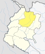
| District | Bajhang District |
| Government | |
| • Type | Local government |
| • Chairperson | Ammar Singh Mahar |
| • IT Head (Information Officer) | Santosh Joshi |
| Area | |
| • Total | 86.15 km2 (33.26 sq mi) |
| Population | |
| • Total | 17,154 |
| • Density | 200/km2 (520/sq mi) |
| Time zone | UTC+05:45 (Nepal Standard Time) |
| Website | http://bitthadchirmun.gov.np |
Bitthadchir (Nepali: बित्थडचिर ) is a Gaupalika(Nepali: गाउपालिका ; gaupalika) in Bajhang District in the Sudurpashchim Province of far-western Nepal.[1] Bitthadchir has a population of 17154.The land area is 86.15 km2.[2]
Demographics
At the time of the 2011 Nepal census, Bitthadchir Rural Municipality had a population of 18,072. Of these, 95.0% spoke Nepali and 5.0% Doteli as their first language.[3]
In terms of ethnicity/caste, 75.2% were Chhetri, 11.7% Kami, 6.8% Hill Brahmin, 2.7% other Dalit, 1.4% Damai/Dholi, 1.0% Thakuri, 0.9% Sanyasi/Dasnami, 0.2% Sarki, 0.1% other Terai and 0.1% others.[4]
In terms of religion, 100.0% were Hindu.[5]
In terms of literacy, 54.5% could read and write, 4.2% could only read and 41.2% could neither read nor write.[6]
References
- ^ "Ministry of Federal Affairs". Retrieved 6 July 2020.
- ^ "National Population and Housing Census 2011(National Report)" (PDF). Central Bureau of Statistics. Government of Nepal. 2012. Archived from the original (PDF) on 2013-04-18. Retrieved 2012-01-01.
- ^ NepalMap Language [1]
- ^ NepalMap Caste [2]
- ^ NepalMap Religion [3]
- ^ NepalMap Literacy [4]
This article about a location in the Bajhang District of Nepal is a stub. You can help Wikipedia by expanding it. |