
Bingen | |
|---|---|
 | |
| Coordinates: 45°42′55″N 121°28′00″W / 45.71528°N 121.46667°W | |
| Country | United States |
| State | Washington |
| County | Klickitat |
| Founded | 1892 |
| Incorporated | April 18, 1924 |
| Government | |
| • Mayor | Catherine Kiewit[1] |
| Area | |
| • Total | 0.89 sq mi (2.30 km2) |
| • Land | 0.62 sq mi (1.61 km2) |
| • Water | 0.26 sq mi (0.68 km2) 11.43% |
| Elevation | 131 ft (40 m) |
| Population | |
| • Total | 778 |
| • Estimate (2022)[4] | 774 |
| • Density | 1,191.01/sq mi (460.07/km2) |
| Time zone | UTC-8 (Pacific (PST)) |
| • Summer (DST) | UTC-7 (PDT) |
| ZIP code | 98605 |
| Area code | 509 |
| FIPS code | 53-06085[5] |
| GNIS feature ID | 1503378[6] |
| Website | bingenwashington.org |
Bingen is a city in Klickitat County, Washington, United States. The population was 778 at the 2020 census.[3]
History
Bingen was founded by P.J. Suksdorf in 1892, and named by him for Bingen am Rhein in Germany.[7] Bingen was officially incorporated on April 18, 1924.
The name of the town is pronounced /ˈbɪndʒən/ (BIN-jen), despite the fact that its German namesake is pronounced /ˈbɪŋən/ (BING-en).
Geography
Bingen is located at 45°42′55″N 121°28′00″W / 45.715311°N 121.466790°W (45.715311, -121.466790).[8]
According to the United States Census Bureau, the city has a total area of 0.70 square miles (1.81 km2), of which, 0.62 square miles (1.61 km2) is land and 0.08 square miles (0.21 km2) is water.[9]
Climate
Bingen has a Warm-summer Mediterranean climate, abbreviated (Köppen Csb) that is characterized by hot and dry summers, and cold, chilly rainy and snowy winters. In Bingen's case the city experiences much warmer summers than locations near the coast such as Portland, but retains high winter rainfall associated with coastal locations. Daytime highs in summer are representative for areas with hot-summer-mediterranean climates, but is moderated by cool nights, causing high diurnal temperature variation.
Average temperatures range from 39 °F (4 °C) in January and 80 °F (27 °C) in July. Bingen on average has wet winters and dry summers, also representative for the region. Temperatures of above 32 °C (90 °F) are usual in summertimes, happening frequently.
Summer highs are extremely hot when compared to areas that are affected by coastal fog.
| Climate data for Bingen, Washington | |||||||||||||
|---|---|---|---|---|---|---|---|---|---|---|---|---|---|
| Month | Jan | Feb | Mar | Apr | May | Jun | Jul | Aug | Sep | Oct | Nov | Dec | Year |
| Mean daily maximum °F (°C) | 45.0 (7.2) |
50.0 (10.0) |
56.0 (13.3) |
61.0 (16.1) |
68.0 (20.0) |
73.0 (22.8) |
80.0 (26.7) |
79.0 (26.1) |
74.0 (23.3) |
64.0 (17.8) |
53.0 (11.7) |
46.0 (7.8) |
62.4 (16.9) |
| Daily mean °F (°C) | 39.0 (3.9) |
43.0 (6.1) |
48.0 (8.9) |
52.0 (11.1) |
58.0 (14.4) |
63.0 (17.2) |
68.0 (20.0) |
68.0 (20.0) |
63.0 (17.2) |
55.0 (12.8) |
46.0 (7.8) |
41.0 (5.0) |
53.7 (12.0) |
| Mean daily minimum °F (°C) | 34.0 (1.1) |
36.0 (2.2) |
39.0 (3.9) |
42.0 (5.6) |
48.0 (8.9) |
58.0 (14.4) |
57.0 (13.9) |
57.0 (13.9) |
52.0 (11.1) |
46.0 (7.8) |
40.0 (4.4) |
36.0 (2.2) |
45.4 (7.5) |
| Average precipitation inches (mm) | 6.2 (160) |
4.4 (110) |
3.8 (97) |
2.0 (51) |
1.4 (36) |
1.1 (28) |
0.3 (7.6) |
0.5 (13) |
1.0 (25) |
2.9 (74) |
6.4 (160) |
7.1 (180) |
37.1 (941.6) |
| Average snowfall inches (cm) | 14.3 (36) |
7.5 (19) |
3.0 (7.6) |
0.4 (1.0) |
0 (0) |
0 (0) |
0 (0) |
0 (0) |
0 (0) |
0.1 (0.25) |
4.8 (12) |
16.4 (42) |
46.5 (117.85) |
| Average rainy days | 15 | 12 | 13 | 10 | 8 | 5 | 2 | 2 | 4 | 9 | 16 | 16 | 112 |
| Source 1: [10] | |||||||||||||
| Source 2: [11] | |||||||||||||
Demographics
| Census | Pop. | Note | %± |
|---|---|---|---|
| 1930 | 365 | — | |
| 1940 | 600 | 64.4% | |
| 1950 | 736 | 22.7% | |
| 1960 | 636 | −13.6% | |
| 1970 | 671 | 5.5% | |
| 1980 | 644 | −4.0% | |
| 1990 | 645 | 0.2% | |
| 2000 | 672 | 4.2% | |
| 2010 | 712 | 6.0% | |
| 2020 | 778 | 9.3% | |
| 2022 (est.) | 774 | [4] | −0.5% |
| U.S. Decennial Census[12] 2020 Census[3] | |||
2020 census
As of the 2020 census, there were 778 people, 284 households in the city.
2010 census
As of the 2010 census, there were 712 people, 286 households, and 161 families living in the city. The population density was 1,148.4 inhabitants per square mile (443.4/km2). There were 313 housing units at an average density of 504.8 per square mile (194.9/km2). The racial makeup of the city was 72.2% White, 0.3% African American, 1.3% Native American, 0.3% Asian, 0.1% Pacific Islander, 19.0% from other races, and 6.9% from two or more races. Hispanic or Latino of any race were 28.1% of the population.
There were 286 households, of which 35.3% had children under the age of 18 living with them, 37.1% were married couples living together, 11.5% had a female householder with no husband present, 7.7% had a male householder with no wife present, and 43.7% were non-families. 34.3% of all households were made up of individuals, and 5.9% had someone living alone who was 65 years of age or older. The average household size was 2.46 and the average family size was 3.15.
The median age in the city was 35.2 years. 26.3% of residents were under the age of 18; 8% were between the ages of 18 and 24; 31.9% were from 25 to 44; 24.8% were from 45 to 64; and 9% were 65 years of age or older. The gender makeup of the city was 53.8% male and 46.2% female.
2000 census
As of the 2000 census, there were 672 people, 286 households, and 157 families living in the city. The population density was 1,032.4 people per square mile (399.2/km2). There were 327 housing units at an average density of 502.4 per square mile (194.2/km2). The racial makeup of the city was 72.62% White, 0.30% African American, 3.72% Native American, 0.74% Asian, 17.56% from other races, and 5.06% from two or more races. Hispanic or Latino of any race were 25.30% of the population.
There were 286 households, out of which 34.3% had children under the age of 18 living with them, 36.4% were married couples living together, 12.9% had a female householder with no husband present, and 45.1% were non-families. 37.4% of all households were made up of individuals, and 7.7% had someone living alone who was 65 years of age or older. The average household size was 2.33 and the average family size was 3.18.
In the city, the population was spread out, with 29.5% under the age of 18, 9.7% from 18 to 24, 31.1% from 25 to 44, 21.3% from 45 to 64, and 8.5% who were 65 years of age or older. The median age was 33 years. For every 100 females, there were 102.4 males. For every 100 females age 18 and over, there were 101.7 males.
The median income for a household in the city was $24,375, and the median income for a family was $27,361. Males had a median income of $27,083 versus $19,886 for females. The per capita income for the city was $12,290. About 21.4% of families and 25.4% of the population were below the poverty line, including 33.5% of those under age 18 and 26.2% of those age 65 or over.
Transportation
Bingen is located along State Route 14, which connects it to other communities along the north bank of the Columbia River. The Hood River Bridge is located west of the city and connects State Route 14 to Hood River, Oregon, and Interstate 84.[13] Bingen is also the terminus of State Route 141, a highway that connects it to White Salmon, Trout Lake, and the base of Mount Adams.[14]
The city is home to Bingen–White Salmon station, which is served by daily Amtrak trains on the Empire Builder between Portland, Oregon, and Chicago.[15] Mount Adams Transportation Service provides bus service.[16]
References
- ^ "Elected Officials". City of Bingen. Retrieved March 26, 2022.
- ^ "2020 U.S. Gazetteer Files". United States Census Bureau. Retrieved July 24, 2022.
- ^ a b c "Explore Census Data". Explore Census Data. United States Census Bureau. Retrieved November 3, 2023.
- ^ a b "City and Town Population Totals: 2020-2022". United States Census Bureau. November 3, 2023. Retrieved November 3, 2023.
- ^ "U.S. Census website". United States Census Bureau. Retrieved January 31, 2008.
- ^ "Bingen". Geographic Names Information System. United States Geological Survey, United States Department of the Interior.
- ^ Majors, Harry M. (1975). Exploring Washington. Van Winkle Publishing Co. p. 150. ISBN 978-0-918664-00-6.
- ^ "US Gazetteer files: 2010, 2000, and 1990". United States Census Bureau. February 12, 2011. Retrieved April 23, 2011.
- ^ "US Gazetteer files 2010". United States Census Bureau. Archived from the original on January 25, 2012. Retrieved December 19, 2012.
- ^ "Bingen, WA". Retrieved July 28, 2020.
- ^ "Bingen, WA". Retrieved July 28, 2020.
- ^ United States Census Bureau. "Census of Population and Housing". Retrieved August 31, 2014.
- ^ "SR-35 Columbia River Crossing Study". Southwest Washington Regional Transportation Council. Retrieved February 1, 2020.
- ^ Washington State Department of Transportation (2014). Washington State Highways, 2014–2015 (PDF) (Map). Olympia: Washington State Department of Transportation. Archived from the original (PDF) on February 21, 2017. Retrieved February 1, 2020.
- ^ "Bingen-White Salmon, WA (BNG)". Great American Stations. Amtrak. Retrieved February 1, 2020.
- ^ "Fixed Route Service". Klickikat County. July 1, 2021. Retrieved April 4, 2022.
External links
![]() Media related to Bingen, Washington at Wikimedia Commons
Media related to Bingen, Washington at Wikimedia Commons
Municipalities and communities of Klickitat County, Washington, United States | ||
|---|---|---|
| Cities | 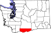 | |
| CDPs | ||
| Unincorporated communities | ||
| Ghost towns | ||
| Indian reservation | ||
| Footnotes | ‡This populated place also has portions in an adjacent county or counties | |
| International | |
|---|---|
| National | |