
| Bingara Shire New South Wales | |||||||||||||||
|---|---|---|---|---|---|---|---|---|---|---|---|---|---|---|---|
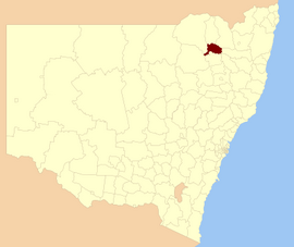 Location within New South Wales | |||||||||||||||
| Population | 2,029 (2004)[1] | ||||||||||||||
| • Density | 0.71101/km2 (1.8415/sq mi) | ||||||||||||||
| Established | 1 January 1944 | ||||||||||||||
| Abolished | 17 March 2004 | ||||||||||||||
| Area | 2,853.7 km2 (1,101.8 sq mi) | ||||||||||||||
| Council seat | Bingara | ||||||||||||||
| Region | New England | ||||||||||||||
| |||||||||||||||
Bingara Shire was a local government area located in the New England region of New South Wales, Australia, about 150 kilometres (93 mi) north of Tamworth via Fossickers Way. The Shire, administered from the town of Bingara covered an area of 2,853.7 square kilometres (1,101.8 sq mi), and existed as a local government entity from 1906 until 2004, when it was amalgamated with Yallaroi Shire and part of Barraba to form the Gwydir Shire.
History
After a petition by locals, the Bingara Municipality was established in the early 1890s to service the town, which at the time had a population of around 750. John Byrnes was chosen as the municipality's first mayor. With the passage of the Local Government Act 1906, which established shires all over New South Wales, the Gwydir Shire was gazetted to serve the surrounding district on 6 March 1906, and Byrnes was elected its first president.
On 17 December 1943, the Bingara Municipality and Gwydir Shire were amalgamated by proclamation into the new Bingara Shire, despite protests from both councils.[2]
On 17 March 2004, Bingera Shire was abolished and merged with the Yallaroi Shire and part of Barraba to form a new Gwydir Shire.
Towns
Population
| Year | Population |
|---|---|
| 1921 | 2,637 |
| 1933 | 3,237 |
| 1947 | 2,862 |
| 1954 | 2,940 |
| 1961 | 2,851 |
| 1966 | 2,744 |
| 1971 | 2,486 |
| 1976 | 2,245 |
| 1981 | 2,264 |
| 1986 | 2,290 |
| 1991 | 2,133 |
| 1996 | 2,080 |
| 2001 | 2,002 |
References
- ^ Australian Bureau of Statistics (23 March 2005). "3218.0 — Regional Population Growth, Australia and New Zealand, 2003-04 — New South Wales". Retrieved 17 June 2011.
- ^ Wilson, Graham. "Development of Local Government". Gwydir Shire Council. Archived from the original on 22 February 2011. Retrieved 19 June 2011.
29°52′59″S 150°33′36″E / 29.883°S 150.560°E
This New South Wales geography article is a stub. You can help Wikipedia by expanding it. |