
| Big Rock Ridge | |
|---|---|
 Big Rock Ridge, as seen from the Northeast | |
| Highest point | |
| Elevation | 575 m (1,886 ft)[1] |
| Prominence | 392 m (1,286 ft)[1] |
| Coordinates | 38°3′33″N 122°36′15″W / 38.05917°N 122.60417°W |
| Geography | |
 Big Rock Ridge  Big Rock Ridge 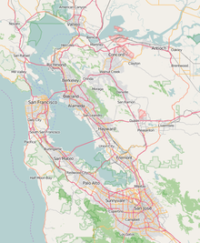 Big Rock Ridge | |
| Location | Marin County, California, U.S. |
| Parent range | California Coast Ranges |
| Topo map | USGS Novato |
| Climbing | |
| Easiest route | Big Rock Trail |
Big Rock Ridge is a ridge near Novato, California, and the 2nd tallest point in Marin County.[2] The ridge is 5 miles long, and runs from the northwest to the east, dividing Novato's Ignacio Valley and San Rafael's Lucas Valley, and separating Novato from central and southern Marin County.[3][4] Big Rock Ridge is named after the rock at the base of Big Rock Trail.
Geography
Big Rock Ridge is the second-highest point in the Marin Hills, which in turn are a part of the California Coast Ranges. Much of eastern Big Rock Ridge is public land, with the Lucas Valley and Ignacio Open Space Preserves covering much of the foothills. Much of the eastern side also falls within city limits, with the northeastern side being in Novato and the southeastern side falling within Lucas Valley-Marinwood.
Various trails run up the ridge, but they all converge at the Big Rock Ridge Fire Road, which runs along the top of the ridge to access the 2 radio towers at the top.[3][5] The easiest way to the top is the 6.7 mile Big Rock Trail, which opened in 2003 when George Lucas donated 800 acres of land to create the Lucas Valley Open Space Preserve.[6] The views from Big Rock Ridge are sweeping, with views to Mt. St Helena and Mt. Diablo from the top.
Geology
Much of the soil on the northern slope is Tocaloma-McMullen Complex soil, which is mostly gravelly loam with a medium to high runoff class. With a land capability classification of 7e and extremely steep slopes, most of the land is unsuitable for cultivation. The southern slope is much more varied when it comes to soil types, but they all share a high runoff class and a land capability classification of 7e. Nearly all of the soil on the north slope is extremely prone to runoff, and is in Hydrologic Soil Group D. The south slope is more mixed.[7]
Hydrology
Many creeks start on Big Rock Ridge. Miller Creek, Ignacio Creek, Halleck Creek, Arroyo San Jose, Arroyo Avichi,, Pacheco Creek, and Blackstone Creek all start on Big Rock Ridge.[8][9]
- ^ a b "Big Rock Ridge, California". Peakbagger.com. Retrieved 2023-02-08.
- ^ "Hike: Big Rock Ridge, Marin's second-highest point". Marin Independent Journal. 2016-12-02. Retrieved 2023-02-08.
- ^ a b "Big Rock Ridge : Climbing, Hiking & Mountaineering : SummitPost". www.summitpost.org. Retrieved 2023-02-08.
- ^ Jack (2018-04-17). "Big Rock Ridge". Nature in Novato. Retrieved 2023-02-08.
- ^ "Hiking in Marin | Big Rock Ridge Trail". Visit Novato. Retrieved 2023-02-08.
- ^ Todd, Gail (2014-01-15). "Big Rock Ridge: San Rafael trail offers great views". SFGATE. Retrieved 2023-02-08.
- ^ "Web Soil Survey". websoilsurvey.sc.egov.usda.gov. Retrieved 2023-10-05.
- ^ "Novato Creek watershed map". Marin County Flood Control District. Retrieved 2023-10-05.
- ^ "Miller Creek watershed map". Marin County Flood Control District. Retrieved 2023-10-05.