
Bieruń | |
|---|---|
 Market square in Bieruń | |
 Coat of arms | |
 Bieruń 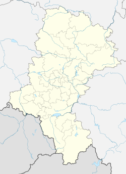 Bieruń | |
| Coordinates: 50°8′N 19°6′E / 50.133°N 19.100°E | |
| Country | |
| Voivodeship | |
| County | Bieruń-Lędziny |
| Gmina | Bieruń (urban gmina) |
| Town rights | 1387 |
| Government | |
| • Mayor | Krystian Grzesica |
| Area | |
| • City | 40.49 km2 (15.63 sq mi) |
| Population | |
| • City | 19,334 |
| • Density | 478/km2 (1,240/sq mi) |
| • Urban | 2,746,000 |
| • Metro | 5,294,000 |
| Time zone | UTC+1 (CET) |
| • Summer (DST) | UTC+2 (CEST) |
| Postal code | 43-150, 43-155, 43-156 |
| Area code | +48 32 |
| Car plates | SBL |
| National roads | |
| Voivodeship roads | |
| Website | http://www.bierun.pl |
Bieruń [ˈbʲɛruɲ] (German: Berun, Silesian: Bieruń) is a town in Upper Silesia, in southern Poland, seat of the Bieruń-Lędziny County in the Silesian Voivodeship. It is located about 25 km (16 mi) south of Katowice.
YouTube Encyclopedic
-
1/3Views:13 9841 044316
-
LO Bierun is also happy
-
Opuszczony Młyn z XX wieku z wyposażeniem - Bieruń Nowy #3 Stacja Opuszczone Urbex
-
DK44 Bieruń Nowy - Tychy
Transcription
Geography
It is located in the Silesian Highlands, on the Gostynia river, a tributary of the Vistula. It is located in the southern part of the Metropolis GZM - metropolis with a population of about 2 million. Bieruń is one of the towns of the 2.7 million conurbation – the Katowice urban area, and within the greater Katowice-Ostrava metropolitan area populated by about 5,294,000 people.[5] The population of the town itself is 19,334 (December 2021).[3] Bieruń includes dzielnicas Bieruń Stary, Bieruń Nowy, Ściernie, Jajosty, Bijasowice and Czarnuchowice and is bordered with Lędziny, Tychy, Chełm Śląski, Bojszowy and Oświęcim.
History

The territory became part of the emerging Polish state in the 10th century. Following the fragmentation of Poland, it formed part of various Piast-ruled provincial duchies of Poland, incl. Opole and Racibórz. Bieruń Stary was the location of a motte-and-bailey castle from the 13th–14th century, which is now an archaeological site.[6] In the 14th century, it passed under Bohemian rule. The settlement of Berouna was first mentioned in a 1376 deed. The name is most probably related to the, similarly spelled, Slavic deity Perun, remains of its cultic place still present at nearby Lędziny. John II, the Přemyslid duke of Racibórz granted it town privileges in 1387. Later on, it returned to the Polish dukes of the Piast dynasty as part of the united Duchy of Opole and Racibórz. After the extinction of the Opole line of the Piasts, in 1532, Bieruń was incorporated by the Habsburg monarchy.
With most of Silesia, it was conquered by Prussia in the First Silesian War of 1740–42 and afterwards incorporated into the Silesia Province. In the mid-19th century, the town's population was predominantly Catholic by confession.[7] On 18 June 1845, a fire destroyed large areas of the town; King Frederick William IV of Prussia personally donated 9000 talers for its reconstruction. Cigarette and munitions factories were set up in the town in the mid-19th century. It became part of the German Empire in 1871 under the Germanized name Berun. In Polish it was known as both Bieruń and Beruń.[7] Seven annual fairs were held in the town in the late 19th century.[7] Located near the border with Lesser Poland and Austrian Silesia, Berun until 1919 was the most southeasterly town of Germany.
After the restoration of independent Poland in 1918, the Third Silesian Uprising of 1921 and the subsequent Upper Silesia plebiscite (in which 1,427 or 82.1% of residents in Bieruń Stary and 292 or 58.4% of residents in Bieruń Nowy voted for Poland), Bieruń was reintegrated with Poland, within which it formed part of the Silesian Voivodeship.
Following the joint German-Soviet invasion of Poland, which started World War II in September 1939, the town was occupied by Germany until 1945. After the war it was administratively part of the Katowice Voivodeship until 1998. From 1975 until 1991 it was a district of the neighbouring Tychy municipality.
Sports
The local football clubs are Unia Bieruń and Piast Bieruń. Both compete in the lower leagues.
International relations
Twin towns - sister cities
 Gundelfingen, Germany, since 1997
 Meung-sur-Loire, France since 2008
 Moravský Beroun, Czech Republic, since 1992
 Ostroh, Ukraine, since 2005
Gallery
-
 Church of Saint Bartholomew
 -
 Interior of the Sanctuary of Saint Valentine
 -

-
 Łysina Lake
References
- ^ "Kierownictwo Urzędu". bierun.pl (in Polish). Miasto Bieruń. Retrieved 11 September 2022.
- ^ "Local Data Bank". Statistics Poland. Retrieved 11 September 2022. Category K1, division G441, subdivision P1410. Data for territorial unit 2414011.
- ^ a b "Local Data Bank". Statistics Poland. Retrieved 11 September 2022. Category K3, group G7, subgroup P1336. Data for territorial unit 2414011.
- ^ "Local Data Bank". Statistics Poland. Retrieved 11 September 2022. Category K3, group G7, subgroup P2425. Data for territorial unit 2414011.
- ^ European Spatial Planning Observation Network (ESPON) "Project 1.4.3". Archived from the original on 2009-07-28. Retrieved 2009-03-28.
- ^ Michał Bugaj. "Gródek stożkowaty z XIII-XV w." Zabytek.pl (in Polish). Retrieved 2 October 2022.
- ^ a b c Słownik geograficzny Królestwa Polskiego i innych krajów słowiańskich, Tom I (in Polish). Warszawa. 1880. p. 155.
{{cite book}}: CS1 maint: location missing publisher (link) - ^ "Miasta partnerskie". bierun.pl (in Polish). Bieruń. Retrieved 2020-03-12.
External links
- Official website (in Polish)
- Jewish Community of Bieruń on Virtual Shtetl
| Urban gminas |  | |
|---|---|---|
| Rural gminas | ||
| International | |
|---|---|
| National | |