
| Bhavani River | |
|---|---|
 | |
 Headwaters of the Bhavani river in Attappati Reserve Forest | |
| Location | |
| Country | India |
| Cities | Udhagamandalam, Mettupalayam, Sathyamangalam, Gobichettipalayam, Bhavani |
| Physical characteristics | |
| Source | |
| • location | Silent Valley |
| Mouth | |
• location | Kaveri River |
| Length | 215 kilometres (134 mi) |
Bhavani is an interstate Indian river which flows through Indian states of Kerala and Tamil Nadu, India. It originates from the Western Ghats and is one among the three rivers of Kerala which flows in eastward direction.
YouTube Encyclopedic
-
1/5Views:15 6779 5212 13511 683186 813
-
Bhavani River, Attappady, Palakkad
-
Agali Vlog | Narasimukku Kottamedu view point | Bhavani River Palakkad | 5K UHD | Safnas Records
-
V1/99:(SOLD) BHAVANI RIVER WATER 4 ACRES FRUITS PLANTATION | V1 Realty's +919843710234
-
Mettupalayam to Sathyamangalam forest road|Bhavanisagar dam|Bhavani river
-
Lets go for a Bhavani River Bath from SR Jungle Resort Aanaikatti Part 4
Transcription
Hydrography
Bhavani river originates from Nilgiri hills of the Western Ghats, enters the Silent Valley National Park in Kerala and flows back towards Tamil Nadu.[citation needed] The Bhavani is a 217-kilometre (135 mi) long perennial river fed mostly by the southwest monsoon and supplemented by the northeast monsoon. Its watershed drains an area of 0.62 million hectares (2,400 sq mi) spread over Tamil Nadu (87%), Kerala (9%) and Karnataka (4%). The main river courses majorly through Coimbatore district and Erode district in Tamil Nadu. About 90 percent of the river's water is used for agriculture irrigation. The Bhavani River is one of the main tributaries of the Cauvery River. It travels for 216 km (134 mi) and joins the Cauvery from the right bank.[1]
The river joins the Cauvery at the Kooduthurai holy site near Bhavani.[2]
Tributaries

Twelve major rivulets including West and East Varagar rivers join Bhavani draining the southern Nilgiri slopes. At Mukkali, Bhavani takes an abrupt 120-degree turn towards the northeast and flows for another 25 kilometres (16 mi) through Attappady plateau. It gets reinforced by the Kunda river coming from the north. Siruvani river, a perennial stream and the Kodungarapallam river, flowing from the south and southeast respectively join the Bhavani at Kerala-Tamil Nadu border.[3] The river then flows east along the base of Nilgiris and enters the plains near Bathra Kaliamman temple at Mettupalayam after joining with Coonoor river coming from northwest.
About 30 kilometres (19 mi) downstream, Moyar River, a major tributary originating in Mudumalai National Park, flows in from the northwest, where it drains the valley between the northern slopes of the Nilgiris and the southern slopes of the Bilgiri Hills. After the Moyar it is blocked by the Lower Bhavani Dam, feeding Lower Bhavani Project Canal near Sathyamangalam in Erode District. The river continues east for over 160 kilometres (99 mi) through Erode District, traversing Kodiveri Dam, near Gobichettipalayam which feeds the Arakkankottai and Thadappalli canals constructed for agricultural purposes.[4] A small barrage across the river was built by Kalingarayan in 1283 CE to feed the 90-kilometre (56 mi) Kalingarayan irrigation canal.[5]
Dams


- Bhavanisagar
The Bhavanisagar dam is located on the Bhavani river in Erode district, Tamil Nadu, India.[6] The dam is one of the largest earthen dams in the world.[7] The dam is situated some 16 km (9.9 mi) west of Sathyamangalam and 35 km (22 mi) from Gobichettipalayam.[8] The Lower Bhavani Project was the first major irrigation project initiated in India after independence in 1948. It was completed by 1955 and opened for use in 1956.[7] The dam was constructed at a cost of ₹210 million (US$2.6 million).[7]
The dam is 8 km (5.0 mi) long and 40 m (130 ft) high. The full reservoir level is 120 ft (37 m) and the dam has a capacity of 32.8×10⁹ cu ft (930×106 m3).[7] The dam has two hydel power stations, one on the east bank canal and the other on the Bhavani river. Each has a capacity of 16 megawatts (21,000 hp) for a total capacity of 32 megawatts (43,000 hp).[7]
- Kodiveri
The Kodiveri dam is located on the Bhavani River near Gobichettipalayam in Western Tamil Nadu. The dam is situated along the State Highway 15 about 15 km (9.3 mi) from Gobichettipalayam towards Sathyamangalam. It was constructed by Kongalvan in the year 1125 CE.[4]
Pollution
Industrial, municipal and agricultural pollution of the river results in poor water quality and negative impacts on the health of people, plants and animals dependent on the river water.[9]
References
- ^ Jain, S. K.; Agarwal, Pushpendra K.; Singh, V. P. (2007). Hydrology and water resources of India. Dordrecht: Springer. pp. 701–708.
- ^ "Performing rituals at Kooduthurai becomes risky". The Hindu. 23 October 2012. Retrieved 25 April 2019.
- ^ "Human chain formed against Kerala's plan to build dam on River Siruvani". NDTV. 26 June 2012. Archived from the original on 14 July 2014. Retrieved 29 January 2016.
- ^ a b Indian Archaeology, a Review. Archaeological Survey of India. 1994.
- ^ "Kalingarayan Canal is 725 years old". The Hindu. 17 January 2007. Archived from the original on 19 August 2010. Retrieved 29 January 2016.
- ^ "Tourist Information for Erode district". Government of Tamil Nadu. Archived from the original on 6 March 2016. Retrieved 1 February 2016.
- ^ a b c d e Uniqueness of Bhavanisagar dam (PDF) (Report). CSTI. Retrieved 1 February 2016.
- ^ "Bhavanisagar dam" (PDF). TNAU. Retrieved 1 February 2016.
- ^ "River Bhavani". rainwaterharvesting.org. Archived from the original on 26 February 2020. Retrieved 8 August 2007.
| State | 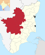 | |
|---|---|---|
| Districts | ||
| Towns | ||
| Culture and Economy | ||
| Rivers | ||
| Languages | ||
| History | ||
11°26′N 77°41′E / 11.433°N 77.683°E