
Bhanga
ভাঙ্গা | |
|---|---|
 | |
| Coordinates: 23°23′N 89°59′E / 23.383°N 89.983°E | |
| Country | |
| Division | Dhaka |
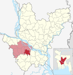
| District | Faridpur |
| Area | |
| • Total | 215.30 km2 (83.13 sq mi) |
| Population (2011) | |
| • Total | 259,032 |
| • Density | 1,200/km2 (3,100/sq mi) |
| Time zone | UTC+6 (BST) |
| Website | Official Map of Bhanga |
Bhanga (Bengali: ভাঙ্গা) is an upazila of Faridpur District in the Division of Dhaka, Bangladesh.[1]
YouTube Encyclopedic
-
1/3Views:3 1831 244695
-
Bhanga Roundbout, Faridpur || Travellers of Bangladesh || Tours and travel 2019
-
Motor Ride In Bhanga Haigh way
-
news A village arbitrator in bhanga thana ,algi union bidyanandi gram
Transcription
Geography
Bhanga is located at 23°23′00″N 89°59′00″E / 23.3833°N 89.9833°E. It has 57,164 households and total area 215.30 km2.
Demographics
As of the 2011 Bangladesh census, Bhanga upazila had 57,164 households and a population of 259,032. 62,224 (24.02%) were under 10 years of age. Bhanga had an average literacy rate of 47.01%, compared to the national average of 51.8%, and a sex ratio of 1067 females per 1000 males. 46,477 (17.94%) of the population lived in urban areas.[2][3]
As of the 1991 Bangladesh census, Bhanga has a population of 214702. Males constitute 50.23% of the population, and females 49.77%. This Upazila's eighteen up population is 105762. Bhanga has an average literacy rate of 25.7% (7+ years), and the national average of 32.4% literate.[4]
Administration
Bhanga Upazila is divided into Bhanga Municipality and 12 union parishads: Algi, Azimnagor, Chandra, Chumurdi, Gharua, Hamirdi, Kalamridha, Kawlibera, Manikdha, Nasirabad, Nurullagonj, and Tujerpur. The union parishads are subdivided into 136 mauzas and 206 villages.[5]
Bhanga Municipality is subdivided into 9 wards and 26 mahallas.[5]
- Upazila Chairman: S M Habibur Rahman Al Habib
- Upazila Nirbahi Officer (UNO):মোঃ আলমগীর হোসেন
Education
According to Banglapedia, Bhanga Pilot High School, founded in 1889, Sadardi High School (1917), and Kalamridha Govinda High School (1927), are notable secondary schools.[1]
- Madhobpur Technical and B,M College
- Kazi Wali Ullah High School
- Kazi Mahbubullah (K.M) College
- Bhanga Mohila College
- Kazi Shamsunnesa Girls School
- Deora High School
- Bharilhat Nesaria Dakhilia Madrasa
- Syed Zanal Abdin High School
- Abdulabad High School
- Brahmondi High School
- Sunflower Ideal Academy
- Sonamoyee High School
- Sharifabad High School & college
- Munsurabad Govt. Primary School
- Maligram high School
- Pulia High School
- East Sadardi High School
- Bhanga pilot High School
- Hoglakandi Govt. Primary School.
- Tuzarpur S.A. High School
- Hamirdi Pilot High School
See also
References
- ^ a b Nandi, Profulla Kumar (2012). "Bhanga Upazila". In Islam, Sirajul; Jamal, Ahmed A. (eds.). Banglapedia: National Encyclopedia of Bangladesh (Second ed.). Asiatic Society of Bangladesh.
- ^ a b "Bangladesh Population and Housing Census 2011 Zila Report – Faridpur" (PDF). bbs.gov.bd. Bangladesh Bureau of Statistics.
- ^ "Community Tables: Faridpur district" (PDF). bbs.gov.bd. Bangladesh Bureau of Statistics. 2011.
- ^ "Population Census Wing, BBS". Archived from the original on 2005-03-27. Retrieved November 10, 2006.
- ^ a b "District Statistics 2011: Faridpur" (PDF). Bangladesh Bureau of Statistics. Archived from the original (PDF) on 13 November 2014. Retrieved 14 July 2014.
| Upazila/Thana: | ||
|---|---|---|
