
Bethel Township | |
|---|---|
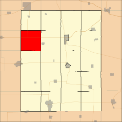 Location in Fayette County | |
| Coordinates: 42°57′10″N 92°01′05″W / 42.95278°N 92.01806°W | |
| Country | |
| State | |
| County | Fayette |
| Area | |
| • Total | 36.12 sq mi (93.54 km2) |
| • Land | 36.09 sq mi (93.46 km2) |
| • Water | 0.03 sq mi (0.08 km2) 0.09% |
| Elevation | 1,115 ft (340 m) |
| Population (2010) | |
| • Total | 297 |
| • Density | 8.2/sq mi (3.2/km2) |
| Time zone | UTC-6 (CST) |
| • Summer (DST) | UTC-5 (CDT) |
| ZIP codes | 50674, 52147, 52171 |
| GNIS feature ID | 0467450 |
Bethel Township is one of twenty townships in Fayette County, Iowa, United States. As of the 2000 census, its population was 297.[1]
YouTube Encyclopedic
-
1/2Views:4 238 951616
-
Man Finds Hidden Doorway On His Property ; Goes In And Realizes He’s Made A Huge Mistake..
-
Bechtel Lecture 2021 - Blackness, Whiteness and the Anabaptist 'Imagined Community'
Transcription
Geography
According to the United States Census Bureau, Bethel Township covers an area of 36.12 square miles (93.54 square kilometers); of this, 36.09 square miles (93.46 square kilometers, 99.91 percent) is land and 0.03 square miles (0.08 square kilometers, 0.09 percent) is water.
Unincorporated towns
(This list is based on USGS data and may include former settlements.)
Adjacent townships
- Eden Township (north)
- Auburn Township (northeast)
- Windsor Township (east)
- Center Township (southeast)
- Banks Township (south)
- Sumner No. 2 Township, Bremer County (southwest)
- Fredericksburg Township, Chickasaw County (west)
- Stapleton Township, Chickasaw County (northwest)
Cemeteries
The township contains these three cemeteries: Bethel, Pitts and Richfield.
Major highways
School districts
- North Fayette Valley Community School District
- Sumner-Fredericksburg Community School District
Political districts
- Iowa's 1st congressional district
- State House District 18
- State Senate District 9
References
- United States Census Bureau 2008 TIGER/Line Shapefiles
- United States Board on Geographic Names (GNIS)
- United States National Atlas
External links
Municipalities and communities of Fayette County, Iowa, United States | ||
|---|---|---|
| Cities |  | |
| Townships | ||
| Unincorporated communities | ||
| Footnotes | ‡This populated place also has portions in an adjacent county or counties | |