
Belitsa Municipality
Община Белица | |
|---|---|
Municipality (Obshtina) | |
 Location in Blagoevgrad province Location on map of Bulgaria 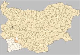 | |
| Coordinates: 41°57′N 23°34′E / 41.950°N 23.567°E | |
| Country | Bulgaria |
| Province (Oblast) | Blagoevgrad |
| Seat | Belitsa |
| Government | |
| • Mayor | Radoslav Revanski (DPS) |
| Area | |
| • Total | 293.54 km2 (113.34 sq mi) |
| Elevation | 952 m (3,123 ft) |
| Population (2011) | |
| • Total | 9,927 |
| • Density | 34/km2 (88/sq mi) |
| Demonym | Belichanin / pl. Belichani |
| Time zone | UTC+2 (EET) |
| • Summer (DST) | UTC+3 (EEST) |
| Website | www |
Belitsa Municipality (Bulgarian: Община Белица, Obshtina Belitsa) is located in the southwestern part of Bulgaria in the northeastern part of the Blagoevgrad Province. The administrative center is the town of Belitsa and there are also 11 villages and the ski resort Semkovo.
Geography
Belitsa municipality is situated in a mountainous area, including parts of the Rila and Rhodope Mountains and the valley of the upper flow of the Mesta river. Belitsa is situated on the southern foothills of Rila, while Semkovo is much higher and is actually the highest part of the municipality. The villages Dagonovo, Kraishte and Gorno Kraishte are in the valley of Mesta river and the rest of the villages are in the Rhodope Mountains.
The entire area of the municipality is 293,536 decares, of which 221,862 are wooded areas and 62,205 are farmlands. The terrain is mostly mountainous and hilly. The territory includes parts of Rila, the Rhodopes, and the dale of the Mesta river. East of the valley, on the river Belichka, there are parts of the eastern (Musalenski) section of the Rila Mountains.
History
The region has been populated 8000 years BC. The remains from that period have been found at the archaeological site Raven near Belitsa. There are Thracian remains near Babyak and Belitsa, some of them with big importance – a wooden sarcophagus exposed in the historical museum in Belitsa and a marble plate with the images of Zeus and Hera, now in the National Historical Museum in Sofia. The name Belitsa has been noted for first time in Ottoman documents from 1576 year. In 1716 the first Christian church has been built. According to the Treaty of Berlin (1878) the region was returned to the Ottoman Empire. After the Ilinden–Preobrazhenie Uprising in 1903 the town of Belitsa was destroyed and burnt. Since 1920 after the Treaty of Neuilly-sur-Seine in 1919 Belitsa and the surrounding villages have remained in Bulgaria.
In the years of the Second World War the Partisan movement engaged people from Belitsa and the near villages, who formed detachment that merged with the bigger detachment Nikola Parapunov.
During the Communist government there has been several acts of renaming the people with non-Bulgarian (Islamic) names, that caused discontent in the pomak people.
Settlements
| Town/Village | Area (km²) | Population |
|---|---|---|
| Belitsa (Белица) | 72.923 | 3 278 |
| Babyak (Бабяк) | 16.662 | 781 |
| Chereshovo (Черешово) | 9.335 | 270 |
| Dagonovo (Дагоново) | 15.802 | 724 |
| Gorno Kraishte (Горно Краище) | 6.159 | 1,167 |
| Galabovo (Гълъбово) | 4.471 | 80 |
| Kraishte (Краище) | 10.523 | 2,375 |
| Kuzyovo (Кузьово) | 14.548 | 272 |
| Lyutovo (Лютово) | 5.477 | 242 |
| Ortsevo (Орцево) | 15.146 | 213 |
| Palatik (Палатик) | 22.313 | 251 |
| Zlataritsa (Златарица) | 34.021 | 133 |
| Total | 227.38 | 9,786 |
Population
Most of the people live in the town of Belitsa and in the villages near Mesta river. The mountainous villages are less populated (see the table above). After the last count in 2011 a slight positive growth is noticed.
| Population | Live births | Deaths | Natural growth | Birth rate (‰) | Death rate (‰) | Natural growth rate (‰) | |
|---|---|---|---|---|---|---|---|
| 2000 | 9,748 | 115 | 91 | 24 | 11.8 | 9.3 | +2.5 |
| 2001 | 9,604 | 113 | 98 | 15 | 11.8 | 10.2 | +1.6 |
| 2002 | 9,558 | 129 | 95 | 34 | 13.5 | 9.9 | +3.6 |
| 2003 | 9,539 | 121 | 84 | 37 | 12.7 | 8.8 | +3.9 |
| 2004 | 9,543 | 123 | 104 | 19 | 12.9 | 10.9 | +2.0 |
| 2005 | 9,518 | 120 | 93 | 27 | 12.6 | 9.8 | +2.8 |
| 2006 | 9,487 | 148 | 105 | 43 | 15.6 | 11.1 | +4.5 |
| 2007 | 9,488 | 132 | 102 | 30 | 13.9 | 10.8 | +3.2 |
| 2008 | 9,497 | 139 | 114 | 25 | 14.6 | 12.0 | +2.6 |
| 2009 | 9,541 | 165 | 89 | 76 | 17.3 | 9.3 | +8.0 |
| 2010 | 9,493 | 121 | 112 | 9 | 12.7 | 11.8 | +0.9 |
| 2011 | 9,911 | 128 | 98 | 30 | 12.9 | 9.9 | +3.0 |
| 2012 | 9,834 | 94 | 125 | -31 | 9.6 | 12.7 | -3.2 |
| 2013 | 9,762 | 85 | 105 | -20 | 8.7 | 10.8 | -2.0 |
| 2014 | 9,706 | 109 | 114 | -5 | 11.2 | 11.7 | -0.5 |
| 2015 | 9,617 | 115 | 131 | -16 | 12.0 | 13.6 | -1.7 |
| 2016 | 9,541 | 87 | 95 | -8 | 9.1 | 10.0 | -0.8 |
| 2017 | 9,426 | 91 | 128 | -37 | 9.7 | 13.6 | -3.9 |
| 2018 | 9,316 | 81 | 107 | -26 | 8.7 | 11.5 | -2.8 |
Religion
The vast majority of the population, especially in the villages are Muslim. There are Christians in Belitsa. The first church in Belitsa, dedicated to St Demetrius of Thessaloniki was built in 1716. The second church, dedicated to St George was built in 1833–1835 with a clock-tower. In the village of Babyak, there is an old mosque from the 17th century. Mosques are built recently in Belitsa and in other villages.
According to the latest Bulgarian census of 2011, the religious composition, among those who answered the optional question on religious identification, was the following:
Administration and institutions
The seat of the municipality is the town of Belitsa. The mayor of the municipality acts as mayor of the seat. There are also elected mayors in the villages: Babyak, Dagonovo, Kraishte and Gorno Kraishte. The other smaller villages have suffragan mayors, appointed from the Municipal Council. Semkovo is not an autonomous township and has no mayor. There is a police station and a post in Belitsa.
Health
In the town of Belitsa work several GP physicians and dentists. The Emergency health care is provided from Razlog.
Education and culture

- High schools in Belitsa:
- Stt Cyril and Methodius ( I-XII grade) ;
- Rehabilitation high school Nikola Vaptsarov for children with respiratory and lung problems ;
- Primary schools (I-VIII grade):
- Stt Cyril and Methodius (Babyak);
- St Paisius of Hilendar (Kraishte);
- Peyo Yavorov (Gorno Kraishte);
- Elementary school Petko Rachov Slaveykov (Dagonovo)
- 12 kindergartens
- Cultural centers with libraries in Belitsa and the major villages: Babyak, Dagonovo, Gorno Kraishte and Kraishte;
- Historical museum;
- Children's dancing troupe "Rila Pearls" in Belitsa.
Economy
The forestry and wood processing is the most developed branch of the industry in the municipality – there are more than forty industrial subjects, situated in Belitsa and the villages near the main road. From the wood they produce paper, furniture and construction elements. Clothing and food industry are also important for the region. Harvesting are gardening are present only in the valley and sheep and goat farming in the mountains. There is a bank for currency exchange.
Transportation
There is only one national secondary road from Velingrad to Razlog, connecting the central part of Bulgaria with southwestern part of the country, that passes through the municipality. Municipal roads connect the villages. The roads need improvement and transportation is difficult, especially in the winter. Regular bus lines run to Sofia, Plovdiv, Blagoevgrad, Velingrad, Razlog, Bansko and Yakoruda daily. There are no municipal lines organized.

Septemvri-Dobrinishte narrow gauge line, running along Mesta river is having stops in Dagonovo and Belitsa station. The station is 4 km south from the town in the village of Kraishte. There is no water transport or air transport in the municipality. The ports of Thessaloniki and Kavala and the international airports of Sofia, Plovdiv, Thessaloniki and Kavala are the nearest sea and airports.
Infrastructure and communications
Central water supply exists only in Belitsa, Kraishte and Gorno Kraishte and in the ski resort Semkovo. The other smaller villages use local water sources. Sewerage works in Belitsa and Dagonovo and in Semkovo. Electrical power supply is well organized and all the inhabited places have electricity. Phone lines are not available in the remote villages and there exist radio connected phones. Mobile connections are limited because of the terrain, but generally available in all villages. Internet via cable is accessible only in Belitsa.
Nature
The Rila and Rhodope Mountains are forming the natural characteristics of the municipality. There are many natural phenomenons and interesting places near Belitsa, Babyak and Semkovo. There is a park for "dancing bears", where live bears, collected from people in Bulgaria and near countries.
Tourism
There are no hotels in Belitsa, but only in Semkovo. Restaurants with traditional and European cuisine are available in Belitsa and Semkovo. The picturesque nature offers a lot of places for sightseeing and picnic.
See also
References
- ^ "Religious composition of Bulgaria 2011". pop-stat.mashke.org.
External links
![]() Media related to Belitsa Municipality at Wikimedia Commons
Media related to Belitsa Municipality at Wikimedia Commons
Capital: Belitsa | |
| Villages | |
| Landmarks | |
| Culture | |
| Notable people |
|