
Befotaka
Befotaka Atsimo Befotaka Sud | |
|---|---|
 Befotaka Location in Madagascar | |
| Coordinates: 23°49′30″S 46°58′44″E / 23.82500°S 46.97889°E | |
| Country | |
| Region | Atsimo-Atsinanana |
| District | Befotaka Sud District |
| Elevation | 779 m (2,556 ft) |
| Time zone | UTC3 (EAT) |
| Postal code | 307 |
Befotaka is a town in Atsimo-Atsinanana Region in south-eastern Madagascar. It is situated near the Itomampy river.
From the coast and Vangaindrano it can be reached by the unpaved, secondary road RN T18 of 94 km in very bad state of conservation to Nosifeno (formerly: Midongy Sud), to continue on another secondary road of 42 km to Befotaka.
YouTube Encyclopedic
-
1/3Views:8321 0297 278
-
Anjiamarango Beach Resort - Aout 2012
-
De landschappen van Madagaskar,Tsingy de Bemaraha , Ranomafana ,Amber Mountain ,Andringitra , Isalo
-
Nosy Be, une île oubliée du temps
Transcription
Nature
It is the gateway to the Midongy du sud National Park (also called: Midongy-Betroka National Park) that is found in a distance of 34 km.[1]
Administration
To the commune of Befotaka also belong the following villages:
- Ambohimasoa
- Ambondr
- Andasy
- Andioteny
- Andranovory, Befotaka
- Andria, Befotaka
- Ankazovelo, Befotaka
- Bekofafa
- Belenalena
- Morarano
- Soabonaka
- Soavariana
- Soarano
References
- ^ "www.parcs-madagascar.com". Archived from the original on 2013-07-18. Retrieved 2013-05-21.
Capital: Farafangana | ||
| Befotaka Sud (6) - 307 | 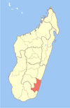 | |
| Farafangana (30) - 309 |
| |
| Midongy-Atsimo (6) - 318 | ||
| Vangaindrano (28) - 320 | ||
| Vondrozo (16) - 322 | ||
5 districts; 86 communes | ||
This Atsimo-Atsinanana location article is a stub. You can help Wikipedia by expanding it. |