
Bayuquan
鲅鱼圈区 | |
|---|---|
 | |
 Location in Yingkou | |
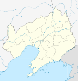 Bayuquan Location in Liaoning | |
| Coordinates: 40°15′49″N 122°07′46″E / 40.26361°N 122.12944°E | |
| Country | People's Republic of China |
| Province | Liaoning |
| Prefecture-level city | Yingkou |
| Time zone | UTC+8 (China Standard) |
Bayuquan District (simplified Chinese: 鲅鱼圈区; traditional Chinese: 鮁魚圈區; pinyin: Bàyúquān Qū) is a district of the city of Yingkou, Liaoning province, People's Republic of China. Located on the northeast coast of the Bohai Sea and in the northwest part of the Liaodong Peninsula, it is 46 kilometres (29 mi) south-southwest of Yingkou city centre. This small city is known for its seafood like fish and crabs which are shipped to all parts of the world. This District is also a tourism spot in the summer.
Bayuquan is also the site of a large sea port for bulk carriers and container ships, administered along with the port of Yingkou, the latter lying to the north of Bayuquan new port.[1][2]
YouTube Encyclopedic
-
1/3Views:394398372
-
Shipspotted at Manila bay anchorage Mv SOUTHERN HARMONY | change crew || Marinosvlog TV
-
Bayuquan 1
-
Διασχίζοντας Κινέζικο σοκάκι στο Bayuquan...
Transcription
Toponym
The literal translation of the toponym is "Japanese Spanish mackerel arc". The local fishermen began to fish here since the early Qing dynasty, as the coast shaped like an arc and the coastal waters are rich in Japanese Spanish mackerel ("bayu" in Chinese), thus, the area is named after "Bayuquan".[3]
Pollution
In recent years, air pollution and smog has posed challenges for district's tourism industry.[citation needed]
Administrative divisions
There are four subdistricts and three towns within the district.[4]
Subdistricts:
- Honghai Subdistrict (红海街道)
- Haixing Subdistrict (海星街道)
- Wanghai Subdistrict (望海街道)
- Haidong Subdistrict (海东街道)
Towns:
- Xiongyue (熊岳镇)
- Lutun (芦屯镇)
- Hongqi (红旗镇)
Climate
| Climate data for Bayuquan (1991–2020 normals) | |||||||||||||
|---|---|---|---|---|---|---|---|---|---|---|---|---|---|
| Month | Jan | Feb | Mar | Apr | May | Jun | Jul | Aug | Sep | Oct | Nov | Dec | Year |
| Mean daily maximum °C (°F) | −2.1 (28.2) |
1.9 (35.4) |
8.6 (47.5) |
17.1 (62.8) |
23.5 (74.3) |
27.2 (81.0) |
29.4 (84.9) |
29.0 (84.2) |
25.0 (77.0) |
17.5 (63.5) |
8.2 (46.8) |
0.6 (33.1) |
15.5 (59.9) |
| Daily mean °C (°F) | −8.3 (17.1) |
−4.0 (24.8) |
2.9 (37.2) |
11.3 (52.3) |
17.8 (64.0) |
22.1 (71.8) |
25.0 (77.0) |
24.2 (75.6) |
18.8 (65.8) |
11.2 (52.2) |
2.6 (36.7) |
−5.0 (23.0) |
9.9 (49.8) |
| Mean daily minimum °C (°F) | −13.9 (7.0) |
−9.5 (14.9) |
−2.4 (27.7) |
5.7 (42.3) |
12.0 (53.6) |
17.1 (62.8) |
21.0 (69.8) |
19.9 (67.8) |
13.1 (55.6) |
5.1 (41.2) |
−2.8 (27.0) |
−10.3 (13.5) |
4.6 (40.3) |
| Average precipitation mm (inches) | 4.0 (0.16) |
7.0 (0.28) |
10.6 (0.42) |
34.5 (1.36) |
52.9 (2.08) |
72.2 (2.84) |
123.8 (4.87) |
161.3 (6.35) |
52.0 (2.05) |
38.1 (1.50) |
20.9 (0.82) |
7.5 (0.30) |
584.8 (23.03) |
| Average precipitation days (≥ 0.1 mm) | 3.2 | 2.8 | 3.6 | 6.0 | 7.4 | 9.2 | 10.4 | 10.0 | 6.0 | 6.2 | 4.9 | 3.4 | 73.1 |
| Average snowy days | 4.4 | 3.4 | 2.7 | 0.7 | 0 | 0 | 0 | 0 | 0 | 0.2 | 3.0 | 4.3 | 18.7 |
| Average relative humidity (%) | 63 | 58 | 54 | 53 | 57 | 69 | 79 | 82 | 75 | 69 | 65 | 64 | 66 |
| Mean monthly sunshine hours | 203.7 | 202.2 | 246.6 | 251.8 | 278.8 | 247.7 | 223.1 | 228.8 | 243.6 | 224.9 | 182.2 | 182.7 | 2,716.1 |
| Percent possible sunshine | 68 | 67 | 66 | 63 | 62 | 55 | 49 | 54 | 66 | 66 | 62 | 63 | 62 |
| Source: China Meteorological Administration[5][6] | |||||||||||||
References
- ^ Guide to port entry - Bayuquan (14th ed.). London: World Ports / IHS. 1 January 2018.
- ^ "Map of Northern Bohai bay". Bing maps. Bing. Retrieved 15 May 2018.
- ^ Encyclopedia of China, Vol. 1 (2nd edition, 中国大百科全书(第二版)第1册). Encyclopedia of China Publishing House. 2009. p. 517. ISBN 978-7-500-07958-3.
- ^ 营口市-行政区划网
- ^ 中国气象数据网 – WeatherBk Data (in Simplified Chinese). China Meteorological Administration. Retrieved 5 October 2023.
- ^ 中国气象数据网 (in Simplified Chinese). China Meteorological Administration. Retrieved 5 October 2023.
External links
This Liaoning location article is a stub. You can help Wikipedia by expanding it. |