
Barani | |
|---|---|
Department | |
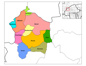 Barani Department location in the province | |
| Country | |
| Province | Kossi Province |
| Population (1996) | |
| • Total | 49,144 |
| Time zone | UTC+0 (GMT 0) |
Barani is a department or commune of Kossi Province in western Burkina Faso. Its capital lies at the town of Barani. According to the 1996 census, the department has a total population of 49,144.[1]
The department of Barani borders the country of Mali to the north. The village of Barani is most well known as the site of an annual horse festival.[2] It can be reached via a road heading north from the village of Bomborokui.
Towns and villages
- Barani (4 804 inhabitants) (capital)
- Babakuy (1 094 inhabitants)
- Bangassi-Koro (420 inhabitants)
- Bangassi Kourou (4 804 inhabitants)
- Berma (1 450 inhabitants)
- Bogo (327 inhabitants)
- Boulé (491 inhabitants)
- Boulemporo (1 397 inhabitants)
- Cissé (918 inhabitants)
- Diamahoun (1 348 inhabitants)
- Djallo (510 inhabitants)
- Dienwely (534 inhabitants)
- Douré (413 inhabitants)
- Illa (1 633 inhabitants)
- Kamandadougou (1 068 inhabitants)
- Karekuy (1 003 inhabitants)
- Kessekuy (1 053 inhabitants)
- Kinseré (1 334 inhabitants)
- Kolonkan Goure Ba (616 inhabitants)
- Kolonkan Goure Diall (1 293 inhabitants)
- Konkoro (594 inhabitants)
- Koroni (762 inhabitants)
- Koubé (575 inhabitants)
- Koulerou (1 978 inhabitants)
- Manekuy (576 inhabitants)
- Mantamou (1 086 inhabitants)
- Medougou (1 766 inhabitants)
- Nabasso (881 inhabitants)
- Niako (479 inhabitants)
- Niemini-Peulh (137 inhabitants)
- Gnimanou (2 176 inhabitants)
- Ouemboye (382 inhabitants)
- Oueressé (1 384 inhabitants)
- Pampakuy (559 inhabitants)
- Sekuy (576 inhabitants)
- Sekuy-Ira (62 inhabitants)
- Sokoura (2 280 inhabitants)
- Soudogo (670 inhabitants)
- Tira (779 inhabitants)
- Torokoto (2 991 inhabitants)
- Waribèrè (961 inhabitants)
- Yalankoro (980 inhabitants)
References
- ^ Burkinabé government inforoute communale Archived January 24, 2008, at the Wayback Machine
- ^ "Archived copy". Archived from the original on 2010-06-03. Retrieved 2008-07-30.
{{cite web}}: CS1 maint: archived copy as title (link)
Capital: Nouna | ||
 | ||
13°10′00″N 3°53′00″W / 13.16667°N 3.88333°W