
Baqa al-Hatab | |
|---|---|
Local Development Committee | |
| Arabic transcription(s) | |
| • Arabic | باقة الحطب |
Baqat al-Hatab | |
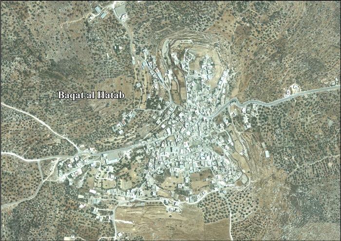
 Baqa al-Hatab Location of Baqat al-Hatab within Palestine | |
| Coordinates: 32°12′17″N 35°06′53″E / 32.20472°N 35.11472°E | |
| Palestine grid | 161/179 |
| State | State of Palestine |
| Governorate | Qalqilya |
| Government | |
| • Type | Local Development Committee |
| Elevation | 464 m (1,522 ft) |
| Population (2017)[2] | |
| • Total | 1,943 |
| Name meaning | Baka, from personal name[3] |
Baqa al-Hatab (Arabic: باقة الحطب) is a Palestinian village in the Qalqilya Governorate in the western area of the West Bank, located 20 kilometers southwest of Nablus. According to the Palestinian Central Bureau of Statistics, the village had a population of 1,943 inhabitants in 2017.[2]
Location
Baqa al-Hatab is located 14.35 kilometers (8.92 mi) northwest of Qalqiliya. It is bordered by Hajja to the east, south and north; Kafr Laqif and Khirbet Sir to the south; ‘Izbat Abu Hamada to the west; and Kafr ‘Abbush to the west and north.[1]
History
Ottoman era
Baqa al-Hatab was incorporated into the Ottoman Empire in 1517 with all of Palestine, and in 1596 it appeared in the tax registers as being in the Nahiya of Bani Sa'b of the Liwa of Nablus. It had a population of 59 households, all Muslims. The villagers paid a fixed tax rate of 33,3% on various agricultural products, such as wheat, barley, summer crops, goats and/or beehives, in addition to "occasional revenues"; a total of 23,900 akçe. 5,25/24 of the revenues went to a Muslim charitable endowment.[4]
In 1870/1871 (1288 AH), an Ottoman census listed the village in the nahiya (sub-district) of Bani Sa'b.[5]
In 1882 the PEF's Survey of Western Palestine (SWP) described Baka (Beni Sab): "A well-built stone village in a conspicuous position on a bare ridge, with a few olives, and a well to the north; it is a small place. A high house on the north side formed a trigonometrical station in 1873."[6] It is historically the mother-village of many family hamula groups that now form the population of the Israeli township of Tira.[7]
British Mandate era
In a 1922 census of Palestine conducted by the British Mandate authorities, Baqa had a population of 207 Muslims,[8] increasing in the 1931 census, when Baqa had a population of 282 Muslims, with 63 houses.[9]
In the 1945 statistics the population was 390 Muslims,[10] with 8,950 dunams of land, according to an official land and population survey.[11] Of this, 645 dunams were for plantations or irrigated land, 1,688 were for cereals,[12] while 36 dunams were built-up land.[13]
Jordanian era
In the wake of the 1948 Arab–Israeli War, and after the 1949 Armistice Agreements, Baqa came under Jordanian rule.
The Jordanian census of 1961 found 569 inhabitants in Baqa Hatab.[14]
1967-present
Since the Six-Day War in 1967, Baqa has been under Israeli occupation.
After the 1995 accords, about 58.4% of the village land is defined in Area B, while the remainder 41.6% is in Area C.[15]
Maqam ash-Sheikh Ali a-Najdi
The village of Baqa al-Hatab is home to the maqam (tomb-shrine) of ash-Sheikh Ali a-Najdi< a tomb located inside a cave next to a well. According to local tradition, ash-Sheikh Ali a-Najdi came from the Najd region of the Arabian Peninsula, in modern-day Saudi Arabia, and arrived in the village during the 19th century. He taught the Quran to the children of the village, and tradition says he committed miraculous acts.[16]
Demography
Local origins
The village's residents have their origins in Hajjah, Qalqiliya, and the Sharon plain.[17]
References
- ^ a b Baqat al Hatab Village Profile, ARIJ, p. 4
- ^ a b Preliminary Results of the Population, Housing and Establishments Census, 2017 (PDF). Palestinian Central Bureau of Statistics (PCBS) (Report). State of Palestine. February 2018. pp. 64–82. Retrieved 2023-10-24.
- ^ Palmer, 1881, p. 179
- ^ Hütteroth and Abdulfattah, 1977, p. 139
- ^ Grossman, David (2004). Arab Demography and Early Jewish Settlement in Palestine. Jerusalem: Magnes Press. p. 255.
- ^ Conder and Kitchener, 1882, p. 164
- ^ Abner Cohen, Arab Border-villages in Israel, Manchester University Press 1965 pp.9-10
- ^ Barron, 1923, Table IX, Sub-district of Nablus, p. 24
- ^ Mills, 1932, p. 59
- ^ Government of Palestine, Department of Statistics, 1945, p. 18
- ^ Government of Palestine, Department of Statistics. Village Statistics, April, 1945. Quoted in Hadawi, 1970, p. 59
- ^ Government of Palestine, Department of Statistics. Village Statistics, April, 1945. Quoted in Hadawi, 1970, p. 105
- ^ Government of Palestine, Department of Statistics. Village Statistics, April, 1945. Quoted in Hadawi, 1970, p. 155
- ^ Government of Jordan, Department of Statistics, 1964, p. 25
- ^ Baqat al Hatab Village Profile, ARIJ, p. 14
- ^ Tal, Uri (2023). Muslim Shrines in Eretz Israel: History, Religion, Traditions, Folklore. Jerusalem: Yad Izhak Ben-Zvi. p. 151. ISBN 978-965-217-452-9.
- ^ Grossman, D. (1986). "Oscillations in the Rural Settlement of Samaria and Judaea in the Ottoman Period". in Shomron studies. Dar, S., Safrai, S., (eds). Tel Aviv: Hakibbutz Hameuchad Publishing House. p. 353
Bibliography
- Barron, J.B., ed. (1923). Palestine: Report and General Abstracts of the Census of 1922. Government of Palestine.
- Conder, C.R.; Kitchener, H.H. (1882). The Survey of Western Palestine: Memoirs of the Topography, Orography, Hydrography, and Archaeology. Vol. 2. London: Committee of the Palestine Exploration Fund.
- Government of Jordan, Department of Statistics (1964). First Census of Population and Housing. Volume I: Final Tables; General Characteristics of the Population (PDF).
- Government of Palestine, Department of Statistics (1945). Village Statistics, April, 1945.
- Hadawi, S. (1970). Village Statistics of 1945: A Classification of Land and Area ownership in Palestine. Palestine Liberation Organization Research Center.
- Hütteroth, Wolf-Dieter; Abdulfattah, Kamal (1977). Historical Geography of Palestine, Transjordan and Southern Syria in the Late 16th Century. Erlanger Geographische Arbeiten, Sonderband 5. Erlangen, Germany: Vorstand der Fränkischen Geographischen Gesellschaft. ISBN 3-920405-41-2.
- Mills, E., ed. (1932). Census of Palestine 1931. Population of Villages, Towns and Administrative Areas. Jerusalem: Government of Palestine.
- Palmer, E.H. (1881). The Survey of Western Palestine: Arabic and English Name Lists Collected During the Survey by Lieutenants Conder and Kitchener, R. E. Transliterated and Explained by E.H. Palmer. Committee of the Palestine Exploration Fund.
External links
- Welcome To Baqat al-Hatab
- Survey of Western Palestine, Map 11: IAA, Wikimedia commons
- Baqat Al Hatab (Fact Sheet), Applied Research Institute–Jerusalem (ARIJ)
- Baqat al Hatab Village Profile, ARIJ
- Baqat al Hatab - aerial photo, ARIJ
- Development Priorities and Needs in Baqat al Hatab, ARIJ
| Cities |  | |
|---|---|---|
| Municipalities |
| |
| Villages |
| |