
Ban Khok
บ้านโคก | |
|---|---|
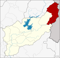 District location in Uttaradit province | |
| Coordinates: 18°1′30″N 101°4′12″E / 18.02500°N 101.07000°E | |
| Country | Thailand |
| Province | Uttaradit |
| Seat | Ban Khok |
| District established | 1977 |
| Area | |
| • Total | 1,055.911 km2 (407.690 sq mi) |
| Population (2008) | |
| • Total | 14,395 |
| • Density | 13.5/km2 (35/sq mi) |
| Time zone | UTC+7 (ICT) |
| Postal code | 53180 |
| Geocode | 5306 |
Ban Khok (Thai: บ้านโคก, pronounced [bâːn kʰôːk]) is the northeasternmost district (amphoe) of Uttaradit province, northern Thailand.
History
The minor district (king amphoe) Ban Khok was established on 1 July 1977, when the two tambon Ban Khok and Muang Chet Ton were split off from Fak Tha district.[1] Sub-districts Na Khum and Bo Bia were created in 1986.[2] On 12 August 1987 it was upgraded to a full district.[3]
In 1984 a boundary dispute with neighboring Laos over the exact location of the watershed between the Mekong and the Nan Rivers led to an armed dispute between the two countries. The disputed area of 19 km2, covering three villages and about 1000 inhabitants, was finally given to Laos.[4]
Geography
Neighboring districts are (from the south clockwise) Nam Pat and Fak Tha of Uttaradit Province, Na Muen and Na Noi of Nan province. To the east is Xaignabouli province of Laos.
The main river of the district is the Pat River, a tributary of the Nan River.
The district is in the Luang Prabang Range mountain area of the Thai highlands.[5]
Administration
The district is divided into four sub-districts (tambon), which are further subdivided into 28 villages (muban). Ban Khok is a sub-district municipality (thesaban tambon) which covers the whole of tambon Ban Khok. There are a further three tambon administrative organizations (TAO).
| No. | Name | Thai | Villages | Pop.[6] |
|---|---|---|---|---|
| 1. | Muang Chet Ton | ม่วงเจ็ดต้น | 7 | 3,623 |
| 2. | Ban Khok | บ้านโคก | 7 | 3,960 |
| 3. | Na Khum | นาขุม | 7 | 3,330 |
| 4. | Bo Bia | บ่อเบี้ย | 7 | 3,482 |
References
- ^ ประกาศกระทรวงมหาดไทย เรื่อง แบ่งท้องที่อำเภอฟากท่า จังหวัดอุตรดิตถ์ ตั้งเป็นกิ่งอำเภอบ้านโคก (PDF). Royal Gazette (in Thai). 94 (60 ง): 2724. July 5, 1977. Archived from the original (PDF) on April 27, 2012.
- ^ ประกาศกระทรวงมหาดไทย เรื่อง ตั้งและเปลี่ยนแปลงเขตตำบลในท้องที่กิ่งอำเภอบ้านโคก และอำเภอตรอน จังหวัดอุตรดิตถ์ (PDF). Royal Gazette (in Thai). 103 (219 ง ฉบับพิเศษ): 21–30. 1986-12-12. Archived from the original (PDF) on June 4, 2012.
- ^ พระราชกฤษฎีกาจัดตั้งอำเภอพญาเม็งราย อำเภอพบพระ อำเภอทับคล้อ อำเภอบ้านโคก และอำเภอโพธิ์ไทร พ.ศ. ๒๕๓๐ (PDF). Royal Gazette (in Thai). 104 (156 ก special): 26–28. August 12, 1987. Archived from the original (PDF) on April 6, 2012.
- ^ Dommen, Arthur J. (January 1985). "Laos in 1984: The year of the Thai border" (PDF). Asian Survey. 25 (1): 114–121. doi:10.2307/2644062. JSTOR 2644062.
- ^ ดร.กระมล ทองธรรมชาติ และคณะ, สังคมศึกษา ศาสนาและวัฒนธรรม ม.1, สำนักพิมพ์ อักษรเจริญทัศน์ อจท. จำกัด, 2548, หน้า 24-25
- ^ "Population statistics 2008". Department of Provincial Administration. Archived from the original on 2009-08-20.
External links
This Uttaradit province location article is a stub. You can help Wikipedia by expanding it. |