
Ballycanew
Baile Uí Chonnmhaí | |
|---|---|
Village | |
 Parish hall and church | |
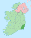
 Ballycanew Location in Ireland | |
| Coordinates: 52°36′32″N 6°18′36″W / 52.609°N 6.31°W | |
| Country | Ireland |
| Province | Leinster |
| County | County Wexford |
| Elevation | 60 m (200 ft) |
| Population | 516 |
| Time zone | UTC+0 (WET) |
| • Summer (DST) | UTC-1 (IST (WEST)) |
| Irish Grid Reference | T146524 |
Ballycanew (historically Ballyconway, from Irish: Baile Uí Chonnmhaí)[2] is a small rural village in Ireland. It is situated in County Wexford, on the R741 regional road 8 km (5.0 mi) south of Gorey. This road is locally known as the "Coast Road".
YouTube Encyclopedic
-
1/2Views:362773
-
BALLYCANEW 0002
-
Paramotor flight to Courtown and Ballycanew
Transcription
History
The village was once known as Ballyconway. An old Irish name for Ballycanew is 'Baile Gan Uaigh' - Town without a grave.[citation needed]
The earliest reference is 1247 when Theodore de Nevel held lands there. In 1821, the population was 1094, but following the great famine it was reduced to 361.[citation needed]
In the past, the Furney family owned a mill, built in 1589 and demolished in 1962. The old creamery was once a thriving industry, with an average of 2.5 million imperial gallons (11,000 m3) of milk supplied per annum.[citation needed]
In June 1965, a Bronze Age grave was discovered in the Ballycanew Parish. This grave yielded a slightly damaged food vessel and broken human bones. The exact date of the burial is uncertain but is probably more than 3,000 years old.[citation needed]
Amenities
The area is served by a primary school, Saint Enda's National School. There are two churches. St Moling's is part of the Roman Catholic parish of Camolin,[3] and St. Mogue's is part of Church of Ireland parish of Gorey.[4] The village has two shops: a Daybreak and a Brooks The village also has two pubs. One for the road and Goslings. It also has three community halls, a fast food place called Sizzles and also has a hairdressers called Tina's. The Ounavarra River passes through the village.
Public transport
Wexford Bus bus route 884 serves Ballycanew from Monday through Sunday linking it to Gorey and Wexford. .[5] |access-date=26 April 2024 |archive-date=27 April 2024 |
The nearest railway station is Gorey railway station on the Rosslare Europort to Dublin line.
See also
References
- ^ "Ballycanew (Ireland) Census Town". citypopulation.de. Retrieved 20 March 2020.
- ^ Placenames Database of Ireland (see archival records)
- ^ "Camolin Parish: Church of the Immaculate Conception".
- ^ "Church of Ireland - A Member of the Anglican Communion".
- ^ "Journey planner". wexfordbus.ie.
This article related to the geography of County Wexford, Ireland is a stub. You can help Wikipedia by expanding it. |