
Baksa district | |
|---|---|
 View of Bhutan Himalayas from Manas National Park | |
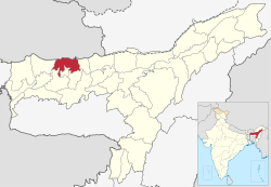 Location in Assam | |
 Baksa district | |
| Coordinates: 26.6935° N, 91.5984° E | |
| Country | |
| State | |
| Territorial Region | |
| Headquarters | Mushalpur |
| Government | |
| • Lok Sabha constituencies | Kokrajhar |
| • Vidhan Sabha constituencies | Tamulpur, Barama, Chapaguri |
| Area | |
| • Total | 1,573 km2 (607 sq mi) |
| Population (2011) | |
| • Total | 560,925 |
| • Density | 360/km2 (920/sq mi) |
| Time zone | UTC+5:30 (Indian Standard Time) |
| Website | baksa |
Baksa district (/ˈbʌksə/ or /ˈbæksə/) is an administrative district in the Bodoland Territorial Region of Assam, one of the North-Eastern states of India. The administrative headquarters is at Mushalpur. Manas National Park is a part of this district.
YouTube Encyclopedic
-
1/4Views:4 4014 0563 4516 025
-
All about Baksa District | বাগছা জিলাৰ বিষয়ে সকলো জানিবলগীয়া কথা |
-
BAKSA district || Basic knowledge || Manjit assam
-
Indo-Bhutan Border ( Baksa District, Assam) #beautyofnature #green #indobhutanborder #india #nature
-
MCQ, Social Science ,Pre-Final Examination-2023-24, Baksa District
Transcription
History
Duars
Baksa district falls under Kamrup Duars which includes the region between the Manas river and the Barnadi river. The two Dooars under Baksa district are Chapakhamar and Gurkola.[1]
Present
Baksa was notified as one of the districts of Bodoland Territorial Council in October 2003 while it started functioning from 1 June 2004[2] when naturalist-bureaucrat Dr Anwaruddin Choudhury of the Assam Civil Service took charge as its founding Deputy Commissioner[citation needed]. It started working from PWD Inspection Bungalow of Barama beside the NH 31 until it was shifted to Mushalpur in late 2010[vague].
It was created from parts of Barpeta, Nalbari and Kamrup districts.[2]
On 23 January 2022, Tamulpur district was created by separating Tamulpur sub-division of Baksa district.[3]
Geography
This district is bounded by Bhutan in the north, Udalguri district in the east, Barpeta, Nalbari and Kamrup districts in the south and Chirang district in the west. Area of the district is 2,400 km2 (930 sq mi).[4]
National protected area
- Manas National Park (Part)
Administration
Mushalpur town is the headquarters of the district.
Divisions
The district has three sub-divisions: Mushalpur, Salbari and Tamulpur. These sub-divisions are further divided into 13 revenue circles: Baksa, Barama, Tamulpur, Goreswar, Baganpara, Ghograpar, Barnagar, Bajali, Jalah, Patharighat, Rangia, Sarupeta and Tihu.
Three Vidhan Sabha constituencies of this district are Tamulpur, Barama and Chapaguri. All of these are part of Kokrajhar Lok Sabha constituency.
Demographics
| Year | Pop. | ±% p.a. |
|---|---|---|
| 1901 | 71,620 | — |
| 1911 | 81,666 | +1.32% |
| 1921 | 95,160 | +1.54% |
| 1931 | 127,011 | +2.93% |
| 1941 | 167,589 | +2.81% |
| 1951 | 197,889 | +1.68% |
| 1961 | 309,224 | +4.56% |
| 1971 | 476,655 | +4.42% |
| 1991 | 769,402 | +2.42% |
| 2001 | 857,947 | +1.10% |
| 2011 | 950,075 | +1.03% |
| source:[5] | ||
According to the 2011 census Baksa district has a population of 950,075.[7] This gives it a ranking of 458th in India (out of a total of 640).[7] The district has a population density of 475 inhabitants per square kilometre (1,230/sq mi).[7] Its population growth rate over the decade 2001-2011 was 11.17%.[7] Baksa has a sex ratio of 967 females for every 1000 males,[7] and a literacy rate of 70.53%.
The residual Baksa district has a population of 560,925, of which 6,611 (1.18%) live in urban areas. The residual district has a sex ratio of 977 females per 1000 males. Scheduled Castes and Tribes made up 30,837 (5.50%) and 209,686 (37.38%) of the population respectively.[7]
According to the 2011 census, 38.34% of the population spoke Assamese, 36.33% Boro, 17.69% Bengali, 2.42% Nepali, 1.61% Sadri and 1.47% Kurukh as their first language.[8]
Education
Major educational institutions of Baksa district are:
- Salbari Higher Secondary school, Salbari
- Bagadhar Brahma Kishan College, Jalah
- Barama College, Barama
- Goreswar College, Goreswar
- Mushalpur College, Mushalpur
- Tamulpur College, Tamulpur
- Koklabari chapaguri College, Simla Hazua
- Barama Higher Secondary school, Barama
- Baksa Polytechnic, Belguri Pathar
- Gyanpeeth Degree College, Nikashi
- Baksa College, Baganpara
- Bathwou Ashram Foraisali, Barama
- Koklabari Girls' High School, Simla
- Kumarikata Junior College, Kumarikata
- Kendriya Vidyalaya, Tamulpur
- Ekalavya Model Residential School, Dalbari
- Anchali Higher Secondary School, Anchali
- Jawahar Navodaya Vidyalaya, Mushalpur
Tourism
Places of interest

A major part of the world-famous Manas National Park is located in this district. The park is well known for its tigers, greater one-horned rhinoceros, wild water buffaloes and golden langurs.[9] Bogamati, a famous picnic spot with picturesque beauties is located in Baksa. Bhangtar is the other scenic location situated close to Bhutan border.
See also
Notes
- ^ (Das 1998:50–51)
- ^ a b Law, Gwillim (25 September 2011). "Districts of India". Statoids. Retrieved 11 October 2011.
- ^ "Assam Govt Forms Tamulpur As New District In State". www.sentinelassam.com. 24 January 2021. Retrieved 24 January 2022.
- ^ "Assam state website – Baksa district". Archived from the original on 9 April 2009. Retrieved 25 June 2008.
- ^ Decadal Variation In Population Since 1901
- ^ "Table C-01 Population By Religion: Assam". census.gov.in. Registrar General and Census Commissioner of India. 2011.
- ^ a b c d e f "District Census Handbook: Baksa" (PDF). censusindia.gov.in. Registrar General and Census Commissioner of India. 2011.
- ^ a b "Table C-16 Population By Mother Tongue: Assam". censusindia.gov.in. Registrar General and Census Commissioner of India. 2011.
- ^ Gee, E.P. (1964). The Wild Life of India. Collins, London.
References
- Phuntsho, Karma (2013). The History of Bhutan. Penguin Books. ISBN 9781908323583.
- Das, Smriti (1998). Assam Bhutan relations with special reference to duars from 1681 to 1949 (PhD). Guwahati University. hdl:10603/67909. Archived from the original on 16 March 2023. Retrieved 2 April 2023.
External links
Places adjacent to Baksa district | |
|---|---|
26°34′51″N 91°25′13″E / 26.58083°N 91.42028°E