
Bajali district | |
|---|---|
 Bajali college | |
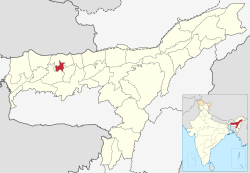 Location in Assam | |
 Bajali district | |
| Country | |
| State | Assam |
| Division | Lower Assam |
| Established | 12 January 2021 |
| Headquarters | Pathsala |
| Government | |
| • Lok Sabha constituencies | Kokrajhar, Barpeta |
| Area | |
| • Total | 418 km2 (161 sq mi) |
| Population (2011) | |
| • Total | 253,816 |
| • Density | 610/km2 (1,600/sq mi) |
| Website | https://bajali.assam.gov.in/ |
Bajali district is a district of the Indian state of Assam, carved out of Barpeta district.[1] The Assam Cabinet headed by former Chief Minister Sarbananda Sonowal approved the proposal to make Bajali a full-fledged district on 10 August 2020.[2] On 12 January 2021 Bajali was formally declared as a district.[3] On 31 December 2022, the district was remerged with existing Barpeta district.[4]
However, on August 25, 2023, the Assam cabinet made an announcement regarding the restoration of the district status of Bajali[5] and on October 12, Bajali again became a district.[6]
Bajali comprised parts of Bajali, Jalah and Sarupeta circles. Dolor Pathar is the most popular village under bajali district And Pathsala is main town of the district.
YouTube Encyclopedic
-
1/3Views:41 1748 8293 563
-
Why Bajali, Biswanath, Hojai and Tamulpur District are Remerged? Current Affairs || Study insight
-
Bajali, the New District of Assam | Sixth Schedule Areas According to Indian Constitution |
-
Pre-Test Exam Paper 2022 2023 Class 10 X Bajali District General Science Paper Matric HSLC
Transcription
Demographics
According to the 2011 census, erstwhile Bajali district has a population of 253,876, of which 11,242 (4.43%) live in urban areas. Bajali has a sex ratio of 978 females per 1000 males. Scheduled Castes notably the Kaibarta-Jalkeot community and Scheduled Tribes notably the Boro community make up 19,192 (7.56%) and 11,486 (4.52%) of the population respectively.[8]
| Circle | Hindus (%) | Muslims (%) | Others (%) |
|---|---|---|---|
| Bajali (Pt) | 94.51 | 5.34 | 0.15 |
| Sarupeta (Pt) | 43.89 | 55.92 | 0.19 |
| Jalah (Pt) | 86.32 | 13.54 | 0.14 |
The district religious composition are as follows: Hindu 172,388, Muslim 81,003 and others at 485 as per 2011 census report.[7]
189,075 of the population spoke Assamese, 53,052 Bengali, 10,877 Boro and 0.36% speaks other minority languages.[9]
References
- ^ "Bajali becomes Assam's 34th district". thenewsmill.com. 2021-02-10. Retrieved 2021-07-10.
- ^ Desk, Sentinel Digital (2020-08-10). "'Bajali' to become the 34th full-fledged district of Assam - Sentinelassam". www.sentinelassam.com. Retrieved 2020-11-26.
- ^ Desk, Sentinel Digital (2021-01-13). "'Bajali' Becomes the 34th Full-Fledged District of Assam". www.sentinelassam.com. Retrieved 2021-01-16.
- ^ Tribune, The Assam (2022-12-31). "Assam: Four districts to re-merge with existing districts". assamtribune.com. Retrieved 2023-01-03.
- ^ "Assam Cabinet decides to 'create' 4 districts". The Hindu. 25 August 2023. Retrieved 26 August 2023.
- ^ Roushan, Anurag; India TV (2023-10-12). "Assam government notifies new Bajali district by bifurcating Barpeta | DETAILS INSIDE". www.indiatvnews.com. Retrieved 2023-10-23.
- ^ a b "Table C-01 Population By Religion: Assam". census.gov.in. Registrar General and Census Commissioner of India. 2011.
- ^ "District Census Handbook: Barpeta" (PDF). censusindia.gov.in. Registrar General and Census Commissioner of India. 2011.
- ^ a b "Table C-16 Population By Mother Tongue: Assam". censusindia.gov.in. Registrar General and Census Commissioner of India. 2011.