
Baireni
बैरेनी | |
|---|---|
 Baireni Location in Nepal | |
| Coordinates: 27°46′N 84°59′E / 27.76°N 84.98°E | |
| Country | |
| Zone | Bagmati Zone |
| District | Dhading District |
| Population (1991) | |
| • Total | 11,821 |
| • Religions | Hindu |
| Time zone | UTC+5:45 (Nepal Time) |
| Website | http://baireni.com |
Baireni is a village development committee in Dhading District in the Bagmati Zone of central Nepal. At the time of the 1991 Nepal census, it had a population of 11,821.[1]
YouTube Encyclopedic
-
1/3Views:2 17890527 022
-
Mid Hill Highway Construction | मध्य पहाडी लोकमार्ग
-
Salyantar Dhading सल्यानटार (Geo FS)
-
Indreni Team || Dhading - Kalleri Part 1
Transcription
References
- ^ "Nepal Census 2001". Nepal's Village Development Committees. Digital Himalaya. Archived from the original on 2008-10-12. Retrieved 2008-08-24.
Headquarters: Dhading Besi | ||
| Gaunpalika | 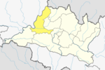 | |
| Municipalities | ||
This article about a location in the Dhading District of Nepal is a stub. You can help Wikipedia by expanding it. |