
Badda
বাড্ডা | |
|---|---|
 South Badda overlooking Gulshan lake (2017) | |
 Expandable map of vicinity of Badda Thana | |
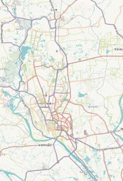 Badda Location of Badda within Dhaka  Badda Location of Badda within Dhaka Division  Badda Location of Badda within Bangladesh | |
| Coordinates: 23°46.3′N 90°25.6′E / 23.7717°N 90.4267°E | |
| Country | |
| Division | Dhaka Division |
| District | Dhaka District |
| Area | |
| • Total | 16.78 km2 (6.48 sq mi) |
| Elevation | 23 m (75 ft) |
| Population (2011)[2] | |
| • Total | 536,621 |
| • Density | 31,980/km2 (82,800/sq mi) |
| Time zone | UTC+6 (BST) |
| Website | Official Map of the Badda Thana |
Badda (Bengali: বাড্ডা) is a Thana of Dhaka District in the Division of Dhaka, Bangladesh. It was formed in December 1998 from parts of Cantonment Thana and Gulshan Thana.[3] Badda is adjacent to Rampura, Gulshan and Baridhara Thanas.
YouTube Encyclopedic
-
1/3Views:59522 51743 552
-
Badda thana police resque 8month child 01817066053
-
Mirpur, Dhaka City , Bangladesh 2022 [4K]
-
ঢাকার মানচিত্র - Dhaka Maps-dhaka map by road-map of dhaka city-dhaka city map
Transcription
Geography
Badda thana is located at 23°46′18″N 90°25′39″E / 23.77159°N 90.42741°E. Its total area is 16.78 km2 (6.48 sq mi).
Demographics
This Badda has a population of 1,57,925. Males constitute 55.68% of the population, and females 44.32%. Badda has an average literacy rate of 58.5%, and the national average of 32.4% literate.[citation needed]
Administration
Badda has 2+4 Unions/Wards, 16+14 Mauzas/Mahallas, and 0 villages.
Suburbs under Badda Thana
- Banasree
- North Badda
- Middle Badda
- South Badda
- Merul Badda
- Badda DIT Project
- Aftabnagar
- Satarkul
- Beraid
Education
According to Banglapedia, Badda Alatunnessa Higher Secondary School, Satarkul School and College, and Cambrian School and College, founded 2004, are notable higher secondary schools.[3] And notable primary schools include Siraj Mia Memorial Model School. Badda thana has dozens of private kinder garden schools, few law schools, and several government primary schools. The area, especially DIT Project, is known for peaceful residential environment. Now there are a few private universities built in Badda. Like BRAC University & United International University.
See also
References
- ^ "Geographic coordinates of Dhaka, Bangladesh". DATEANDTIME.INFO. Retrieved 7 July 2016.
- ^ Bangladesh Bureau of Statistics (2011). "Population & Housing Census" (PDF). Bangladesh Government. Archived from the original (PDF) on 3 September 2017. Retrieved 17 April 2015.
- ^ a b Molla, Md Tuhin (2012). "Badda Thana". In Islam, Sirajul; Jamal, Ahmed A. (eds.). Banglapedia: National Encyclopedia of Bangladesh (Second ed.). Asiatic Society of Bangladesh.
This Dhaka Division location article is a stub. You can help Wikipedia by expanding it. |