
Aurora | |
|---|---|
| Municipality of Aurora | |
 Poblacion of Aurora | |
 Flag  Seal | |
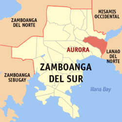 Map of Zamboanga del Sur with Aurora highlighted | |
OpenStreetMap  | |
 Aurora Location within the Philippines | |
| Coordinates: 7°56′54″N 123°34′55″E / 7.9484278°N 123.5818778°E | |
| Country | Philippines |
| Region | Zamboanga Peninsula |
| Province | Zamboanga del Sur |
| District | 1st district |
| Founded | August 22, 1942 |
| Named for | Aurora Quezon |
| Barangays | 44 (see Barangays) |
| Government | |
| • Type | Sangguniang Bayan |
| • Mayor | Boen Dorotheo R. Cabahug |
| • Vice Mayor | Silvano C. Zanoria |
| • Representative | Divina Grace C. Yu |
| • Municipal Council | Members |
| • Electorate | 36,746 voters (2022) |
| Area | |
| • Total | 180.95 km2 (69.87 sq mi) |
| Elevation | 157 m (515 ft) |
| Highest elevation | 501 m (1,644 ft) |
| Lowest elevation | 0 m (0 ft) |
| Population (2020 census)[3] | |
| • Total | 52,995 |
| • Density | 290/km2 (760/sq mi) |
| • Households | 12,790 |
| Economy | |
| • Income class | 2nd municipal income class |
| • Poverty incidence | 29.80 |
| • Revenue | ₱ 223.2 million (2020) |
| • Assets | ₱ 878.7 million (2020) |
| • Expenditure | ₱ 159.2 million (2020) |
| • Liabilities | ₱ 453.5 million (2020) |
| Service provider | |
| • Electricity | Zamboanga del Sur 1 Electric Cooperative (ZAMSURECO 1) |
| Time zone | UTC+8 (PST) |
| ZIP code | 7020 |
| PSGC | |
| IDD : area code | +63 (0)62 |
| Native languages | Subanon Cebuano Chavacano Tagalog Maguindanaon |
| Website | aurorazds |
Aurora, officially the Municipality of Aurora (Cebuano: Lungsod sa Aurora; Subanen: Benwa Aurora; Maguindanaon: Inged nu Awrura, Jawi: ايڠد نو اورور; Chavacano: Municipalidad de Aurora; Tagalog: Bayan ng Aurora), is a 2nd class municipality in the province of Zamboanga del Sur, Philippines. According to the 2020 census, it has a population of 52,995 people.[3]
The town was named after President Manuel Quezon's wife, Aurora Quezon.
In 1948, a portion of Aurora was separated to form the town of Molave.[5]
YouTube Encyclopedic
-
1/5Views:3362 5508 2885138 471
-
Taf's Wonderland 2021 / Drone Footage / Aurora, Zamboanga Del Sur
-
Aurora , Zamboanga Del Sur aerial view
-
AURORA, ZAMBOANGA DEL SUR'S 44 BARANGAYS!
-
Amazing Trip / TRAVEL VLOG #1
-
Aurora Zamboanga del Sur
Transcription
Geography
It is the easternmost municipality in Zamboanga del Sur, bounded by the Province of Lanao del Norte on its eastern side.
Barangays
Aurora is politically subdivided into 44 barangays. Each barangay consists of puroks while some have sitios.
- Acad
- Alang-alang
- Alegria
- Anonang
- Bagong Mandaue
- Bagong Maslog
- Bagong Oslob
- Bagong Pitogo
- Baki
- Balas
- Balide
- Balintawak
- Bayabas
- Bemposa
- Cabilinan
- Campo Uno
- Ceboneg
- Commonwealth
- Gubaan
- Inasagan
- Inroad
- Kahayagan East (Katipunan)
- Kahayagan West
- Kauswagan
- La Paz (Tinibtiban)
- La Victoria
- Lantungan
- Libertad
- Lintugop
- Lubid
- Maguikay
- Mahayahay
- Monte Alegre
- Montela
- Napo
- Panaghiusa
- Poblacion
- Resthouse
- Romarate
- San Jose
- San Juan
- Sapa Loboc
- Tagulalo
- Waterfall
Climate
| Climate data for Aurora, Zamboanga del Sur | |||||||||||||
|---|---|---|---|---|---|---|---|---|---|---|---|---|---|
| Month | Jan | Feb | Mar | Apr | May | Jun | Jul | Aug | Sep | Oct | Nov | Dec | Year |
| Average high °C (°F) | 28 (82) |
28 (82) |
29 (84) |
30 (86) |
29 (84) |
28 (82) |
28 (82) |
28 (82) |
28 (82) |
28 (82) |
28 (82) |
28 (82) |
28 (83) |
| Average low °C (°F) | 21 (70) |
21 (70) |
21 (70) |
22 (72) |
23 (73) |
23 (73) |
22 (72) |
22 (72) |
22 (72) |
22 (72) |
22 (72) |
21 (70) |
22 (72) |
| Average precipitation mm (inches) | 69 (2.7) |
58 (2.3) |
67 (2.6) |
60 (2.4) |
109 (4.3) |
114 (4.5) |
83 (3.3) |
78 (3.1) |
76 (3.0) |
92 (3.6) |
86 (3.4) |
63 (2.5) |
955 (37.7) |
| Average rainy days | 12.8 | 11.6 | 14.8 | 17.4 | 24.8 | 23.5 | 20.7 | 18.5 | 17.4 | 22.5 | 21.6 | 15.6 | 221.2 |
| Source: Meteoblue[6] | |||||||||||||
Demographics
| Year | Pop. | ±% p.a. |
|---|---|---|
| 1948 | 35,090 | — |
| 1960 | 25,558 | −2.61% |
| 1970 | 25,975 | +0.16% |
| 1975 | 31,092 | +3.67% |
| 1980 | 37,248 | +3.68% |
| 1990 | 38,097 | +0.23% |
| 1995 | 40,157 | +0.99% |
| 2000 | 42,820 | +1.39% |
| 2007 | 47,177 | +1.35% |
| 2010 | 48,434 | +0.96% |
| 2015 | 50,755 | +0.90% |
| 2020 | 52,995 | +0.85% |
| Source: Philippine Statistics Authority[7][8][9][10] | ||
Economy
References
- ^ Municipality of Aurora | (DILG)
- ^ "2015 Census of Population, Report No. 3 – Population, Land Area, and Population Density" (PDF). Philippine Statistics Authority. Quezon City, Philippines. August 2016. ISSN 0117-1453. Archived (PDF) from the original on May 25, 2021. Retrieved July 16, 2021.
- ^ a b Census of Population (2020). "Region IX (Zamboanga Peninsula)". Total Population by Province, City, Municipality and Barangay. Philippine Statistics Authority. Retrieved 8 July 2021.
- ^ "PSA Releases the 2018 Municipal and City Level Poverty Estimates". Philippine Statistics Authority. 15 December 2021. Retrieved 22 January 2022.
- ^ "An act creating the municipality of Molave in the province of Zamboanga and making said municipality the capital of the province". LawPH.com. Retrieved 2011-04-08.
- ^ "Aurora: Average Temperatures and Rainfall". Meteoblue. Retrieved 1 May 2020.
- ^ Census of Population (2015). "Region IX (Zamboanga Peninsula)". Total Population by Province, City, Municipality and Barangay. Philippine Statistics Authority. Retrieved 20 June 2016.
- ^ Census of Population and Housing (2010). "Region IX (Zamboanga Peninsula)" (PDF). Total Population by Province, City, Municipality and Barangay. National Statistics Office. Retrieved 29 June 2016.
- ^ Censuses of Population (1903–2007). "Region IX (Zamboanga Peninsula)". Table 1. Population Enumerated in Various Censuses by Province/Highly Urbanized City: 1903 to 2007. National Statistics Office.
- ^ "Province of Zamboanga del Sur". Municipality Population Data. Local Water Utilities Administration Research Division. Retrieved 17 December 2016.
- ^ "Poverty incidence (PI):". Philippine Statistics Authority. Retrieved December 28, 2020.
- ^ "Estimation of Local Poverty in the Philippines" (PDF). Philippine Statistics Authority. 29 November 2005.
- ^ "2003 City and Municipal Level Poverty Estimates" (PDF). Philippine Statistics Authority. 23 March 2009.
- ^ "City and Municipal Level Poverty Estimates; 2006 and 2009" (PDF). Philippine Statistics Authority. 3 August 2012.
- ^ "2012 Municipal and City Level Poverty Estimates" (PDF). Philippine Statistics Authority. 31 May 2016.
- ^ "Municipal and City Level Small Area Poverty Estimates; 2009, 2012 and 2015". Philippine Statistics Authority. 10 July 2019.
- ^ "PSA Releases the 2018 Municipal and City Level Poverty Estimates". Philippine Statistics Authority. 15 December 2021. Retrieved 22 January 2022.
External links
Places adjacent to Aurora, Zamboanga del Sur | |
|---|---|
| Municipalities | |
|---|---|
| Component city | |
| Highly urbanized city |
|
This article about a location in Zamboanga Peninsula region is a stub. You can help Wikipedia by expanding it. |