
Ascutney, Vermont | |
|---|---|
 Proctor Library | |
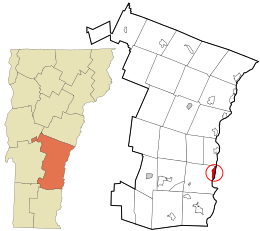 Location in Windsor County and the state of Vermont. | |
| Coordinates: 43°24′30″N 72°24′25″W / 43.40833°N 72.40694°W | |
| Country | United States |
| State | Vermont |
| County | Windsor |
| Area | |
| • Total | 1.7 sq mi (4.3 km2) |
| • Land | 1.7 sq mi (4.3 km2) |
| • Water | 0.0 sq mi (0.0 km2) |
| Elevation | 413 ft (126 m) |
| Population (2010) | |
| • Total | 540 |
| • Density | 330/sq mi (130/km2) |
| Time zone | UTC-5 (Eastern (EST)) |
| • Summer (DST) | UTC-4 (EDT) |
| ZIP code | 05030 |
| Area code | 802 |
| FIPS code | 50-01750[1] |
| GNIS feature ID | 1456178[2] |
Ascutney is an unincorporated village and census-designated place (CDP) in the town of Weathersfield, Windsor County, Vermont, United States.[3] It is located in the northeastern section of Weathersfield, in the portion of that town adjacent to Mount Ascutney, after which the village is named. As of the 2010 census, the population of the CDP was 540.[4]
YouTube Encyclopedic
-
1/2Views:1 289412
-
Hiking Mt. Ascutney in Vermont
-
Mount Ascutney, VT
Transcription
Geography
Ascutney is located at geographical coordinates 43° 24′ 25″ North, 72° 24′ 27″ West (43.407059, -72.407562). The southern flanks of Mount Ascutney rise to the north of the CDP, with its summit in the neighboring towns of Windsor and West Windsor.
U.S. Route 5 runs north–south through Ascutney, intersected by Vermont routes 12 and 131 at the center of the CDP. Interstate 91 forms the western boundary of the CDP and serves Ascutney by Exit 8. From Ascutney, Route 12 crosses the Connecticut River into Claremont, New Hampshire.
References
- ^ "U.S. Census website". United States Census Bureau. Retrieved January 31, 2008.
- ^ "US Board on Geographic Names". United States Geological Survey. October 25, 2007. Retrieved January 31, 2008.
- ^ U.S. Geological Survey Geographic Names Information System: Ascutney, Vermont
- ^ "Profile of General Population and Housing Characteristics: 2010 Demographic Profile Data (DP-1): Ascutney CDP, Vermont". United States Census Bureau. Retrieved August 1, 2012.
External links
Municipalities and communities of Windsor County, Vermont, United States | ||
|---|---|---|
| Towns | ||
| Villages | ||
| CDPs | ||
| Other communities | ||
| International | |
|---|---|
| National | |
This article about a location in Vermont is a stub. You can help Wikipedia by expanding it. |