
Prades | |
|---|---|
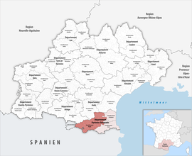 Location within the region Occitanie | |
| Country | France |
| Region | Occitania |
| Department | Pyrénées-Orientales |
| No. of communes | 123 |
| Subprefecture | Prades |
| Area | 2,181.4 km2 (842.2 sq mi) |
| Population (Jan. 2020)[1] | 60,250 |
| • Density | 28/km2 (70/sq mi) |
| INSEE code | 663 |
The arrondissement of Prades is an arrondissement of France in the Pyrénées-Orientales department (Northern Catalonia) in the Occitanie region. It has 123 communes.[2] Its population is 59,828 (2016), and its area is 2,181.4 km2 (842.2 sq mi).[3]
YouTube Encyclopedic
-
1/3Views:6321 155781
-
Location gite Eus Pyrénées Orientales prades
-
Tiny Tour | Farena Spain | A picturesque Rural Escape in Prades Mountains | 2020 Aug
-
Toastmasters CC 9 speech evaluation by DTM Don Prades
Transcription
Composition
The communes of the arrondissement of Prades, and their INSEE codes, are:[2]
- Les Angles (66004)
- Angoustrine-Villeneuve-des-Escaldes (66005)
- Ansignan (66006)
- Arboussols (66007)
- Ayguatébia-Talau (66010)
- Baillestavy (66013)
- Bélesta (66019)
- Bolquère (66020)
- Boule-d'Amont (66022)
- Bouleternère (66023)
- Bourg-Madame (66025)
- La Cabanasse (66027)
- Campôme (66034)
- Campoussy (66035)
- Canaveilles (66036)
- Caramany (66039)
- Casefabre (66040)
- Casteil (66043)
- Catllar (66045)
- Caudiès-de-Conflent (66047)
- Caudiès-de-Fenouillèdes (66046)
- Clara-Villerach (66051)
- Codalet (66052)
- Conat (66054)
- Corbère (66055)
- Corbère-les-Cabanes (66056)
- Corneilla-de-Conflent (66057)
- Corneilla-la-Rivière (66058)
- Dorres (66062)
- Égat (66064)
- Enveitg (66066)
- Err (66067)
- Escaro (66068)
- Espira-de-Conflent (66070)
- Estavar (66072)
- Estoher (66073)
- Eus (66074)
- Eyne (66075)
- Feilluns (66076)
- Fenouillet (66077)
- Fillols (66078)
- Finestret (66079)
- Fontpédrouse (66080)
- Fontrabiouse (66081)
- Font-Romeu-Odeillo-Via (66124)
- Formiguères (66082)
- Fosse (66083)
- Fuilla (66085)
- Glorianes (66086)
- Ille-sur-Têt (66088)
- Joch (66089)
- Jujols (66090)
- Lansac (66092)
- Latour-de-Carol (66095)
- Latour-de-France (66096)
- Lesquerde (66097)
- La Llagonne (66098)
- Llo (66100)
- Mantet (66102)
- Marquixanes (66103)
- Los Masos (66104)
- Matemale (66105)
- Maury (66107)
- Millas (66108)
- Molitg-les-Bains (66109)
- Montalba-le-Château (66111)
- Mont-Louis (66117)
- Mosset (66119)
- Nahuja (66120)
- Néfiach (66121)
- Nohèdes (66122)
- Nyer (66123)
- Olette (66125)
- Oreilla (66128)
- Osséja (66130)
- Palau-de-Cerdagne (66132)
- Pézilla-de-Conflent (66139)
- Planès (66142)
- Planèzes (66143)
- Porta (66146)
- Porté-Puymorens (66147)
- Prades (66149)
- Prats-de-Sournia (66151)
- Prugnanes (66152)
- Prunet-et-Belpuig (66153)
- Puyvalador (66154)
- Py (66155)
- Rabouillet (66156)
- Railleu (66157)
- Rasiguères (66158)
- Réal (66159)
- Ria-Sirach (66161)
- Rigarda (66162)
- Rodès (66165)
- Sahorre (66166)
- Saillagouse (66167)
- Saint-Arnac (66169)
- Sainte-Léocadie (66181)
- Saint-Féliu-d'Amont (66173)
- Saint-Martin-de-Fenouillet (66184)
- Saint-Michel-de-Llotes (66185)
- Saint-Paul-de-Fenouillet (66187)
- Saint-Pierre-dels-Forcats (66188)
- Sansa (66191)
- Sauto (66192)
- Serdinya (66193)
- Souanyas (66197)
- Sournia (66198)
- Tarerach (66201)
- Targasonne (66202)
- Taurinya (66204)
- Thuès-Entre-Valls (66209)
- Trévillach (66215)
- Trilla (66216)
- Ur (66218)
- Urbanya (66219)
- Valcebollère (66220)
- Valmanya (66221)
- Vernet-les-Bains (66222)
- Villefranche-de-Conflent (66223)
- Vinça (66230)
- Vira (66232)
- Le Vivier (66234)
History
The arrondissement of Prades was created in 1800.[4] In January 2017 it gained 23 communes from the arrondissement of Perpignan.[5]
As a result of the reorganisation of the cantons of France which came into effect in 2015, the borders of the cantons are no longer related to the borders of the arrondissements. The cantons of the arrondissement of Prades were, as of January 2015:[6]
References
- ^ "Téléchargement du fichier d'ensemble des populations légales en 2020". The National Institute of Statistics and Economic Studies. 29 December 2022.
- ^ a b "Arrondissement de Prades (663)". INSEE. Retrieved 2019-10-03.
- ^ "Comparateur de territoire, géographie au 01/01/2019". INSEE. Retrieved 2019-10-03.
- ^ Historique des Pyrénées-Orientales
- ^ "Arrêté préfectoral, 29 December 2016" (PDF). Archived from the original (PDF) on 2019-07-27. Retrieved 2019-10-25.
- ^ Populations légales 2012: 66 Pyrénées-Orientales, INSEE
42°36′54″N 2°25′25″E / 42.61500°N 2.42361°E