
Mayenne | |
|---|---|
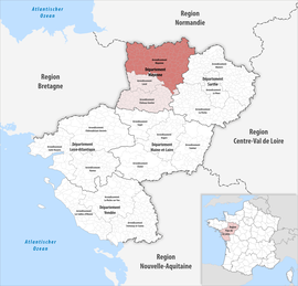 Location within the region Pays de la Loire | |
| Country | France |
| Region | Pays de la Loire |
| Department | Mayenne |
| No. of communes | 130 |
| Subprefecture | Mayenne |
| Area | 2,961.8 km2 (1,143.6 sq mi) |
| Population (Jan. 2020)[1] | 118,694 |
| • Density | 40/km2 (100/sq mi) |
| INSEE code | 533 |
The arrondissement of Mayenne is an arrondissement of France in the Mayenne department in the Pays de la Loire region. It has 132 communes.[2] Its population is 120,982 (2016), and its area is 2,961.8 km2 (1,143.6 sq mi).[3]
YouTube Encyclopedic
-
1/2Views:1 003729
-
Grand Saint Antoine Tous Les Saints - Ayiti
-
Lancement du pont Berthier (février 2016) - Time-lapse
Transcription
Composition
The communes of the arrondissement of Mayenne, and their INSEE codes, are:[2]
- Alexain (53002)
- Ambrières-les-Vallées (53003)
- Andouillé (53005)
- Aron (53008)
- Assé-le-Bérenger (53010)
- Averton (53013)
- La Baconnière (53015)
- Bais (53016)
- La Bazoge-Montpinçon (53021)
- La Bazouge-des-Alleux (53023)
- Belgeard (53028)
- La Bigottière (53031)
- Blandouet-Saint Jean (53228)
- Boulay-les-Ifs (53038)
- Brecé (53042)
- Brée (53043)
- Carelles (53047)
- Chailland (53048)
- Champéon (53051)
- Champfrémont (53052)
- Champgenéteux (53053)
- Chantrigné (53055)
- La Chapelle-au-Riboul (53057)
- La Chapelle-Rainsouin (53059)
- Charchigné (53061)
- Châtillon-sur-Colmont (53064)
- Chevaigné-du-Maine (53069)
- Colombiers-du-Plessis (53071)
- Commer (53072)
- Contest (53074)
- Couesmes-Vaucé (53079)
- Couptrain (53080)
- Courcité (53083)
- Crennes-sur-Fraubée (53085)
- La Croixille (53086)
- Désertines (53091)
- La Dorée (53093)
- Ernée (53096)
- Évron (53097)
- Fougerolles-du-Plessis (53100)
- Gesnes (53105)
- Gesvres (53106)
- Gorron (53107)
- Grazay (53109)
- La Haie-Traversaine (53111)
- Le Ham (53112)
- Hambers (53113)
- Hardanges (53114)
- Hercé (53115)
- Le Horps (53116)
- Le Housseau-Brétignolles (53118)
- Izé (53120)
- Javron-les-Chapelles (53121)
- Jublains (53122)
- Juvigné (53123)
- Landivy (53125)
- Larchamp (53126)
- Lassay-les-Châteaux (53127)
- Lesbois (53131)
- Levaré (53132)
- Lignières-Orgères (53133)
- Livet (53134)
- Loupfougères (53139)
- Madré (53142)
- Marcillé-la-Ville (53144)
- Martigné-sur-Mayenne (53146)
- Mayenne (53147)
- Mézangers (53153)
- Montaudin (53154)
- Montenay (53155)
- Montreuil-Poulay (53160)
- Montsûrs (53161)
- Moulay (53162)
- Neau (53163)
- Neuilly-le-Vendin (53164)
- Oisseau (53170)
- La Pallu (53173)
- Parigné-sur-Braye (53174)
- Le Pas (53176)
- La Pellerine (53177)
- Placé (53179)
- Pontmain (53181)
- Pré-en-Pail-Saint-Samson (53185)
- Ravigny (53187)
- Rennes-en-Grenouilles (53189)
- Le Ribay (53190)
- Sacé (53195)
- Saint-Aignan-de-Couptrain (53196)
- Saint-Aubin-du-Désert (53198)
- Saint-Aubin-Fosse-Louvain (53199)
- Saint-Baudelle (53200)
- Saint-Berthevin-la-Tannière (53202)
- Saint-Calais-du-Désert (53204)
- Saint-Cyr-en-Pail (53208)
- Saint-Denis-de-Gastines (53211)
- Sainte-Gemmes-le-Robert (53218)
- Saint-Ellier-du-Maine (53213)
- Sainte-Marie-du-Bois (53235)
- Sainte-Suzanne-et-Chammes (53255)
- Saint-Fraimbault-de-Prières (53216)
- Saint-Georges-Buttavent (53219)
- Saint-Georges-le-Fléchard (53220)
- Saint-Georges-sur-Erve (53221)
- Saint-Germain-d'Anxure (53222)
- Saint-Germain-de-Coulamer (53223)
- Saint-Germain-le-Guillaume (53225)
- Saint-Hilaire-du-Maine (53226)
- Saint-Julien-du-Terroux (53230)
- Saint-Léger (53232)
- Saint-Loup-du-Gast (53234)
- Saint-Mars-du-Désert (53236)
- Saint-Mars-sur-Colmont (53237)
- Saint-Mars-sur-la-Futaie (53238)
- Saint-Pierre-des-Landes (53245)
- Saint-Pierre-des-Nids (53246)
- Saint-Pierre-sur-Erve (53248)
- Saint-Thomas-de-Courceriers (53256)
- Saulges (53257)
- Soucé (53261)
- Thorigné-en-Charnie (53264)
- Thubœuf (53263)
- Torcé-Viviers-en-Charnie (53265)
- Trans (53266)
- Vaiges (53267)
- Vautorte (53269)
- Vieuvy (53270)
- Villaines-la-Juhel (53271)
- Villepail (53272)
- Vimartin-sur-Orthe (53239)
- Voutré (53276)
History
The arrondissement of Mayenne was created in 1800.[4] At the March 2016 reorganisation of the arrondissements of Mayenne, it gained 38 communes from the arrondissement of Laval.[5]
As a result of the reorganisation of the cantons of France which came into effect in 2015, the borders of the cantons are no longer related to the borders of the arrondissements. The cantons of the arrondissement of Mayenne were, as of January 2015:[6]
- Ambrières-les-Vallées
- Bais
- Couptrain
- Ernée
- Gorron
- Le Horps
- Landivy
- Lassay-les-Châteaux
- Mayenne-Est
- Mayenne-Ouest
- Pré-en-Pail
- Villaines-la-Juhel
References
- ^ "Téléchargement du fichier d'ensemble des populations légales en 2020". The National Institute of Statistics and Economic Studies. 29 December 2022.
- ^ a b "Arrondissement de Mayenne (533)". INSEE. Retrieved 2019-10-01.
- ^ "Comparateur de territoire, géographie au 01/01/2019". INSEE. Retrieved 2019-10-01.
- ^ Historique de la Mayenne
- ^ "Arrêté préfectoral, 24 March 2016" (PDF). Retrieved 2019-10-22.
- ^ "Populations légales 2012: 53Mayenne" (PDF). INSEE. December 2014.
48°18′N 0°37′W / 48.30°N 0.62°W