
Albertville | |
|---|---|
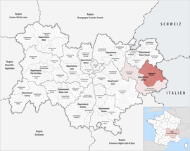 Location within the region Auvergne-Rhône-Alpes | |
| Country | France |
| Region | Auvergne-Rhône-Alpes |
| Department | Savoie |
| No. of communes | 69 |
| Subprefecture | Albertville |
| Area | 2,466.1 km2 (952.2 sq mi) |
| Population (Jan. 2020)[1] | 112,234 |
| • Density | 46/km2 (120/sq mi) |
| INSEE code | 731 |
The arrondissement of Albertville is an arrondissement of France in the Savoie department in the Auvergne-Rhône-Alpes region. It has 69 communes.[2] Its population is 111,751 (2016), and its area is 2,466.1 km2 (952.2 sq mi).[3]
YouTube Encyclopedic
-
1/3Views:1 7899413 485
-
Lorena Grim, Institut de beauté à Paris 16ème
-
Petit Bivouac 2015 - Lung - Bande annonce
-
Toiletteur - Créer son salon
Transcription
Composition
The communes of the arrondissement of Albertville, and their INSEE codes, are:[2]
- Aime-la-Plagne (73006)
- Albertville (73011)
- Allondaz (73014)
- Les Allues (73015)
- Les Avanchers-Valmorel (73024)
- La Bâthie (73032)
- Beaufort (73034)
- Les Belleville (73257)
- Bonvillard (73048)
- Bourg-Saint-Maurice (73054)
- Bozel (73055)
- Brides-les-Bains (73057)
- Césarches (73061)
- Cevins (73063)
- Champagny-en-Vanoise (73071)
- Les Chapelles (73077)
- Cléry (73086)
- Cohennoz (73088)
- Courchevel (73227)
- Crest-Voland (73094)
- Esserts-Blay (73110)
- Feissons-sur-Salins (73113)
- Flumet (73114)
- Frontenex (73121)
- La Giettaz (73123)
- Gilly-sur-Isère (73124)
- Grand-Aigueblanche (73003)
- Grésy-sur-Isère (73129)
- Grignon (73130)
- Hautecour (73131)
- Hauteluce (73132)
- Landry (73142)
- La Léchère (73187)
- Marthod (73153)
- Mercury (73154)
- Montagny (73161)
- Montailleur (73162)
- Monthion (73170)
- Montvalezan (73176)
- Moûtiers (73181)
- Notre-Dame-de-Bellecombe (73186)
- Notre-Dame-des-Millières (73188)
- Notre-Dame-du-Pré (73190)
- Pallud (73196)
- Peisey-Nancroix (73197)
- La Plagne-Tarentaise (73150)
- Planay (73201)
- Plancherine (73202)
- Pralognan-la-Vanoise (73206)
- Queige (73211)
- Rognaix (73216)
- Sainte-Foy-Tarentaise (73232)
- Sainte-Hélène-sur-Isère (73241)
- Saint-Marcel (73253)
- Saint-Nicolas-la-Chapelle (73262)
- Saint-Paul-sur-Isère (73268)
- Saint-Vital (73283)
- Salins-Fontaine (73284)
- Séez (73285)
- Thénésol (73292)
- Tignes (73296)
- Tournon (73297)
- Tours-en-Savoie (73298)
- Ugine (73303)
- Val-d'Isère (73304)
- Venthon (73308)
- Verrens-Arvey (73312)
- Villard-sur-Doron (73317)
- Villaroger (73323)
History
The arrondissement of Albertville was created in 1860.[4]
As a result of the reorganisation of the cantons of France which came into effect in 2015, the borders of the cantons are no longer related to the borders of the arrondissements. The cantons of the arrondissement of Albertville were, as of January 2015:[5]
- Aime
- Albertville-Nord
- Albertville-Sud
- Beaufort
- Bourg-Saint-Maurice
- Bozel
- Grésy-sur-Isère
- Moûtiers
- Ugine
References
- ^ "Téléchargement du fichier d'ensemble des populations légales en 2020". The National Institute of Statistics and Economic Studies. 29 December 2022.
- ^ a b "Arrondissement d'Albertville (731)". INSEE. Retrieved 2019-10-03.
- ^ "Comparateur de territoire, géographie au 01/01/2019". INSEE. Retrieved 2019-10-03.
- ^ Historique de la Savoie
- ^ Populations légales 2012: 73 Savoie, INSEE
45°40′00″N 6°23′15″E / 45.66667°N 6.38750°E