
Armona, California | |
|---|---|
 Armona, California | |
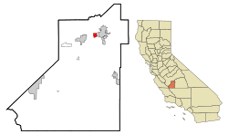 Location in Kings County and the state of California | |
 Armona, California Location in the United States | |
| Coordinates: 36°18′57″N 119°42′30″W / 36.31583°N 119.70833°W | |
| Country | |
| State | |
| County | |
| Area | |
| • Total | 2.05 sq mi (5.32 km2) |
| • Land | 2.05 sq mi (5.32 km2) |
| • Water | 0.00 sq mi (0.00 km2) 0% |
| Elevation | 239 ft (73 m) |
| Population (2020) | |
| • Total | 4,274 |
| • Density | 2,081.83/sq mi (803.81/km2) |
| Time zone | UTC−8 (Pacific (PST)) |
| • Summer (DST) | UTC−7 (PDT) |
| ZIP code | 93202 |
| Area code | 559 |
| FIPS code | 06-02700 |
| GNIS feature IDs | 1652665, 2407762 |
Armona is a census-designated place (CDP) in Kings County, California, United States. Armona is located 3.5 miles (5.6 km) west-southwest of Hanford,[3] at an elevation of 239 feet (73 m).[2] It is part of the Hanford–Corcoran Metropolitan Statistical Area. The population was 4,156 at the 2010 census.[4] Armona's motto is "Small and Proud".
YouTube Encyclopedic
-
1/4Views:3 4071 17511 414395
-
Hanford California Hanford Armona Road
-
Chinese Temple Armona CA
-
Lemoore California
-
Somewhere between Corcoran and Hanford California
Transcription
Geography
Armona is located in northern Kings County at 36°18′57″N 119°42′30″W / 36.31583°N 119.70833°W.[2] California State Route 198 runs through the community, leading east into Hanford, the county seat, and west 4 miles (6 km) to Lemoore.
According to the United States Census Bureau, the CDP has a total area of 1.9 square miles (4.9 km2), all of it land.
History
The name "Armona" was applied to a railroad station in the 1880s. It was subsequently transferred to the present location on the Southern Pacific Railroad in 1891. Reportedly, the name was coined by transposing the first two letters of the name "Ramona".[5]
The first school in the Armona vicinity was the Giddings School built in 1880. The Giddings School District was renamed Armona in 1907. A new brick school house was constructed in the early 1920s. As that structure did not comply with California's earthquake standards (the Field Act), it was replaced in 1953 with what is now the Armona Elementary School.[6]
The Armona post office was established in 1887.[3]
Demographics
| Census | Pop. | Note | %± |
|---|---|---|---|
| 2020 | 4,274 | — | |
| U.S. Decennial Census[7] | |||
2010
The 2010 United States Census[8] reported that Armona had a population of 4,156. The population density was 2,182.5 inhabitants per square mile (842.7/km2). The racial makeup of Armona was 2,058 (49.5%) White, 99 (2.4%) African American, 64 (1.5%) Native American, 85 (2.0%) Asian, 13 (0.3%) Pacific Islander, 1,597 (38.4%) from other races, and 240 (5.8%) from two or more races. Hispanic or Latino of any race were 2,784 persons (67.0%).
The Census reported that 4,156 people (100% of the population) lived in households, 0 (0%) lived in non-institutionalized group quarters, and 0 (0%) were institutionalized.
There were 1,152 households, out of which 640 (55.6%) had children under the age of 18 living in them, 641 (55.6%) were opposite-sex married couples living together, 214 (18.6%) had a female householder with no husband present, 106 (9.2%) had a male householder with no wife present. There were 105 (9.1%) unmarried opposite-sex partnerships, and 5 (0.4%) same-sex married couples or partnerships. 147 households (12.8%) were made up of individuals, and 51 (4.4%) had someone living alone who was 65 years of age or older. The average household size was 3.61. There were 961 families (83.4% of all households); the average family size was 3.88.
The age distribution of the population shows 1,421 people (34.2%) under the age of 18, 438 people (10.5%) aged 18 to 24, 1,089 people (26.2%) aged 25 to 44, 902 people (21.7%) aged 45 to 64, and 306 people (7.4%) who were 65 years of age or older. The median age was 28.7 years. For every 100 females, there were 92.3 males. For every 100 females age 18 and over, there were 88.4 males.
There were 1,202 housing units at an average density of 631.2 per square mile (243.7/km2), of which 728 (63.2%) were owner-occupied, and 424 (36.8%) were occupied by renters. The homeowner vacancy rate was 1.1%; the rental vacancy rate was 4.1%. 2,645 people (63.6% of the population) lived in owner-occupied housing units and 1,511 people (36.4%) lived in rental housing units.
2000
As of the census[9] of 2000, there were 3,239 people, 961 households, and 786 families residing in the CDP. The population density was 1,688.3 inhabitants per square mile (651.9/km2). There were 1,012 housing units at an average density of 527.5 per square mile (203.7/km2). The racial makeup of the CDP was 56.25% White, 4.29% Black or African American, 2.41% Native American, 1.33% Asian, 0.25% Pacific Islander, 29.98% from other races, and 5.50% from two or more races. 48.60% of the population were Hispanic or Latino of any race.
There were 961 households, out of which 47.8% had children under the age of 18 living with them, 58.5% were married couples living together, 16.0% had a female householder with no husband present, and 18.2% were non-families. 13.5% of all households were made up of individuals, and 5.7% had someone living alone who was 65 years of age or older. The average household size was 3.37 and the average family size was 3.68.
In the CDP, the age distribution of the population shows 35.4% under the age of 18, 9.7% from 18 to 24, 29.3% from 25 to 44, 18.6% from 45 to 64, and 7.1% who were 65 years of age or older. The median age was 28 years. For every 100 females, there were 94.2 males. For every 100 females age 18 and over, there were 91.6 males.
Economy
At the time of the 2000 census, the median income for a household in the CDP was $32,790, and the median income for a family was $32,232. Males had a median income of $26,905 versus $22,981 for females. The per capita income for the CDP was $11,850. About 24.2% of families and 26.6% of the population were below the poverty line, including 37.8% of those under age 18 and 8.9% of those age 65 or over. The estimated unemployment rate was 13.1% in November 2016.[10]
Transportation
Bus
Kings Area Regional Transit (KART) operates regularly scheduled fixed route bus service, vanpool service for commuters and Dial-A-Ride (demand response) services throughout Kings County as well as to Fresno [1].
Major highway
Rail
Amtrak does not have a station in Armona but does provide passenger service to Hanford, which is 3.5 miles (5.6 km) east of Armona. Freight service is available from the San Joaquin Valley Railroad, which passes through Armona.
Education
Public schools in the community are operated by the Armona Union Elementary School District. They include:
- Armona Elementary School
- Parkview Middle School
The district also sponsors the Crossroads Charter Academy, a K-12 independent study charter school.
There is one K-12 private school, Armona Union Academy, which is operated by the Seventh-day Adventist Church.
Armona is in the Hanford Joint Union High School District.
Nearby community colleges include West Hills College Lemoore and the Hanford center of College of the Sequoias.
Government
In the California State Legislature, Armona is in the 14th Senate District, represented by Democrat Anna Caballero, and in the 32nd Assembly District, represented by Republican Vince Fong.[11]
In the United States House of Representatives, Armona is in California's 21st District and is represented by Democrat TJ Cox. Armona is represented on the Kings County Board of Supervisors by Craig Pedersen.[12]
Notable people
Lyn Lary played shortstop for six different teams in his twelve-year career in Major League Baseball including with the New York Yankees
Notable sites

The United Methodist Church was constructed in 1910.
References
- ^ "2020 U.S. Gazetteer Files". United States Census Bureau. Retrieved October 30, 2021.
- ^ a b c "Armona". Geographic Names Information System. United States Geological Survey, United States Department of the Interior. Retrieved November 2, 2014.
- ^ a b Durham, David L. (1998). California's Geographic Names: A Gazetteer of Historic and Modern Names of the State. Clovis, Calif.: Word Dancer Press. p. 994. ISBN 1-884995-14-4.
- ^ "Geographic Identifiers: 2010 Demographic Profile Data (G001): Armona CDP, California". U.S. Census Bureau, American Factfinder. Retrieved January 25, 2019.[dead link]
- ^ Durham, David L. (2001). Place-Names of Central California. Clovis, California: Word Dancer Press. p. 6. ISBN 1-884995-33-0.
- ^ Gibson, Harold (2001). History of Kings County Public Schools. Hanford, California: George Watson, Copy Connection.
- ^ "Census of Population and Housing". Census.gov. Retrieved June 4, 2016.
- ^ "2010 Census Interactive Population Search: CA – Armona CDP". U.S. Census Bureau. Archived from the original on July 15, 2014. Retrieved July 12, 2014.
- ^ "U.S. Census website". United States Census Bureau. Retrieved January 31, 2008.
- ^ http://www.calmis.ca.gov/htmlfile/county/kings.htm Archived 2013-04-24 at the Wayback Machine accessed January 2, 2017
- ^ "Statewide Database". UC Regents. Archived from the original on February 1, 2015. Retrieved December 10, 2014.
- ^ "District Map: County of Kings Board of Supervisors". Kings County. Retrieved August 4, 2017.
External links
Municipalities and communities of Kings County, California, United States | ||
|---|---|---|
| Cities |  | |
| CDPs | ||
| Unincorporated communities | ||
| Ghost towns | ||