
Highway 74 | ||||
|---|---|---|---|---|
 | ||||
| Route information | ||||
| Maintained by ArDOT | ||||
| Location | ||||
| Country | United States | |||
| State | Arkansas | |||
| Highway system | ||||
| ||||

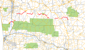
Arkansas Highway 74 (AR 74 and Hwy. 74) is a series of state highways of 103.73 miles (166.94 km) total in Northwest and north central Arkansas and is divided into eight separate sections.
YouTube Encyclopedic
-
1/1Views:40 053
-
Edward Wayne Edwards Zodiac Killer West Memphis Three Cemetary.wmv
Transcription
Route description

The westernmost section route begins in Devil's Den State Park at AR 170. The route winding out of the park heading east. AR 74 crosses I-49 at exit 45 before ending at US 71 in Winslow.
A second segment begins at US 71 just north of Winslow and runs east approximately two miles (3.2 km) before becoming County Road 43 (CR 43).
Section 3 begins at AR 16 in Elkins, running approximately 20 miles (32 km) before ending at US 412B in Huntsville.
A fourth section begins at AR 23 south of Huntsville, heading east 14 miles (23 km) before ending at AR 21 in Kingston.
Near Ponca a fifth section begins at AR 43, running east past Lost Valley for a distance of 20 miles (32 km), ending at AR 7 in Jasper.
South of Jasper, AR 74 resumes again, passing through unincorporated areas of Newton County. The route meets AR 123 in Piercetown and runs concurrently for four miles (6.4 km) before splitting off at Mount Judea. From there, it continues six more miles (9.7 km) miles to Bass, where it terminates at Cave Road.
AR 74 begins a seventh section in Snowball at AR 377. The route runs seven miles (11 km) to meet US 65 north of Marshall.
South of Marshall, AR 74 resumes, following AR 27 for one mile (1.6 km) before splitting off. It continues another 19 miles (31 km) before ending at AR 66 east of Thola.
Major intersections
| County | Location | mi | km | Destinations | Notes | ||
|---|---|---|---|---|---|---|---|
| Washington | Devil's Den State Park | 0.0 | 0.0 | Western terminus | |||
| Winslow | 6.8 | 10.9 | Interchange, exit 45 | ||||
| 12.8 | 20.6 | Southern end of US 71 concurrency | |||||
| Brentwood | 16.3 | 26.2 | Northern end of US 71 concurrency | ||||
| Wyola | 18.7 | 30.1 | CR 38 | Eastern terminus | |||
| Gap in route | |||||||
| Elkins | 0.0 | 0.0 | Western terminus | ||||
| Madison | Wesley | 6.5 | 10.5 | Southern terminus of AR 295 | |||
| Lamar Township | 8.6 | 13.8 | Northern terminus of AR 303 | ||||
| | 10.5 | 16.9 | Northern terminus of AR 295 | ||||
| Huntsville | 19.1 | 30.7 | Eastern terminus | ||||
| Gap in route | |||||||
| | 0.0 | 0.0 | Western terminus | ||||
| | 14.0 | 22.5 | Eastern terminus | ||||
| Gap in route | |||||||
| Newton | Ponca | 0.0 | 0.0 | Western terminus | |||
| | 13.7 | 22.0 | Northern terminus of AR 327 | ||||
| Jasper | 14.0 | 22.5 | Northern end of AR 7 concurrency | ||||
| 14.1 | 22.7 | Southern end of AR 7 concurrency | |||||
| 14.1 | 22.7 | Southern end AR 7 concurrency | |||||
| Piercetown | 23.8 | 38.3 | Northern end of AR 123 concurrency | ||||
| Vendor | 26.0 | 41.8 | Eastern terminus of AR 374 | ||||
| Mount Judea | 28.3 | 45.5 | Southern end of AR 123 concurrency | ||||
| Bass | 33.6 | 54.1 | CR 38 | Eastern terminus | |||
| Gap in route | |||||||
| Searcy | Snowball | 0.0 | 0.0 | Western terminus; northern terminus of AR 366 | |||
| | 7.1 | 11.4 | Eastern terminus | ||||
| Gap in route | |||||||
| Marshall | 0.0 | 0.0 | Western terminus | ||||
| Stone | Alco | 18.1 | 29.1 | Eastern terminus | |||
1.000 mi = 1.609 km; 1.000 km = 0.621 mi
| |||||||
See also
References
External links
 Media related to Arkansas Highway 74 at Wikimedia Commons