
Arendsee | |
|---|---|
 Town hall | |
 Coat of arms | |
Location of Arendsee within Altmarkkreis Salzwedel district 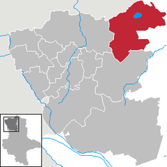 | |
 Arendsee  Arendsee | |
| Coordinates: 52°52′36″N 11°29′12″E / 52.8767°N 11.4867°E | |
| Country | Germany |
| State | Saxony-Anhalt |
| District | Altmarkkreis Salzwedel |
| Government | |
| • Mayor (2016–23) | Norman Klebe[1] |
| Area | |
| • Total | 269.68 km2 (104.12 sq mi) |
| Elevation | 25 m (82 ft) |
| Population (2021-12-31)[2] | |
| • Total | 6,791 |
| • Density | 25/km2 (65/sq mi) |
| Time zone | UTC+01:00 (CET) |
| • Summer (DST) | UTC+02:00 (CEST) |
| Postal codes | 39619 |
| Dialling codes | 039003, 039034, 039036, 039384 |
| Vehicle registration | SAW, GA, KLZ |
| Website | www |
Arendsee (German pronunciation: [ˈaːʁəntseː]) is a town in the Altmarkkreis Salzwedel, Saxony-Anhalt, Germany. It is named after the lake Arendsee, located north of the town.
YouTube Encyclopedic
-
1/3Views:9 13710 7766 509
-
„unterwegs in Sachsen-Anhalt" in Arendsee (Altmark) (mdr 2oo6)
-
Ruinen von Arendsee (1)🐉Waldheim // Stahlhelmheim // Waldschänke
-
Rund um den Arendsee in der Altmark Sachsen Anhalt
Transcription
Geography


The municipality is located in the Altmark region and on the southern bank of the Arendsee lake, the largest and deepest natural lake in Saxony-Anhalt.
Subdivisions
The town Arendsee consists of Arendsee proper (including the Ortsteile Genzien and Gestien) and the following Ortschaften or municipal divisions:[3]
- Binde (incl. Ritzleben)
- Fleetmark (incl. Lüge, Molitz, Störpke)
- Höwisch
- Kaulitz
- Kerkau (incl. Lübbars)
- Kläden (incl. Kraatz)
- Kleinau (incl. Dessau, Lohne)
- Leppin (incl. Harpe, Zehren)
- Mechau
- Neulingen
- Rademin (incl. Ladekath)
- Sanne-Kerkuhn (Sanne and Kerkuhn)
- Schrampe (incl. Zießau)
- Thielbeer (incl. Zühlen)
- Vissum (incl. Kassuhn, Schernikau)
- Ziemendorf
History
The locality and the lake were first mentioned in the Royal Frankish Annals in 822.
In 1184 Otto I, Margrave of Brandenburg founded a Benedictine nunnery in Arendsee while the then competent Prince-Bishop of Verden, Tammo (d. 1188), endowed it with estates.
The former municipalities Binde, Höwisch, Kaulitz, Kerkau, Kläden, Kleinau, Leppin, Neulingen, Sanne-Kerkuhn, Schrampe, Thielbeer and Ziemendorf were merged into Arendsee on 1 January 2010.[4] The former municipalities Fleetmark, Mechau, Rademin and Vissum were merged into Arendsee on 1 January 2011.[5]
Population development
|
|
1964–1981 census results, from 2011: 2011 European Union census[6]
References
- ^ Bürgermeisterwahlen in den Gemeinden, Endgültige Ergebnisse, Statistisches Landesamt Sachsen-Anhalt, accessed 8 July 2021.
- ^ "Bevölkerung der Gemeinden – Stand: 31. Dezember 2021" (PDF) (in German). Statistisches Landesamt Sachsen-Anhalt. June 2022.
- ^ Hauptsatzung der Stadt Arendsee (Altmark), 21 January 2020.
- ^ Gebietsänderungen vom 01.01. bis 31.12.2010, Statistisches Bundesamt
- ^ Gebietsänderungen vom 01.01. bis 31.12.2011, Statistisches Bundesamt
- ^ "Statistical office Saxony-Anhalt: Bevölkerungsbewegungen (Gemeinden anklicken)". Archived from the original on 2016-08-07. Retrieved 2016-12-08.
External links
 Media related to Arendsee (Altmark) at Wikimedia Commons
Towns and municipalities in Altmarkkreis Salzwedel | ||
|---|---|---|
| International | |
|---|---|
| National | |
| Geographic | |